500 Festival Forecast – Monday (5/1/17)
Week-at-a-Glance:
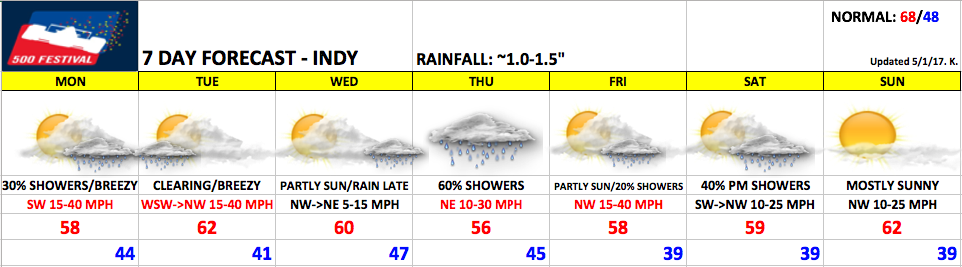
Synopsis: Below is the forecast for the preparations for the mini marathon this week. Scattered showers and very breezy today, some morning showers possible Tuesday before clearing but still remaining breezy. Partly sunny skies expected Wednesday before a system approaches late into Thursday morning bringing our next chance for showers. Some lingering showers possible on Friday before clearing into Saturday morning…and then our next disturbance moves in from the north Saturday afternoon.
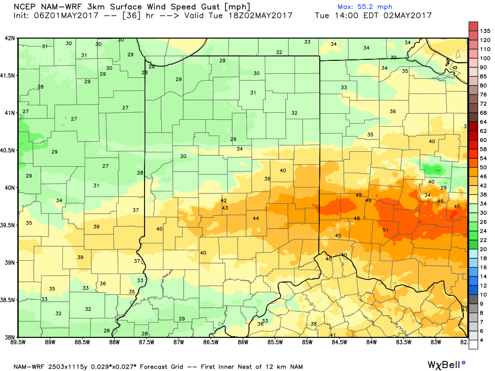
Monday: Watching for clouds to increase into this afternoon as well as scattered showers throughout the day. Winds will also be a weather-related hazard gusting at times over 40mph out of the southwest, expecting a high near 58º.
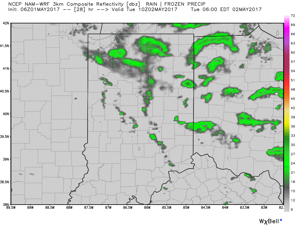
30-40% shower coverage expected getting into this afternoon:
Very gusty winds out of the southwest sustained at ~15mph, at times gusting up to 40+mph.
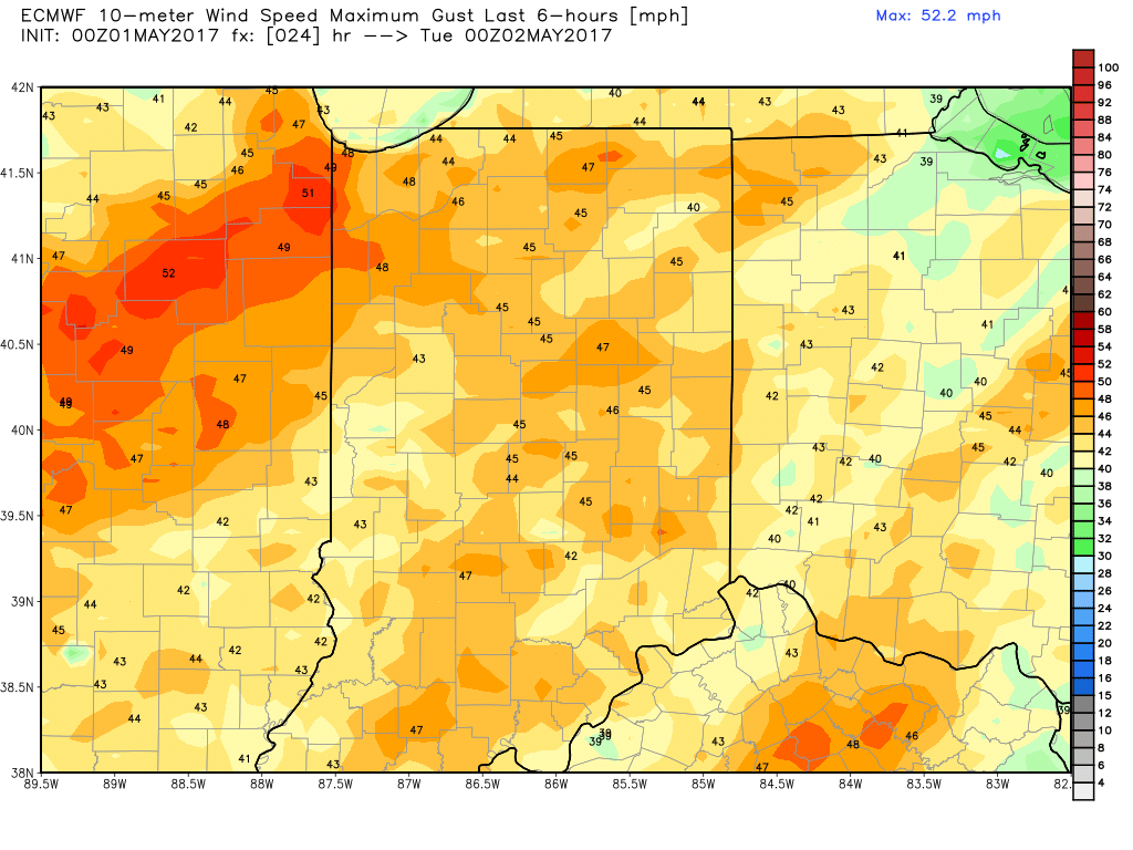
Tuesday: some morning showers will be possible before skies start to clear throughout the day with a high temperature near 62º expected. Winds may pose a problem Tuesday as they will be west-southwest turning towards the northwest at 15mph gusting at times to 40+mph as well. Can’t rule out some wind-related weather hazards here.
Possible showers lingering throughout the early morning hours before clearing to a mix of sun and clouds.
Another round of windy conditions expected with winds out of the west-southwest to northwest at 15mph gusting at times at 40+mph.
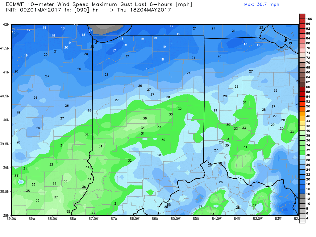
Wed/Thurs: Expecting partly sunny skies and a nice day on Wednesday with a high near 60º. Our next chance for inclement weather comes late Wednesday night into Thursday as a low pressure system works its way into the Midwest. We do have some data take the track slightly further north which could increase shower coverage, but at this time keeping it near 60% on Thursday, with a high near 56º. Winds will be out of the Northeast at 10mph gusting at times up to 30mph. Some rain-related weather delays will be possible Thursday.
European model showing rain chances expanding on Thursday…keeping coverage ~60% at this time:
Winds will be out of the northeast at 10mph and gusting at times up to 30mph.
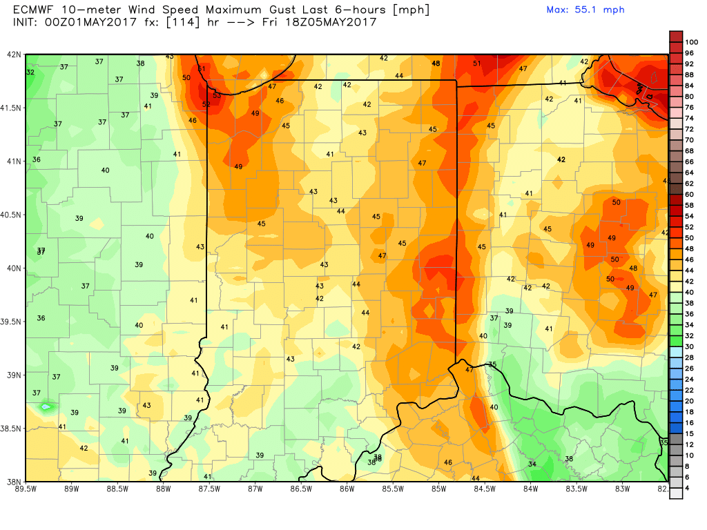
Friday: here we will feature partly sunny skies with a small chance ~20% for some showers, winds out of the northwest at 10-15 mph gusting at times up to 40mph. Expecting a high near 58º. Can’t rule out a shower or wind-related delay on Friday.
~20% for a shower on Friday:
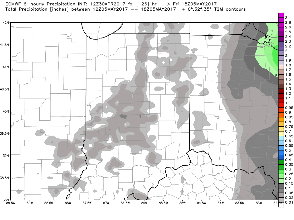
Quite gusty again with winds out of the northwest at 10-15 mph gusting at times to 40mph.
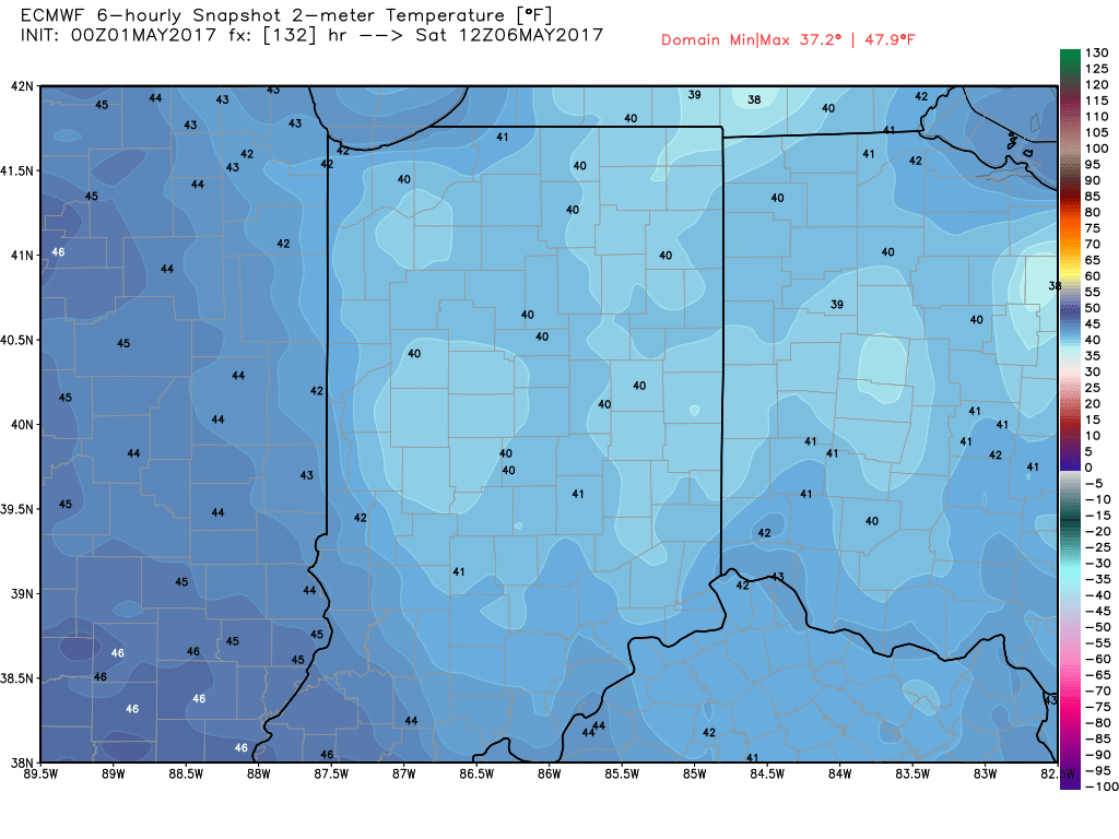
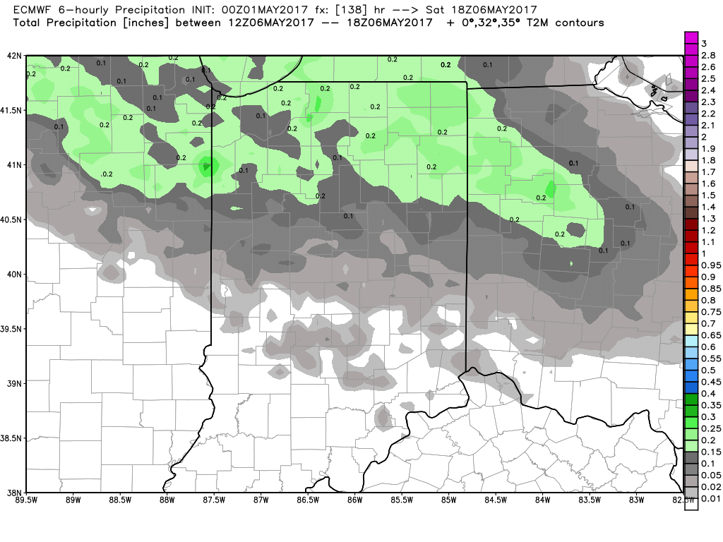
Saturday: looks like we will start off the day clear and cool, however a disturbance will work its way from north to south during the afternoon into the evening giving us ~40% for showers, a high near 59º and winds southwest turning northwest at 10-25 mph.
Will be a cool, clear start to the morning with a temp near 40º.
Will see our rain chances increase afternoon into the evening to around 30-40% as a disturbance works its way from north to south.
Sunday skies will clear and will be a very nice day. If you have any questions please don’t hesitate to reach out, have a wonderful week!
-Kirk