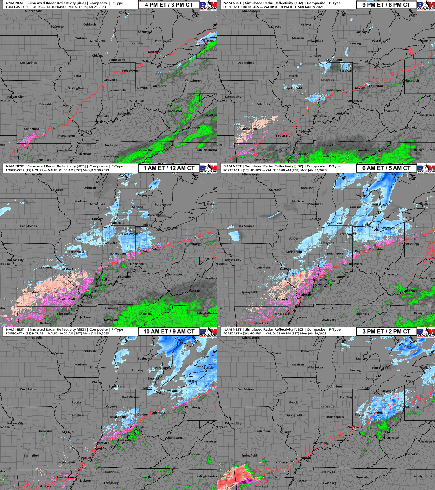
Click here for future radar loop: https://bamwx.com/wp-content/uploads/2023/01/ezgif-3-08c281b848.gif
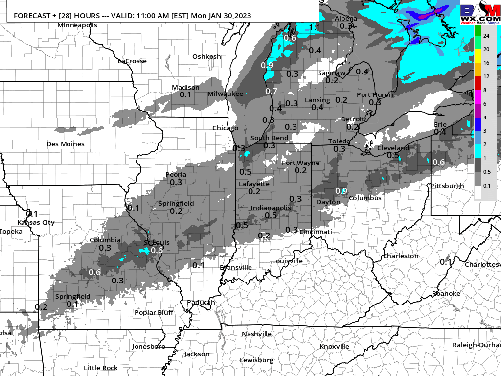
Click here for favored snow / sleet accumulation: https://bamwx.com/wp-content/uploads/2023/01/image-10-1.png
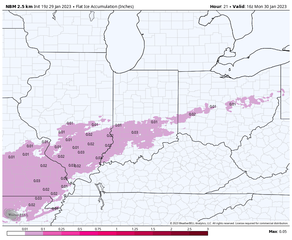
Click here for favored ice accumulation: https://bamwx.com/wp-content/uploads/2023/01/image-9-1.png
Good evening! Linked above are the latest thoughts on timing and totals for the upcoming wintry precip expected this evening and to continue through the overnight hours. Latest data trends indicating slightly earlier timeline with latest wave of activity. These changes are reflected well in your application. To emphasize again, regardless of precip type, pavement impacts will be possible for the duration of this event.
For a more detailed explanation on thoughts for this system, please see extended local video below.
Local Video: https://youtu.be/eRXf2qWKNhw
As always, if you have any questions, please reach out.


