Good Wednesday morning, below you will find an updated forecast for the educational events on Thursday and Friday later this week. Have a blessed day!
Synopsis: Today we wanted to update you on our latest thoughts for storms along the cold front on Thursday, we do continue to have a concern for gusty to strong storms during the afternoon on Thursday that we are watching closely…can’t rule out a weather delay. Otherwise, we are cooler on Friday but with some sunshine possible.
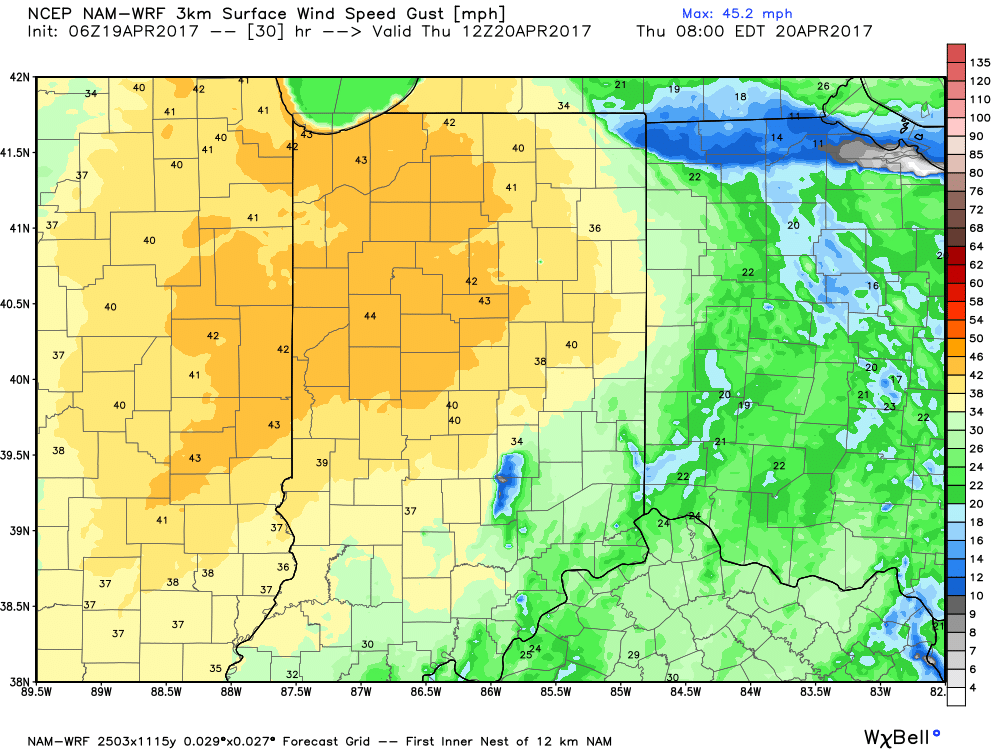
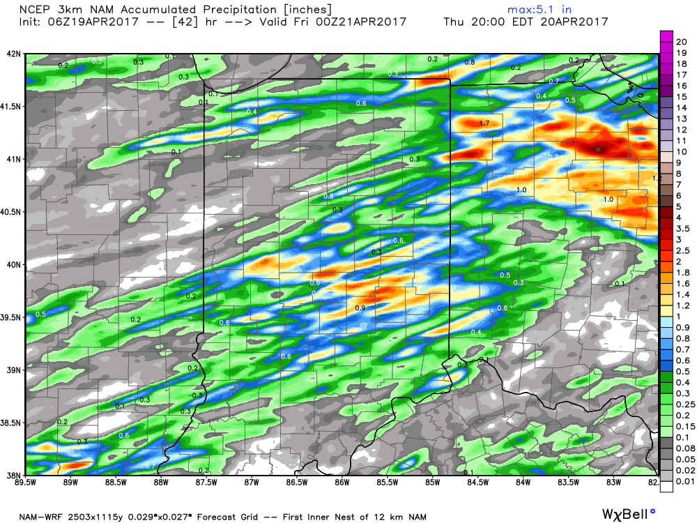
Thursday: The cold front has slowed down slightly since our update yesterday, forecasted to bring storms to the Indy metro area right now by 1-2pm. Can’t rule out a strong storm here as there will be ample amounts of energy and moisture so we will watching and updating on that as necessary. Otherwise, high temperatures will be near 79º, with winds out of the southwest at 15mph gusting at times (especially in the morning) upwards of 40mph. Precipitation is expected to be 0.25-0.50″, however if we get under a stronger storm it could be as high as an 1.0″.
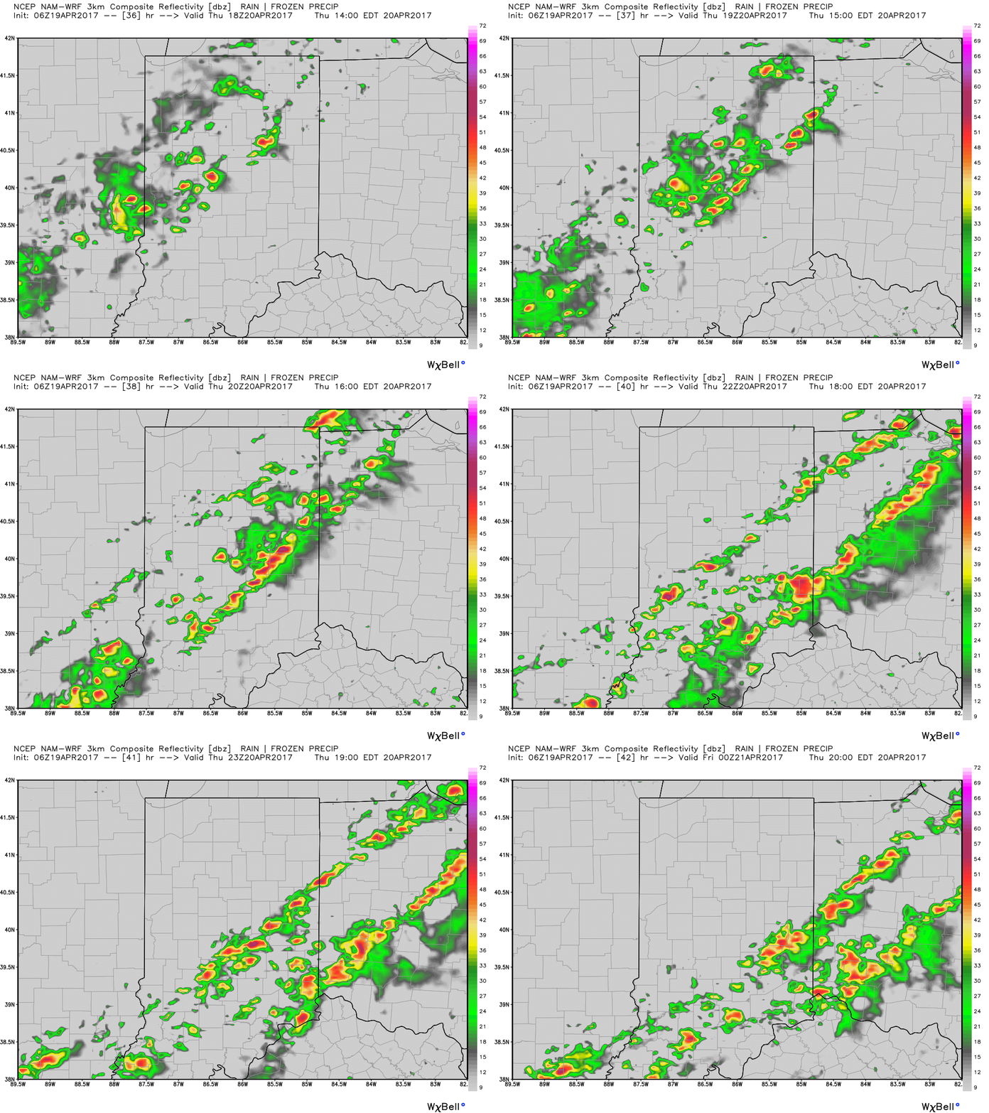
Simulated radar via the NAM-3km model has storms firing just north and west of the Indy metro between 1-2pm moving south and east clearing by ~8pm so it will be on the back-end of the educational event on Thursday.
It will be windy Thursday, especially during the morning with winds out of the southwest at 15mph gusting at times up to 40mph.
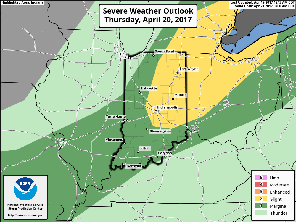
Slight risk issued for strong storms here…isolated large hail and gusty winds will be the main threats…however, an isolated tornado threat cannot be totally ruled out at this time.
Total precipitation from this event expected to be 0.25-0.50″, however if a stronger storm does develop it could drop up to 1.0″+ of rainfall.
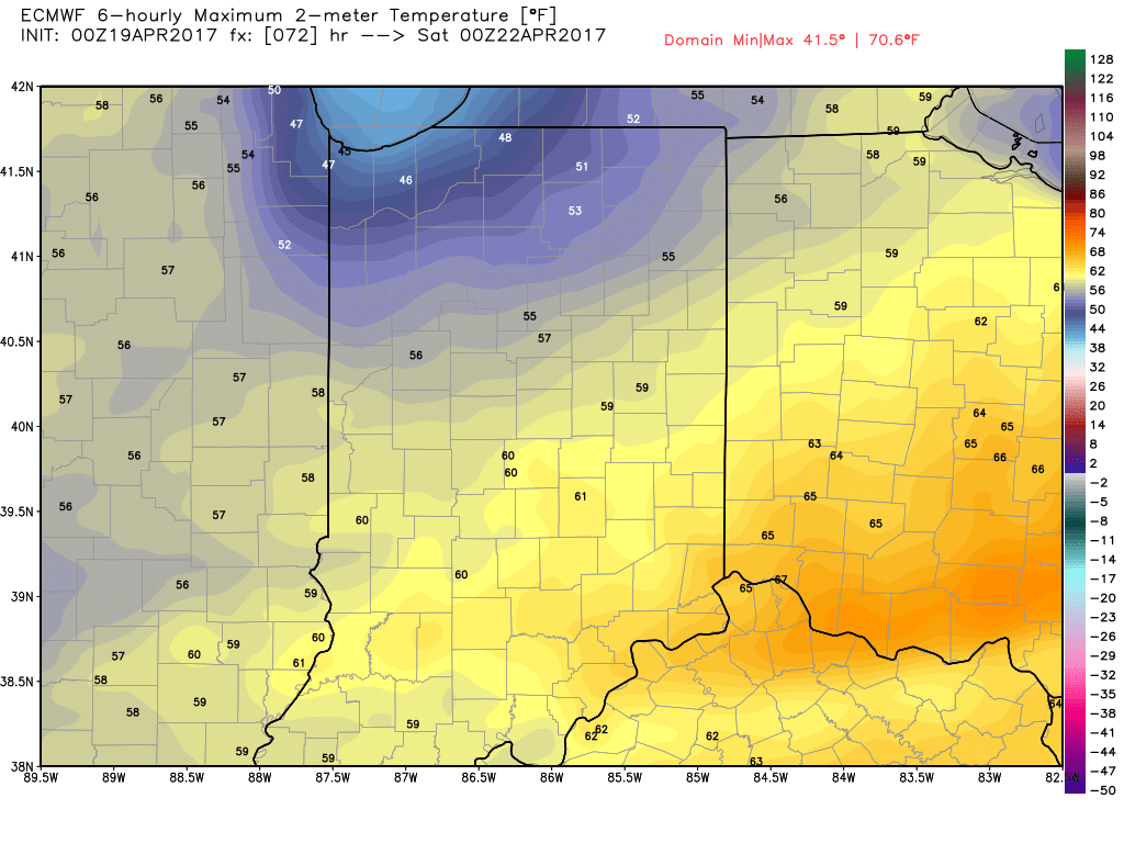
Friday: A cooler day is expected here behind Thursday’s cold front with forecasted highs near 60º, with a north-northwest wind at 5mph gusting at times up to 20mph and partly sunny skies for the event. No weather related hazards are expected.
If you have any questions please let us know!
-Kirk
