12-8-17 Ft. Wayne District Forecast
Synopsis: Good Friday morning! Watching for things to get going early Saturday morning with the first wave and then dealing with an lake effect snow (especially west) as we go throughout the second half of the day on Saturday…details in the video on more exact timing and location of that heavy band of snow. Slight adjustments made to the official snowfall accumulation forecast, the heaviest snow likely setting up in the Elkhart and Wabash sub-districts into late Saturday night. We stay very active into next week with multiple shots for snowfall in the forecast. Let us know if you have any questions, have a blessed day! -Kirk
Today’s video (6 min):
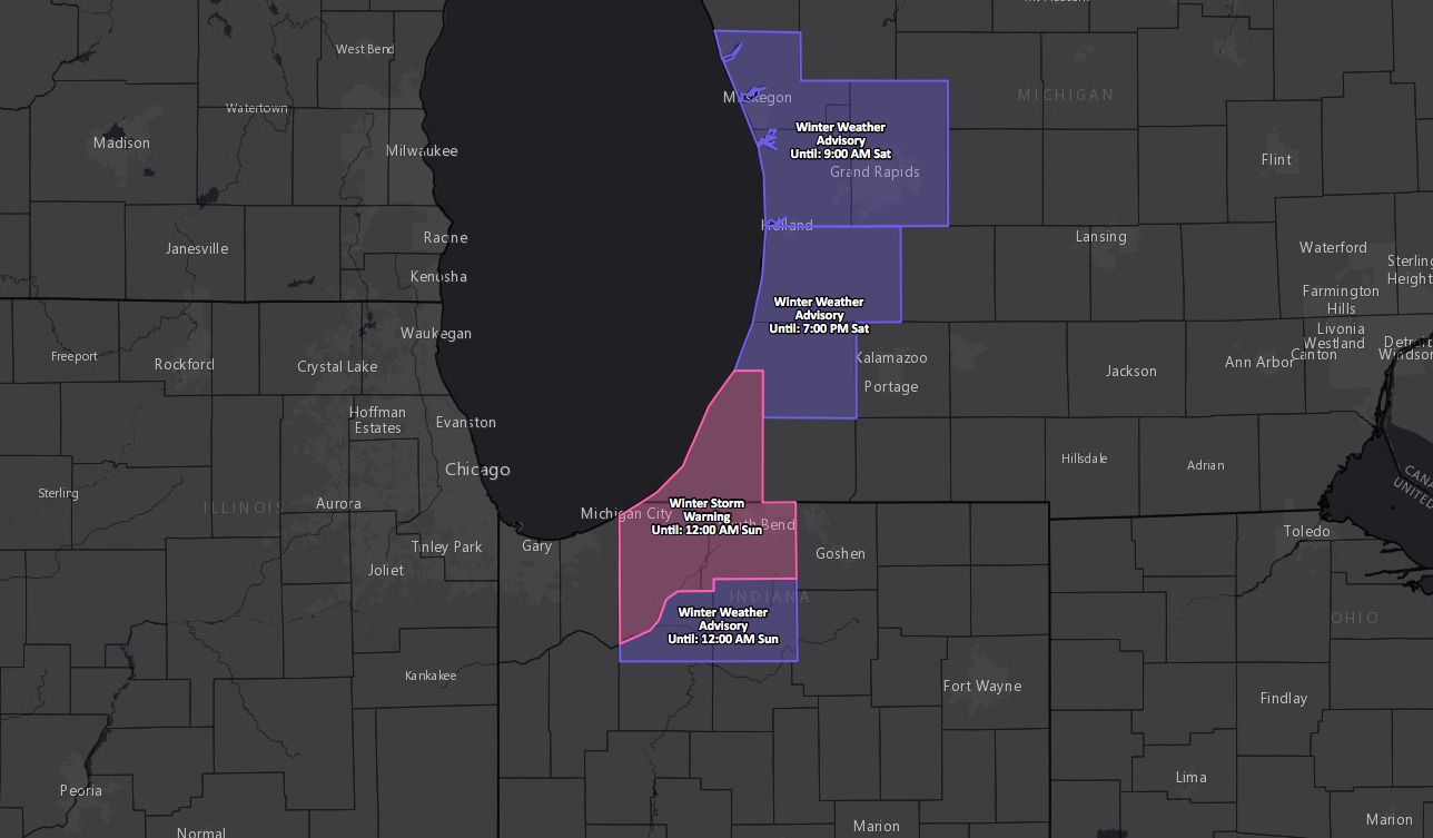
Current winter storm advisories/warnings to the west…we really don’t expect widespread advisories/warnings to push east into the District:
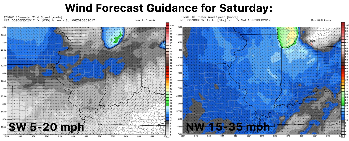
Updated wind guidance for Saturday:
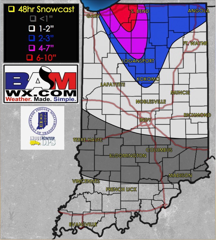
Updated snowfall accumulation forecast this morning…only slight adjustments noted:
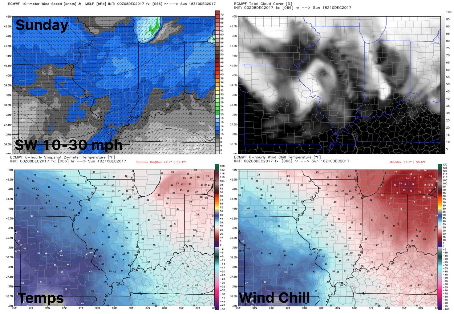
Sunday forecast…important to note that some sunshine will be possible as well as winds shifting out of the southwest again: