*In this kind of pattern it’s crucial to watch every update including afternoon videos with the latest details*
12-7-17 Ft. Wayne District Forecast
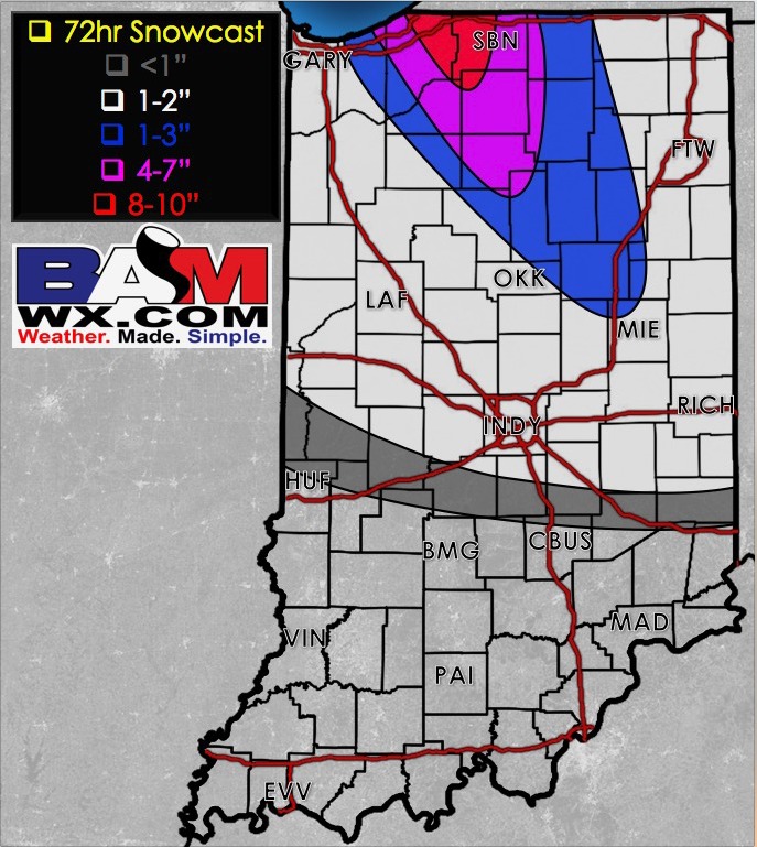
Synopsis: Good Thursday morning! Today we discuss the ongoing shot of lake effect snow falling across the district this morning and then the latest details on the accumulating snowfall potential heading into Saturday. We have the first wave moving through during the day bringing light accumulations of 1-3″ and then backside lake effect snow showers falling with the northwest wind fetch. We drop temps into the lower teens Sunday morning, so a potential refreeze is on the table as well. We stay very active into next week with multiple shots of snowfall being possible…if you have questions let us know, talk to you soon. K.
Today’s video (6 min):
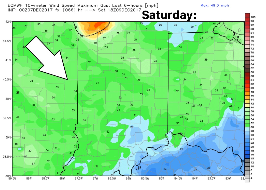
Wind forecast Saturday is out of the northwest today at 10-15 mph gusting up to 30+ mph:
Latest thoughts on snowfall accumulations over the next 72 hours: