Good Thursday afternoon! After mild weather to end November and open December, big changes are developing in the pattern. Thanks to an amplifying jet stream pattern, the eastern portion of the country will see a very wintry pattern evolve into mid-month with multiple disturbances to bring snow chances. The lake-effect machine will crank up big-time as well with this pattern! This blog will cover the overall pattern evolution and things to look out as we go through the month.
First we will do a quick overview of the pattern ahead, then dive into more specific systems we are watching. The pattern through next week will feature a tale of two different extremes in the United States. A very strong ridge will continue to setup along the west coast of the U.S. into Alaska, allowing for a deep trough to develop downstream across the eastern United States. Remember the jet stream is analogous to a water bed…when you push up on one end, it goes down on the other side. 🙂
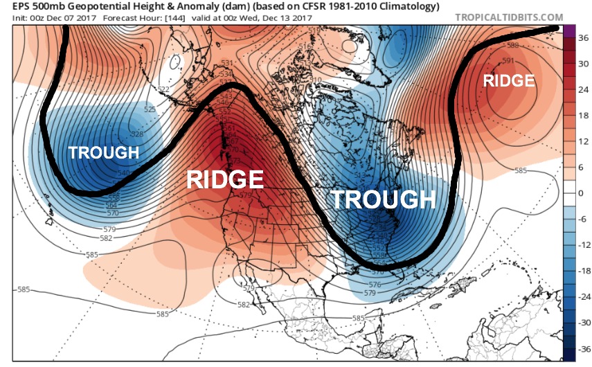
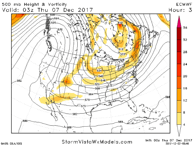
In this type of pattern we will expect to find multiple disturbances riding along the jet stream (traced in black above) to deliver snow chances across the eastern U.S. over the next week. Here is an animation of these pieces of energy branching off from the Aleutian low….overtopping the ridge in Alaska, then diving down into the Great Lakes and Ohio Valley through late next week:
If you are looking for any good snowstorms in the Midwest or Ohio Valley, the set-up into late next week is not favorable for any “big systems” here as the southern branch of the jet stream is being suppressed too far south. Areas along the east coast would have a shot if phasing can occur just right. Looking beyond late next week..it appears the southern branch of the jet stream may ramp up and allow for bigger storm systems. This will occur as the amplified pattern starts to relax (more info on this at the end of the blog).
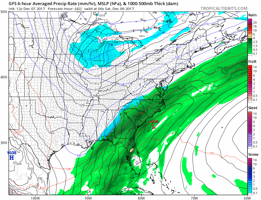
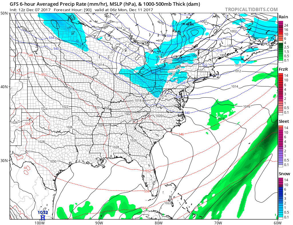
The first system dives in on Saturday bringing snowfall into the Great Lakes and Ohio Valley. This will churn up a significant lake-effect snow event this weekend across the major lake-effect snow belt regions. We also need to watch this eastern storm system that may brush the east coast with some snow.
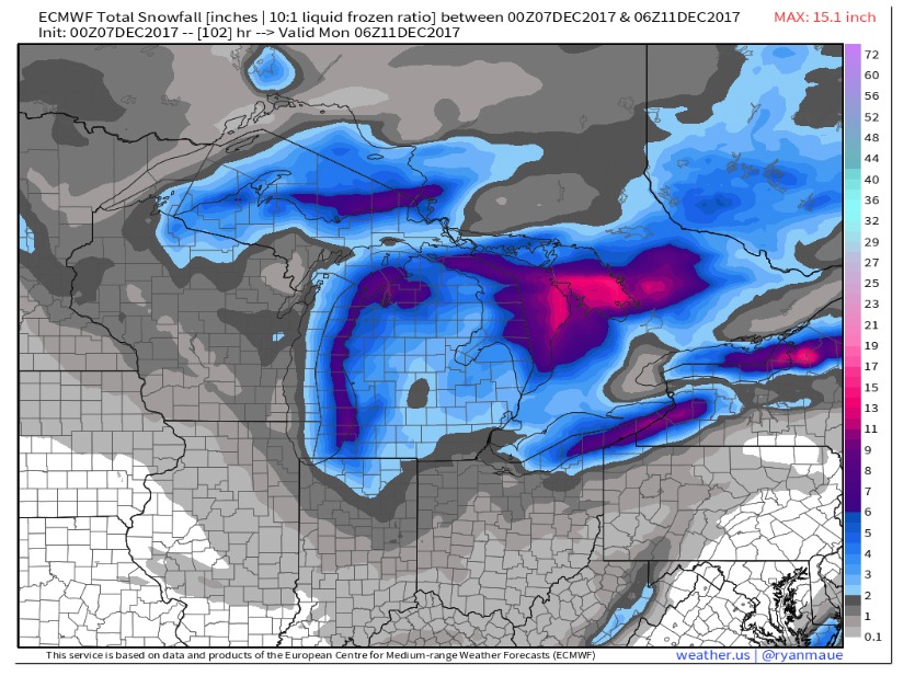
Check out the snowfall potential through the weekend off the European model:
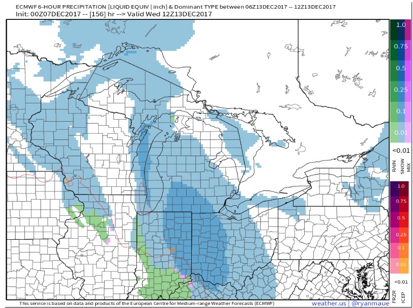
The next system dives in on Monday…this could bring a healthy swath of snow to portions of the Great Lakes and interior Northeast. Check out that intense lake-effect snow band showing up in west Michigan and northern Indiana…as well as additional bands in the interior northeast from late Monday all the way into Wednesday:
The European model brings in another clipper by Wednesday, with significant lake-effect snow through late week:
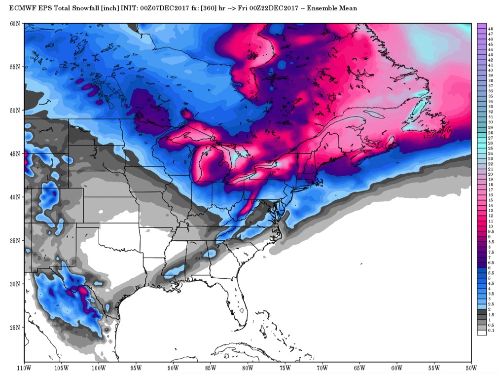
It should be noted that the exact track and orientation of these systems remains uncertain until we get within 48 hours out. The main take-away is we see one system after another diving in with this pattern. Check out how much snow we may put down across the Great Lakes and Interior Northeast over the next 15 days. This forecast comes off the European model ensemble average snow totals:
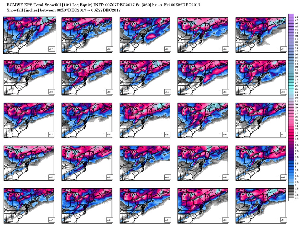
We can break that down by looking at the multiple different solutions for snowfall amounts over the next 15 days (just for fun…take with a grain of salt):
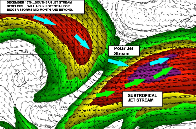
We start to see some changes by the end of next and beyond as the subtropical jet stream starts to ramp up…..this will aid in potential for larger systems to develop where “phasing” of the jets occur. GFS model jet stream level winds for December 15th shown below:
As these stronger systems develop, we also need to watch for increasing warmer risks as well within the pattern. We will continue to keep a close watch on the pattern ahead. Have a great afternoon!
We are your weather prediction specialists!
-24/7/365 On call weather consulting services
-Daily detailed custom video forecasts sent to email
-Daily long range weather analytics
-Daily energy and natural gas demand report
-Daily Ag weather report
-On site meteorological services
-Forensic meteorological services
Contact: mailto:[email protected]
Call: 317-643-2261
Visit: https://bamwx.com
Like us: https://www.facebook.com/bamwx/
Follow us on Twitter: @bamwxcom
Follow us on Instagram: @bamwxcom
Follow us on snapchat: @bamwxcom