12-6-17 Wed Short-Term Update. Snow Tonight. Accumulating Snow Sat. M.
Short-Term Video 7 Min:
Synopsis: A weak wave will move along and south of I-70 this evening that may offer up some slick spots or a few locations that could see a coating of snow. The area below needs to watch radar and roads between 8pm-2am tonight. Again maybe a coating or a few slick spots. Ill send text updates tonight if necessary and you can always reach out for questions. 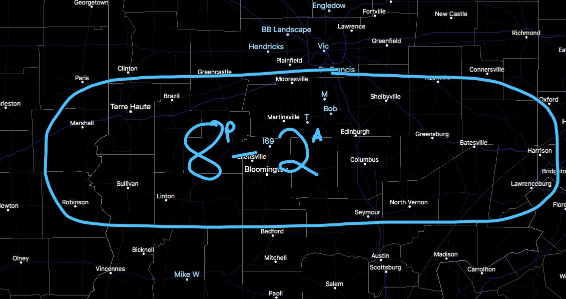
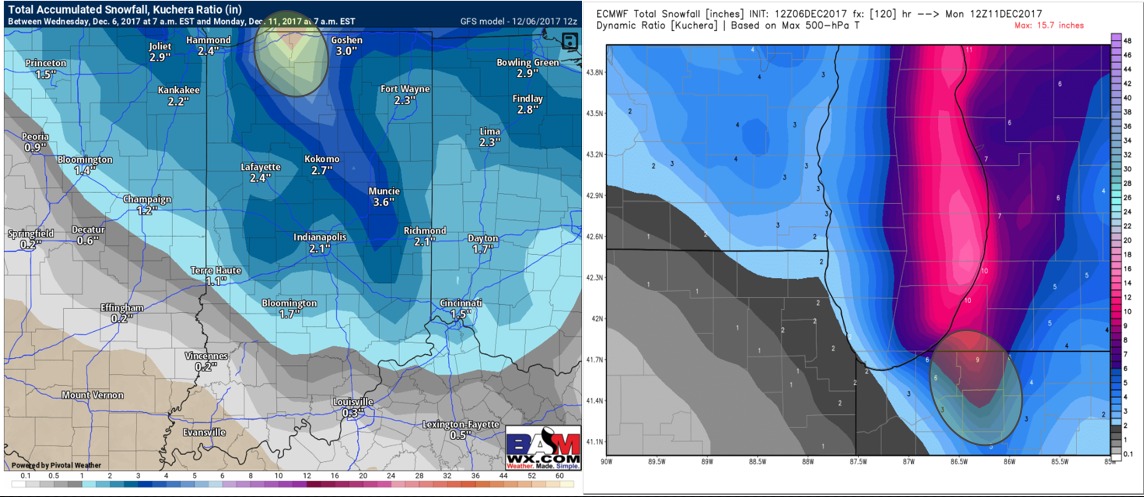
Lake effect snow accumulations tonight will be around 1-2″ in the extreme northern county row as lake effect snow starts late tonight and lets up by ~2/3PM Thursday. This is the FIRST round of 3 the next 6 days. Round 2 comes Sat night that could bring another 4-7″ of snow in the area I’ve highlighted below with the GFS & Euro images side by side. I wouldnt be shocked if there is more snow up that way but will wait for further data runs for more confidence.  Our system this weekend looks rather impressive for a quick thump of snow. Right now overall we are thinking ~1-3″ of snow possible. As we get closer it wouldn’t shock me to see possible Iso 4″ reports. It will be windy as winds will gust 10-30 MPH Sat. Winds will start from the SW and then shift out of the NW by 3/4PM Sat. There will also be some peaks of sunshine possible that may allow to melt some snow that has fallen which could lead to a rapid refreeze Sat night as temps get into the lower teens for overnight lows!
Below is an EARLY idea of POSSIBLE snowfall accumulations by Sunday AM. Please be sure to watch the video as there is a lot to this and a detailed analysis is needed. Keep in mind you have the clipper AND backside snow Sat evening from strong north wind and cold air advection. Let me know if you have any questions. M.