Today’s video (5 min):
A weak wave will move along and south of I-70 and across the northern parts of the districts this evening that may offer up some slick spots or a few locations that could see a coating of snow. The area below needs to watch radar and roads between 8pm-2am tonight. Again maybe a coating or a few slick spots. I’ll send text updates tonight if necessary and you can always reach out for questions.
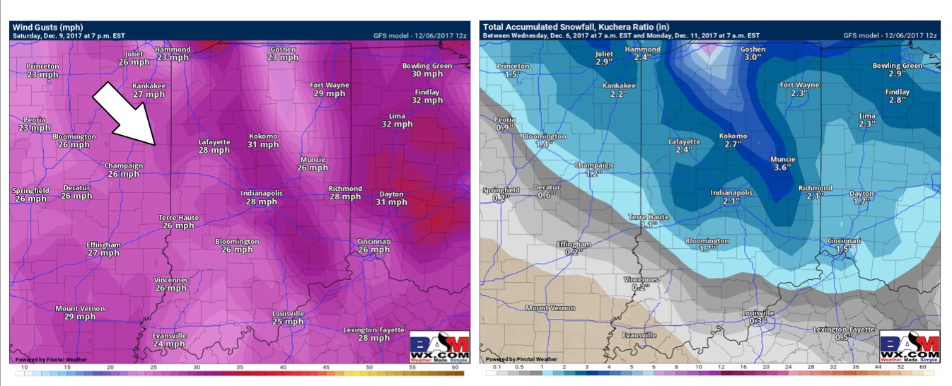
Continue to eye Saturday for accumulating snowfall starting ~7am…we think the northern parts of the area see the best opportunity for snowfall, the issue is that temps look to be at or slightly above freezing on Saturday which will possibly eat away at what accumulates on the surface. With that being said we are monitoring any liquid that remains on untreated surfaces to potentially refreeze late Saturday night/early Sunday as temps take a dive into the teens. Winds will be gusting upwards of 30mph on Saturday afternoon into the evening, this could keep the snow blowing around, limiting the extent of the refreeze potential. We are watching this threat closely. Details are in the video.