Today’s video (7 min):
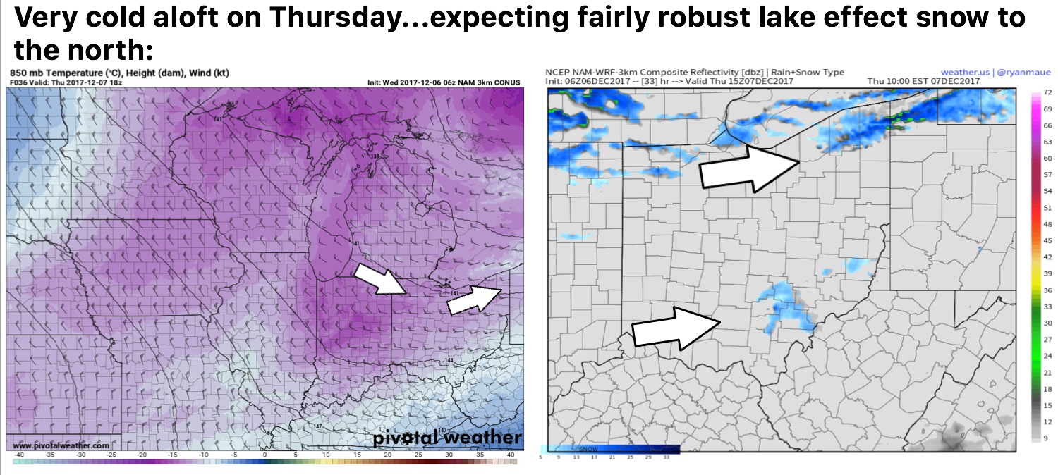
Continue to eye Thursday for lake effect snowfall from Defiance, Toledo, Cleveland to Jefferson. We do favor from Chardon, Warren to Jefferson for the heaviest lake effect snowfall accumulation locally ranging from 4-6″ with isolated 8-10″ not being ruled out. I also think there will be some snow flurries south of I-70 early Thursday into the afternoon moving west to east a piece of energy works through:
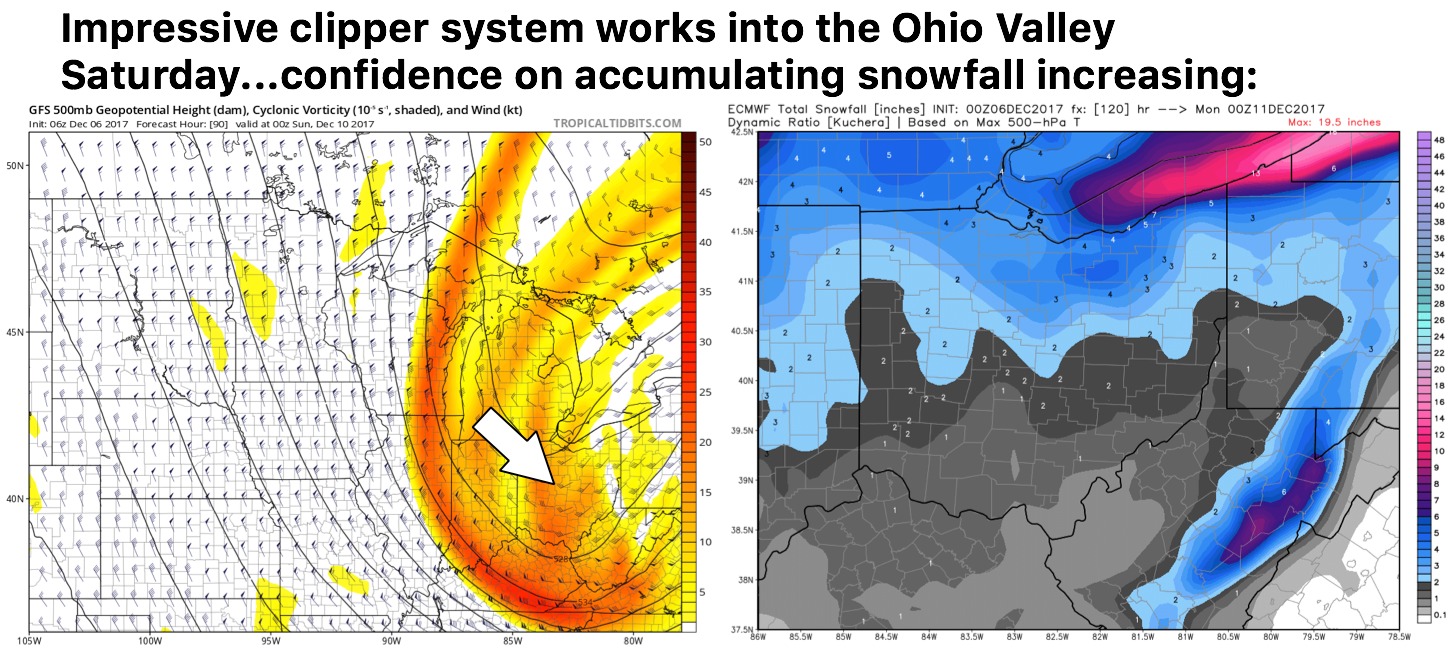
The more widespread snowfall event comes the second half of the day on Saturday into early Sunday as a robust clipper system swings into the Ohio Valley…an additional 1-3″ is looking likely in this scenario. Check back often on timing and thoughts on accumulation:
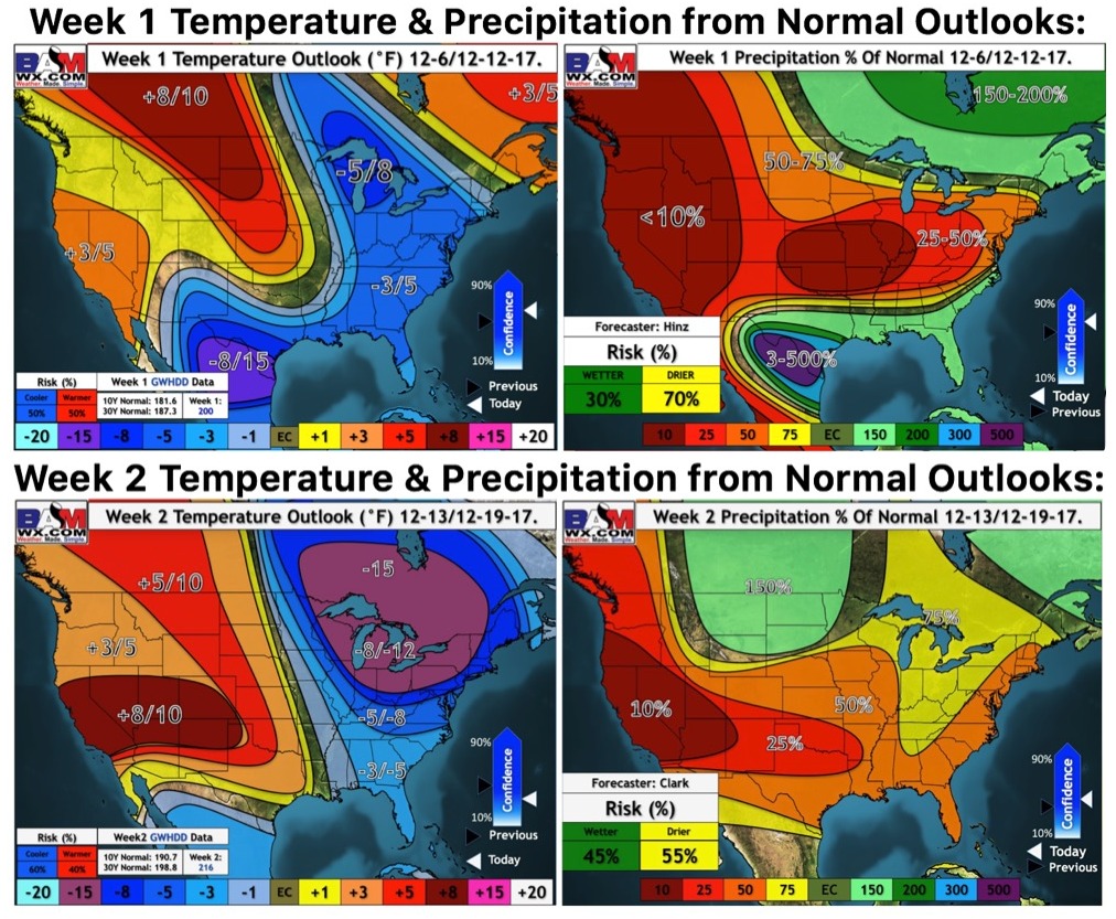
Updated weeks 1 and 2 long-range outlooks…we continue to trend colder in the week 2 timeframe across the eastern US: