12-6-17 La Porte / Ft. Wayne District Forecast – Accumulating Snow…Details Here:
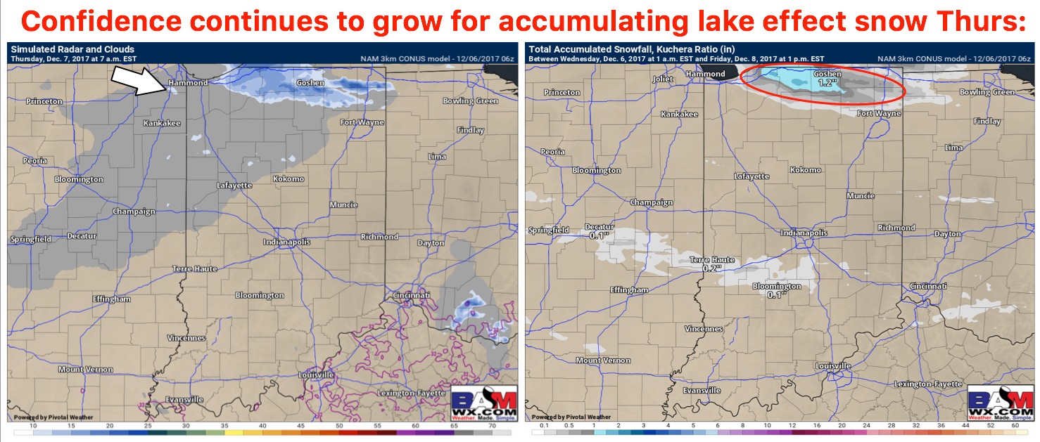
Synopsis: Good Wednesday morning! We continue to target the threat for accumulating lake effect snowfall across the northern row of counties into Thursday as we get a west-northwest wind fetch at 10-25mph off the lake…overall we think the timeframe is ~4am-4pmEST (all timing details in the video). Round #2 comes Thursday morning with a few snow showers and isolated slick spots as a ribbon of energy moves east. Round #3, the big show, comes very early Saturday into the afternoon as a trough sweeps into the Ohio Valley and brings a more widespread snowfall event. There will be a threat for backside lake effect snow showers late Saturday night ending early Sunday morning as well with a northwest fetch off the lake. The overall takeaway here folks is we have a lot going on as we head into the weekend. As always, if you have any questions at all in terms of timing and accumulations don’t hesitate to reach out. -Kirk
Today’s video (6 min):
Updated thoughts on the lake effect snowfall as we get into Thursday…details in today’s video…favoring the northern row of counties for light accumulation (~1.0-2.0″ with an isolated 3.0″ report not out of the question):