Today’s Iowa Video Forecast:
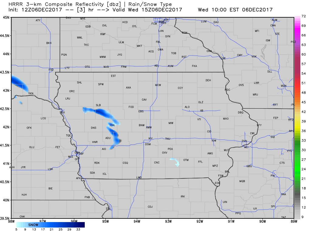
A few flurries work in across western and southern Iowa through the day. As reinforcing arctic air builds in tonight, we may see additional flurries in northern portions of the state. Forecast radar over the next 17 hours shown below:
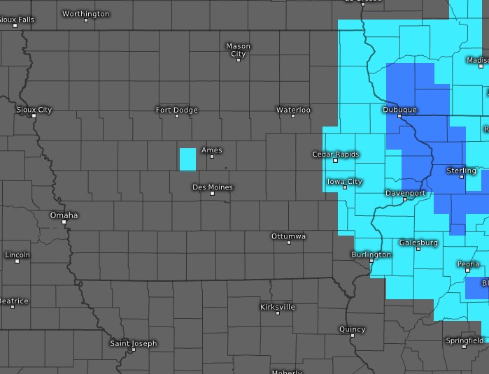
We may see a few flurries early Friday, and then we need to watch for the potential of extreme eastern parts of the state to see light snow from a clipper system Friday night into early Saturday. May see light accumulations from Waukon to Dubuque down to Davenport. Forecast radar at 6am Saturday shown below:
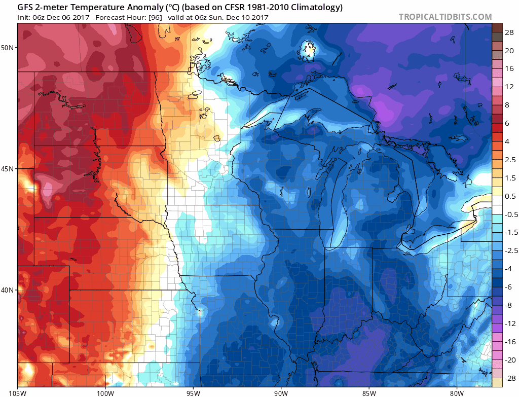
Looking at temperature anomalies from Sunday through Wednesday, we a see a brief warmer trend Sunday into Monday before it turns sharply colder again by Tuesday. We need to watch for light snow systems to work in as well.
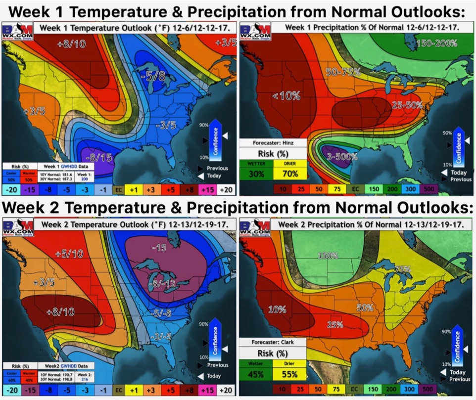
Our weeks 1 and 2 outlooks: