12-5-17 La Porte / Ft. Wayne District Forecast:
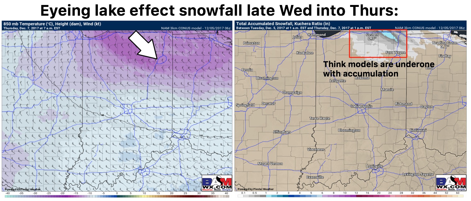
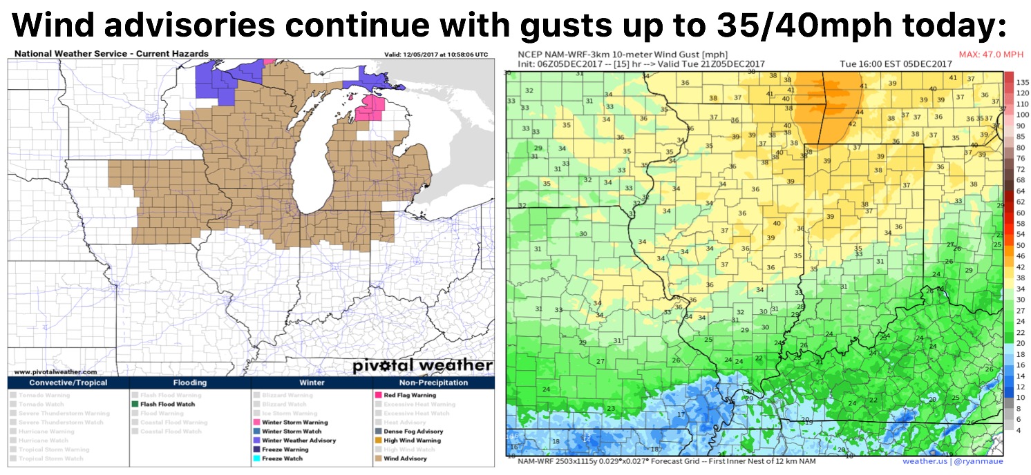
Synopsis: Good Tuesday morning! Today we discuss the much colder pattern settling in for the remainder of the week with multiple chances for lake effect snowfall. We get gusty today with gusts possible up to 35/40 mph at times so it’ll definitely feel chilly behind the front. Regarding our first lake effect snow potential we are eyeing late Wednesday night into Thursday morning for a northwest to southeast fetch across the Lake, we also think models are underdone regarding accumulating snowfall as well given how cold it is aloft. There is potential for some slick spots in this timeframe we will need to monitor. Late Friday into Saturday we will have another piece of energy to watch bringing possible light accumulating snow and then again Saturday night into Sunday. The details will need to be fine-tuned with each event, the key take away is we have a lot of things to keep an eye on; let us know if you have any questions, have a blessed day! -Kirk
Today’s video (6 min):
We are gusty once again today across the northern districts:
Current thoughts on Wednesday night into Thursday morning lake effect snowfall potential…think models are slightly underdone and main risk area is South Bend east: