Today’s video (6 min):
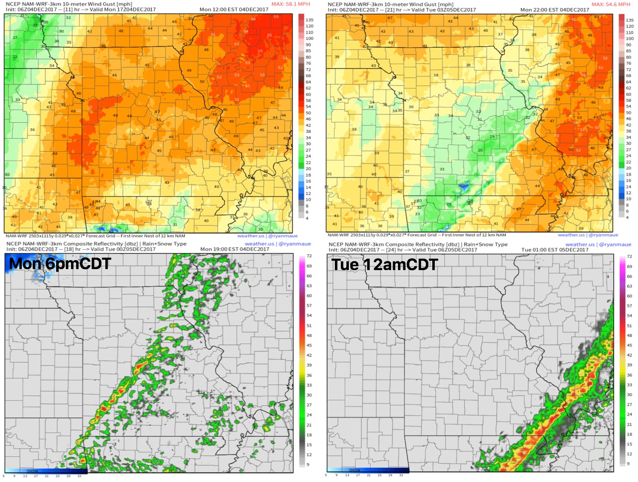
Today will feature very warm temps in the mid to upper 60s, gusty conditions and a line of showers and a couple of storms working west to east (mainly across the eastern half of the state) as we get later into the day.
Rainfall guidance here shows the precipitation mainly focused I-70 south with 0.25-0.5″ likely, a few pockets of 0.5-1″ will be possible across southeastern parts of the state as well.
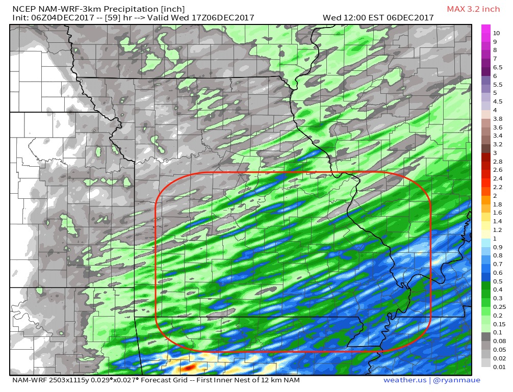
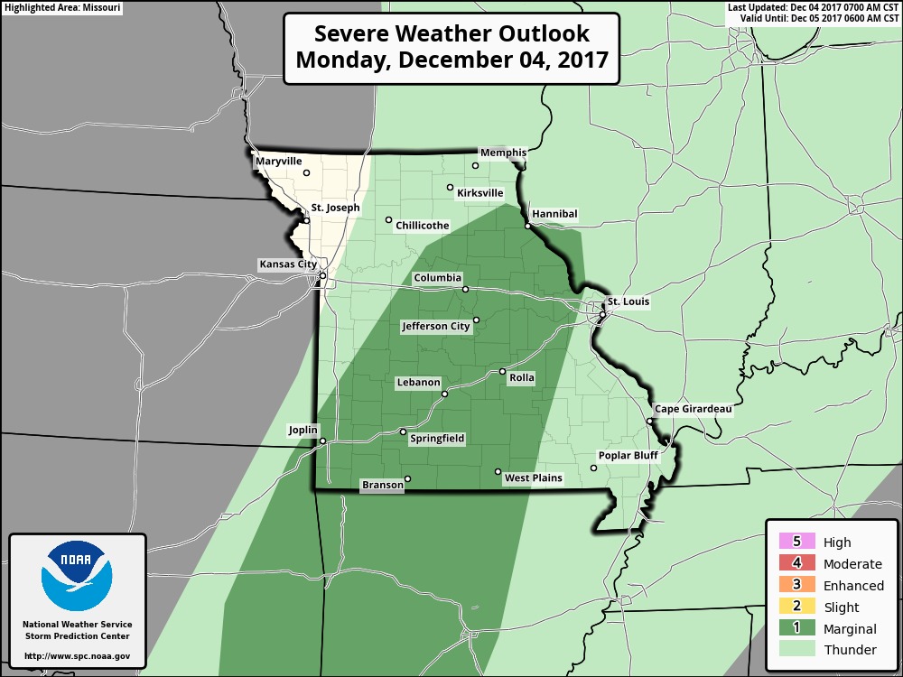
Can’t rule out a strong storm with this as well, not expecting widespread strong storms, however.
Watching very closely Friday into early Saturday for a clipper system to work in across the state…details still need fine-tuning in terms of timing and possible snowfall accumulation, but this is a timeframe we are watching closely for snowfall potential.
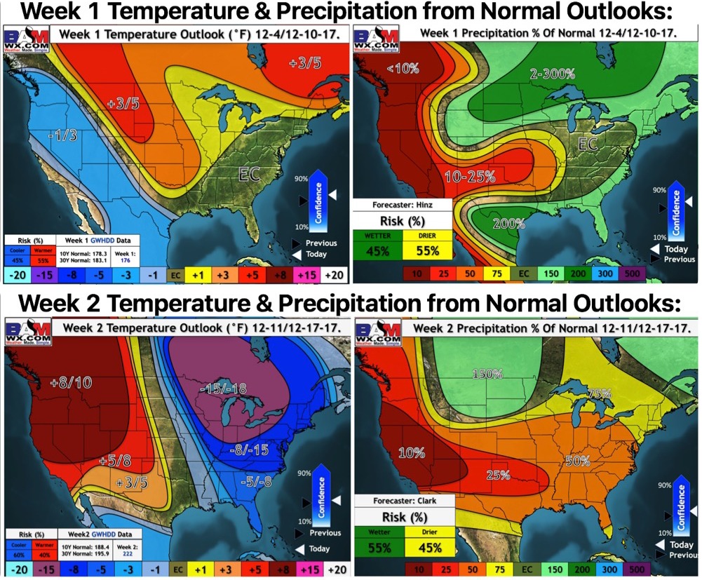
Updated long-range outlooks for weeks 1 and 2 show the pattern transition from above normal warmth to colder than normal: