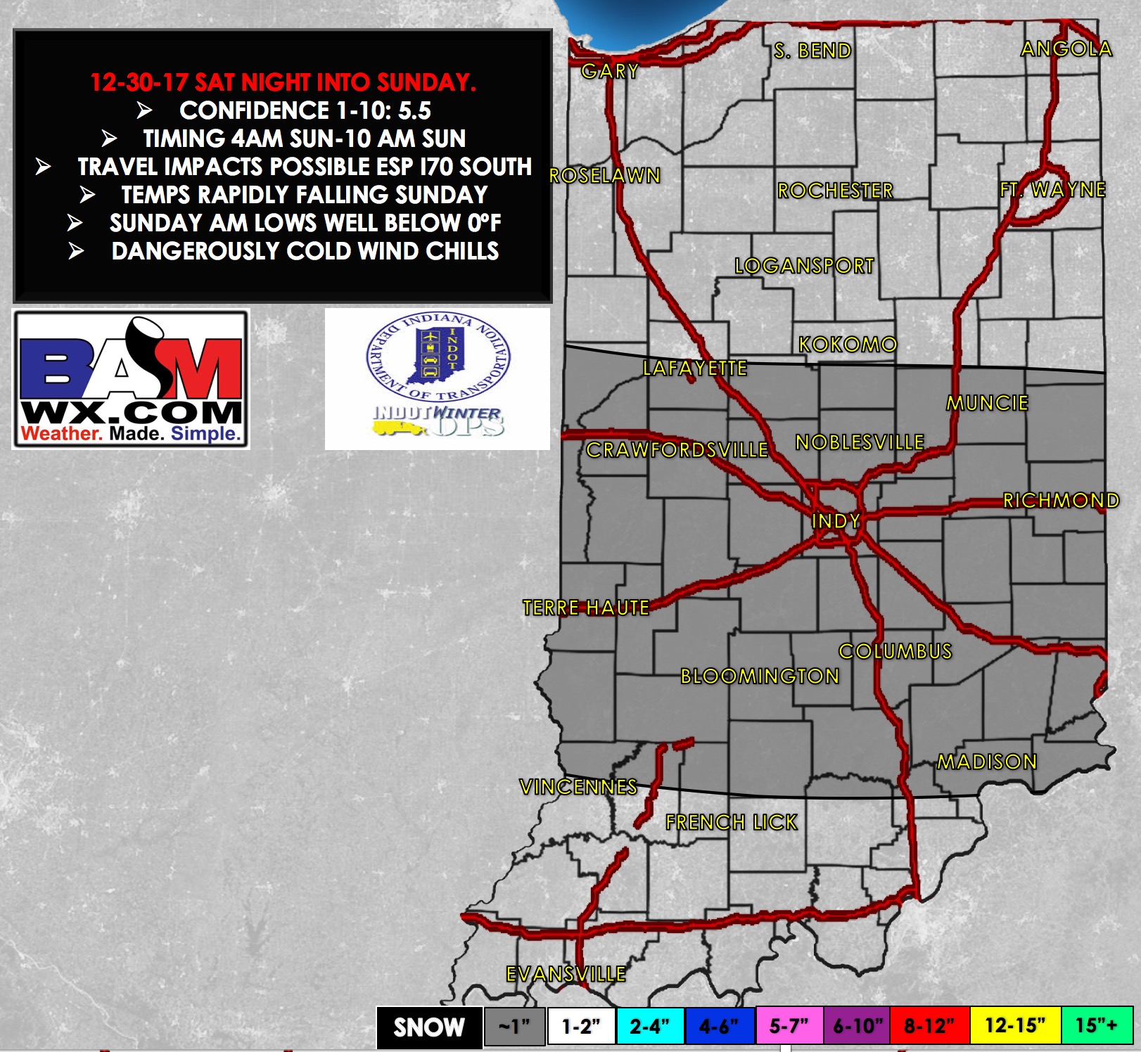
Synopsis: Good Saturday afternoon! Scattered flurries are common across the area, with a burst of snow that affected portions of Ohio, Switzerland, and Jefferson counties this morning in the Seymour district. Expect scattered flurries and a few light snow showers to continue this afternoon. A disturbance will move into the area late tonight through the first half of Sunday, bringing a chance for quick light snow accumulations across south-central Indiana. Details in the video below. Have a great day, and let us know if you have any questions!
Video:
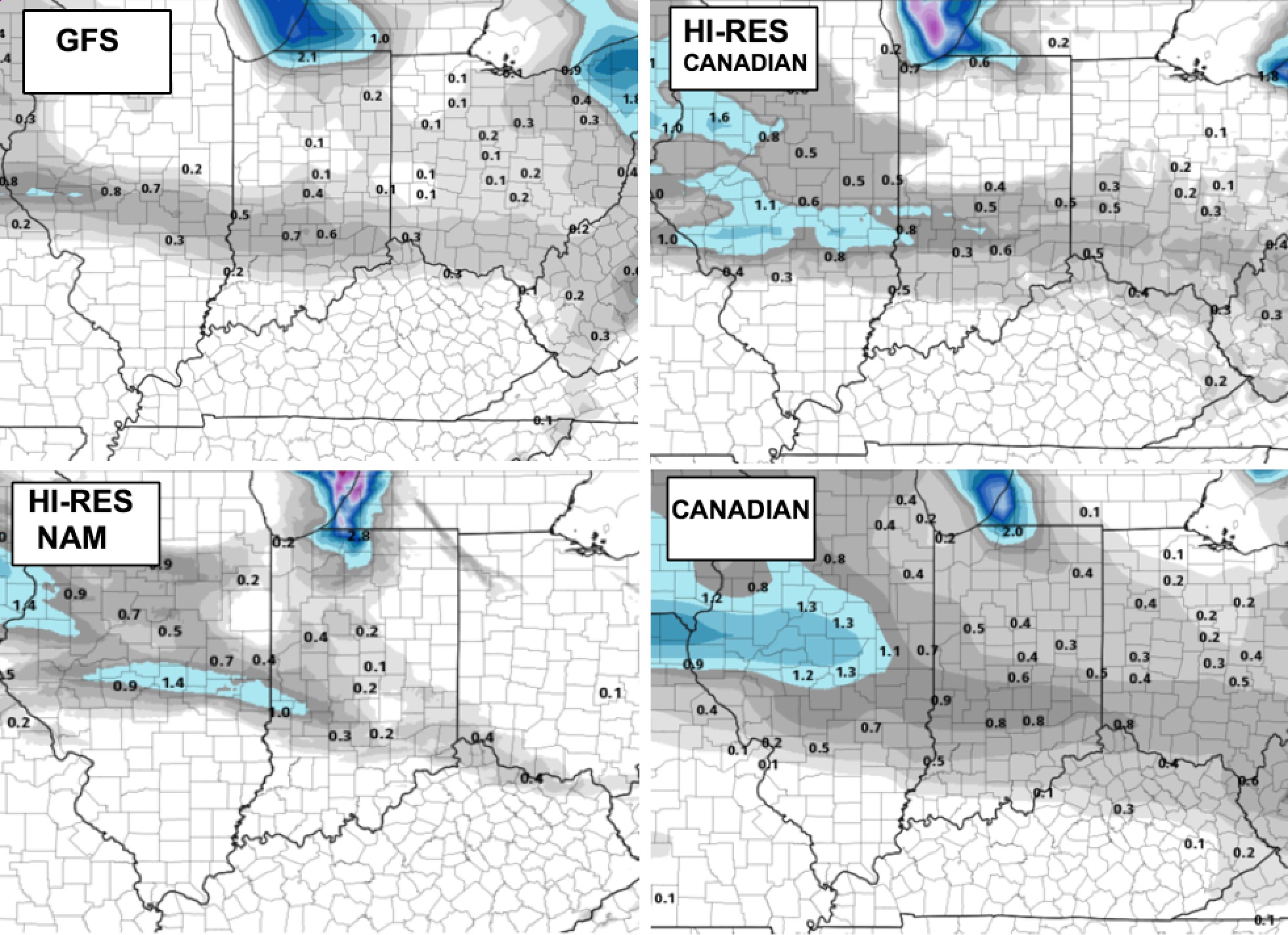
Watching an upper-level disturbance that will move into northern sections of the Seymour district late tonight, then work south across south-central Indiana mid-morning Sunday. This will bring a swath of light snowfall and a quick up to 1″ of snow being easily possible. The main timing for our area looks to be from 7am-12pm EST. As you can see from these maps, it looks like a swath from Martinsville to Franklin, south to Sullivan, Bloomington, Columbus, Bedford, Seymour east towards Batesville down to Madison will be the most likely spots.