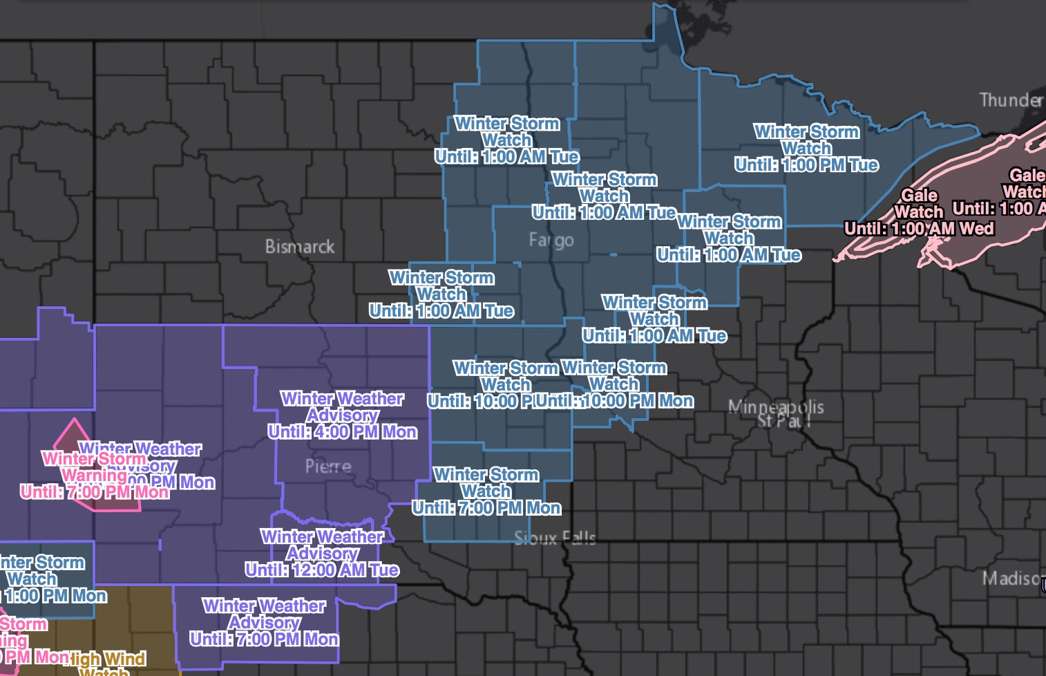
Good Sunday afternoon! Hope you all are having a great weekend. We continue to track big changes in the weather as a strong storm system is expected to move across the region tomorrow. This will bring heavy snow to portions of the region, along with very gusty winds and sharply colder air. We have winter storm watches and winter weather advisories out for much of South Dakota, eastern North Dakota, as well as western and northern Minnesota, all going into effect Monday morning.
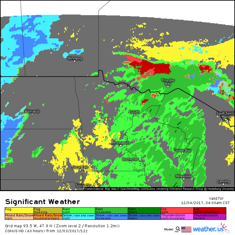
Here is the forecast radar and timing through the event. Note the time-stamp on the bottom right:
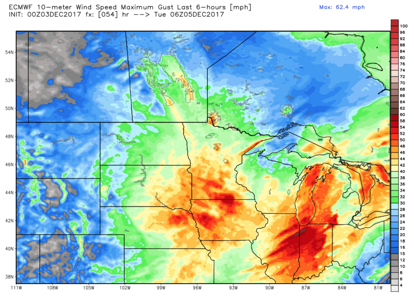
The worst of this storm hits Monday afternoon through Monday night. Expecting blizzard conditions to develop as well on Monday evening within the snow band. Latest data brings wind gusts up to 50 mph Monday night:
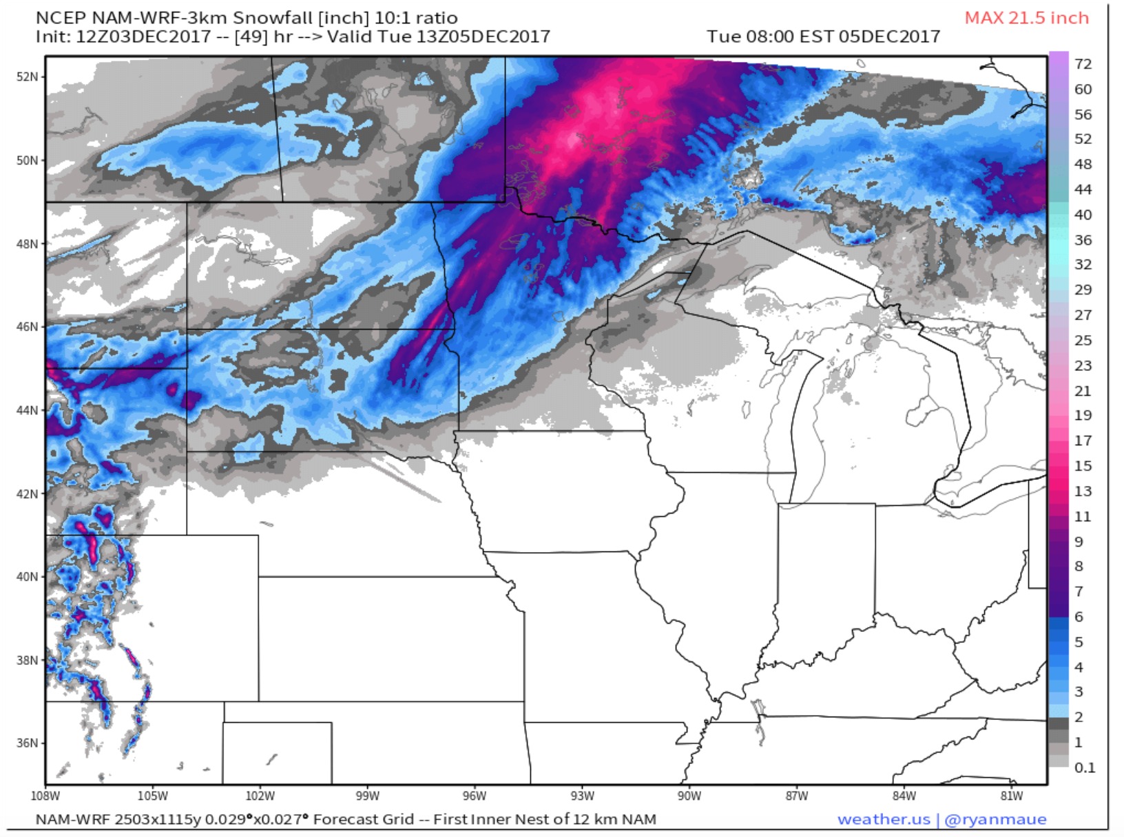
Latest snowfall guidance puts down a few inches within the advisory areas, with a 4-6″ band from eastern South Dakota through western and northern Minnesota. Northern Minnesota likely sees areas with higher than 6″.