Today’s video (7 min):
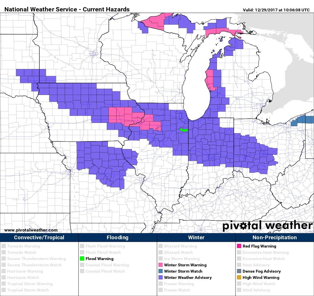
Updated winter weather advisories lasting through Saturday for the risk of accumulating snowfall…think accumulating snowfall lingers a touch further east than the current advisories show:
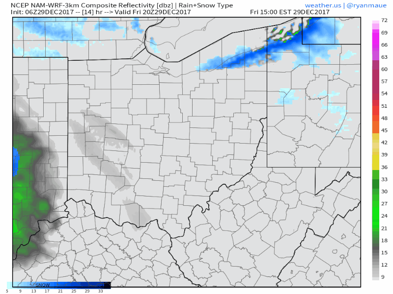
Simulated radar guidance from the 3km NAM showing a good illustration of the moderate to heavy snowfall working in later this afternoon and slowly tapering off east throughout the day on Saturday…the window for the main wave today is 4pm-7amSat…with lingering bursts of snow or snow squalls throughout the afternoon hours across most locations expected:
Updated snowfall guidance this morning by the team shows a nice swath of 2-4″ with lesser amounts to the north and south:
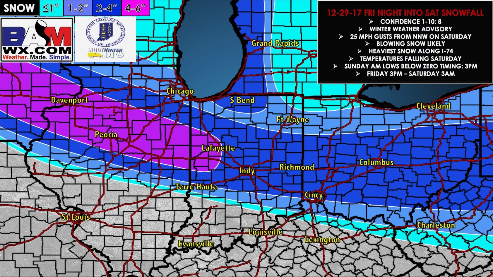
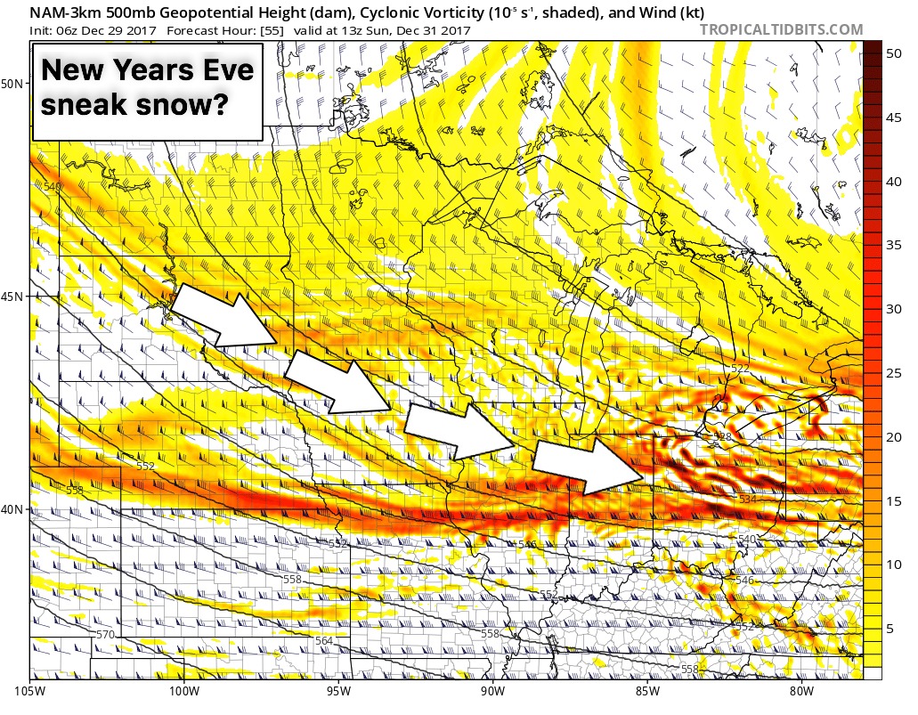
Winds will be a brisk NW 10-15 gusting at times to 25-30mph on Saturday and cloud cover holding most of the day as well. We are watching closely for a secondary wave of light snowfall accumulation to work west to east into New Years Eve…more details in the video and as we get closer to this timeframe:
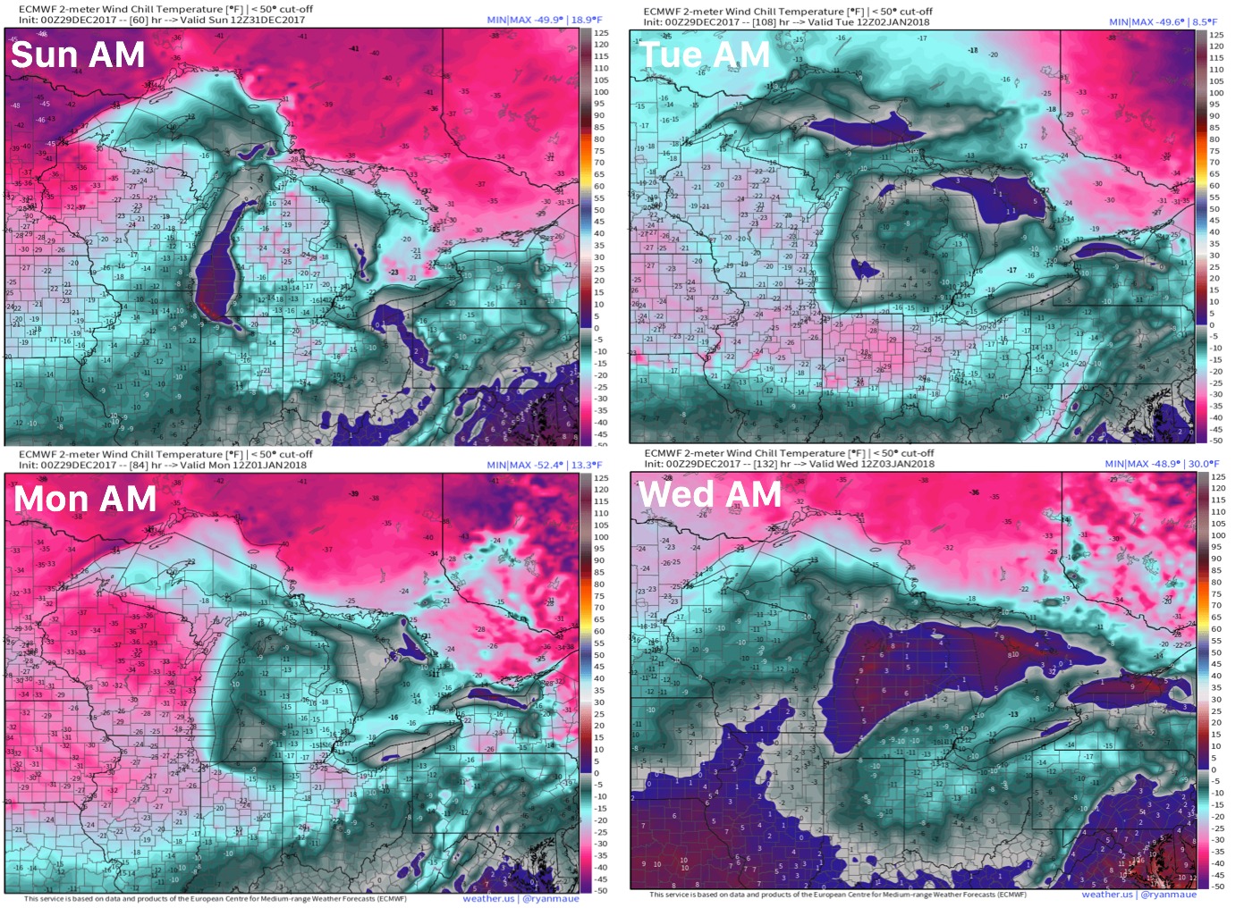
Wind chill guidance into early next week shows the bone-chilling cold settling…make sure the furnace is up and running well and faucets are at a steady drip to keep pipes from freezing especially overnight: