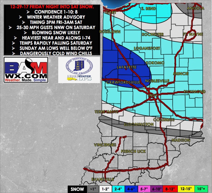
Synopsis: Good Friday morning! Accumulating snowfall moves in later this afternoon through the overnight hours Saturday morning, with additional accumulating lake effect snowfall starting to ramp up later Saturday morning into Sunday as well…so multiple shots of accumulating snowfall ahead as we head into New Years Eve (all details on timing/accumulations in the video). Saturday will feature brisk northwest winds at 10-15mph gusting at times to 25-30 mph and mostly cloudy skies overall so some additional blowing snow and slick surfaces will be likely. The arctic chill settles in Sunday morning and lingers into next week with every day waking up to below zero wind chills. We will have multiple updates throughout the day regarding the evolution of the snowfall…let us know if you have any questions as always, have a blessed day! -Kirk
Today’s video (7 min):
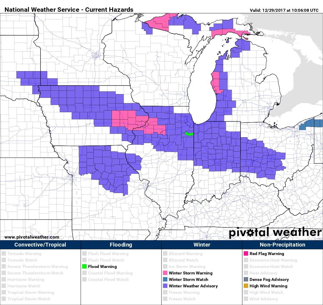
Current winter weather advisories through Saturday morning:
Updated Indiana snowfall accumulation map through Saturday morning:
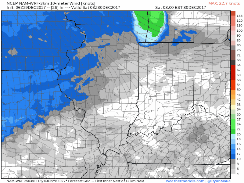
Winds on Saturday will be brisk out of the Northwest at 10-15mph gusting at times to 25-30mph:
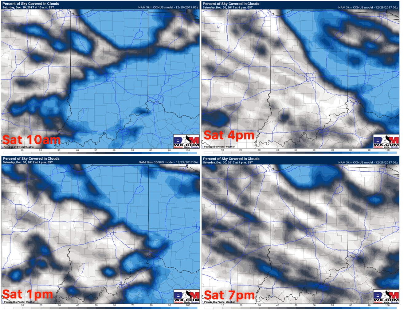
Overall expecting Saturday to be mostly cloudy up north with peaks of sunshine possible:
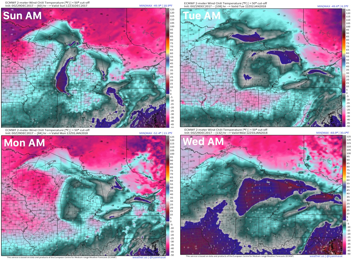
Wind chill guidance Sun-Wed mornings…frigid air working in starting New Years lingering basically all of next week: