Video:
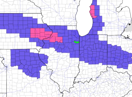
Latest winter weather alerts…counties in pink are under a winter storm warning where up to 6″ is snow is most likely. The advisories are in place through midnight, and the winter storm warning goes until 10pm. Note the advisory near Quincy is for the potential of light freezing drizzle/flurries this afternoon/evening.
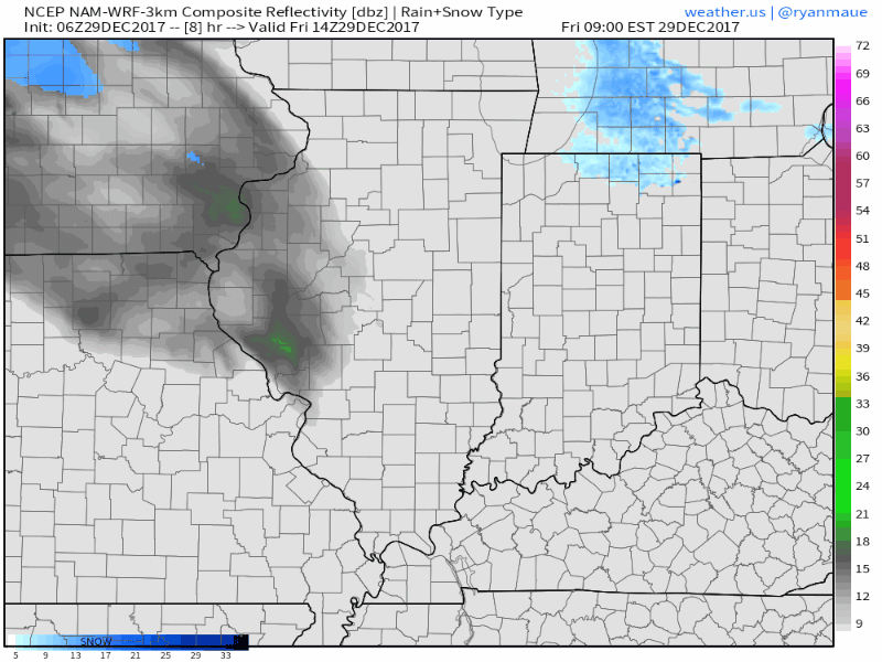
Snow will rapidly move in by mid to late morning and continue through the afternoon, gradually decreasing through the night.
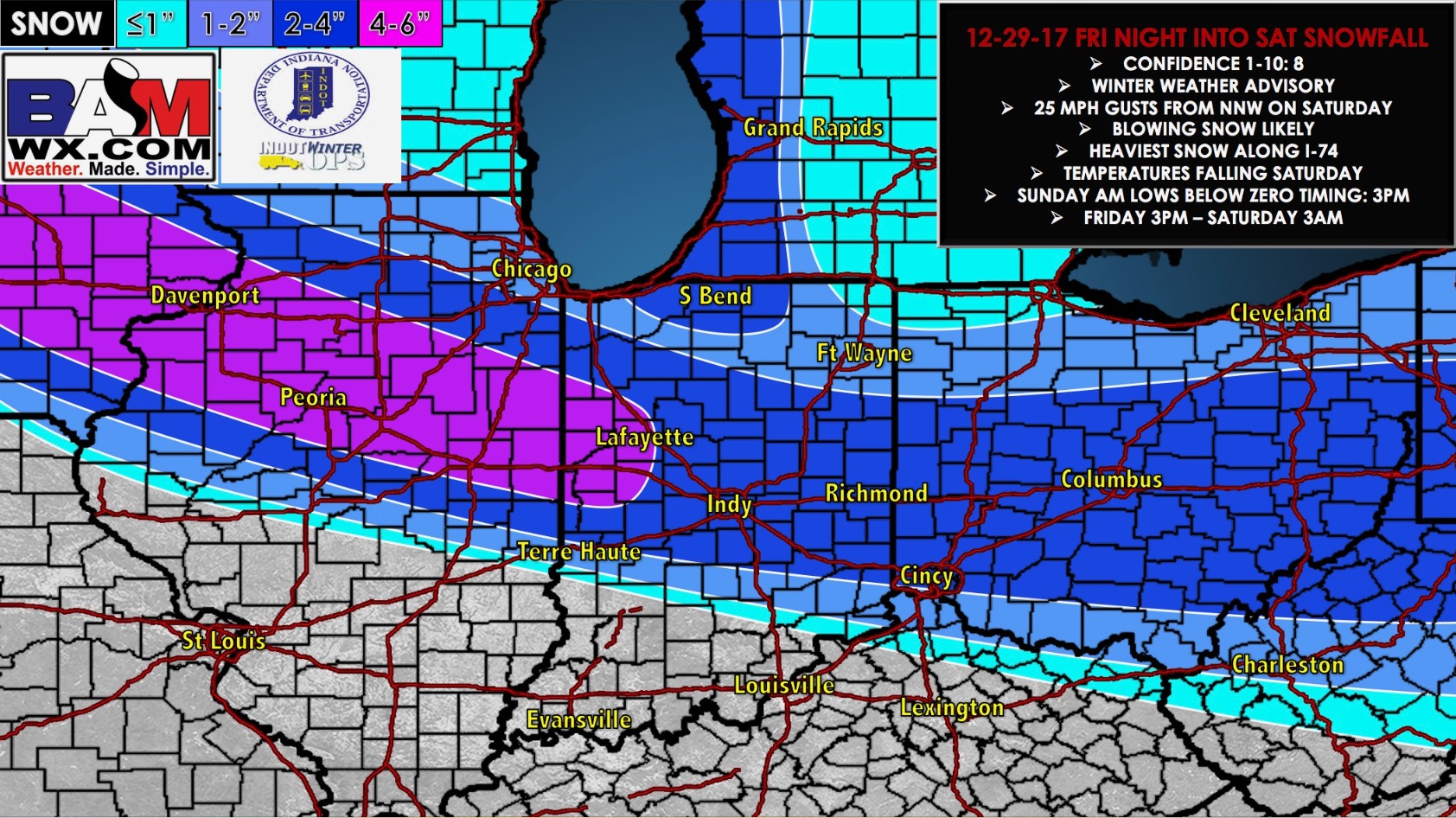
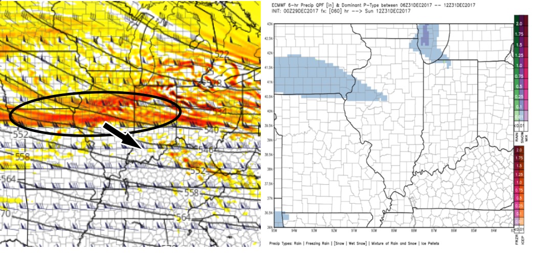
Our forecast hasn’t changed much regarding placement and amounts…just a nudge upward overall. Areas along I-74 and just north continue to look like the areas that see the heaviest band of several inches today.
An upper level disturbance will push through the state on Sunday, and bring the potential for some light snow showers which may produce light accumulations for some.
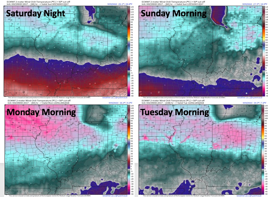
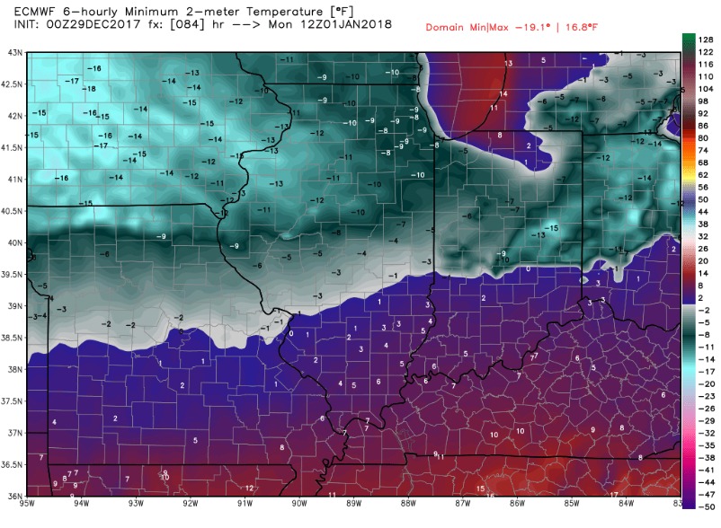
We will ring in the new year with “unbelievably cold” temperatures! Check out the forecast lows for Monday morning. If anything, we may be slightly colder than this. Leave your faucets dripping!
Check out the wind chills during this time-frame. Dangerous cold.