Synopsis: Good Thursday morning! Watching an area of light snow showers near Terre Haute as of 5:45 EST. This activity is running into very dry air, so confidence is low whether or not any flurries will impact the area this morning. Areas from near Bloomington to Martinsville would have the best chance around 7am. The next impulse of energy will move in between 5pm-10pm EST, and offer up another chance for a few flurries or snow showers, again mainly in northern parts of the area. Watching a stronger impulse of energy Friday afternoon-night that will bring snow across central and northern Indiana, and will likely impact northern portions of the area. Snow looks to move in by 3-5pm EST Friday mainly from a Terre Haute to Bloomington-Seymour line and points north, and continuing through the night. There will be a sharp cut-off between 1-2″ and nothing at all, so we will need to better fine-tune the placement over the next 24 hours. Reinforcing bitter cold builds in this weekend and sticks around next week. Details in the video. Have a great day, and let us know if you have any questions!
Video:
Forecast radar shows the potential of a few flurries/snow showers mainly in northern portions of the area this evening:
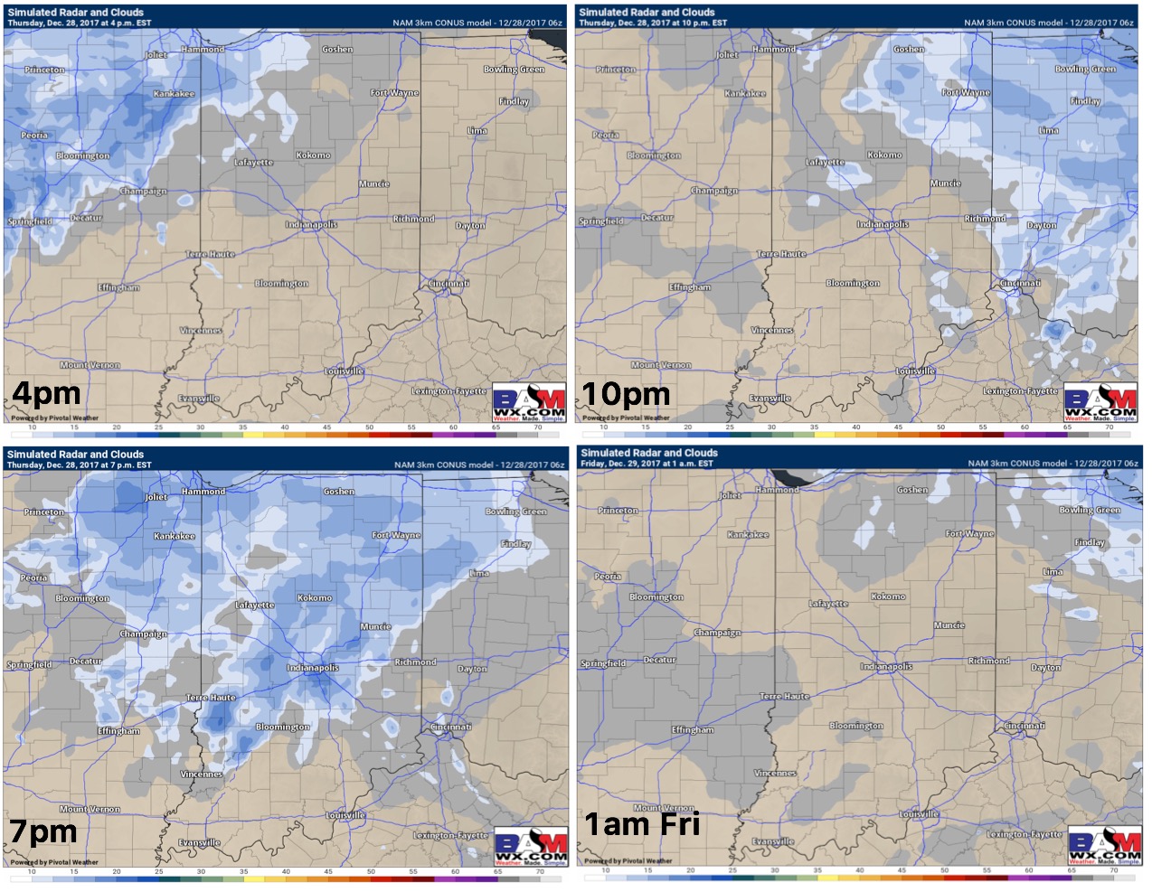
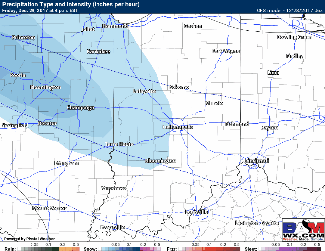
Forecast radar Friday afternoon and night:
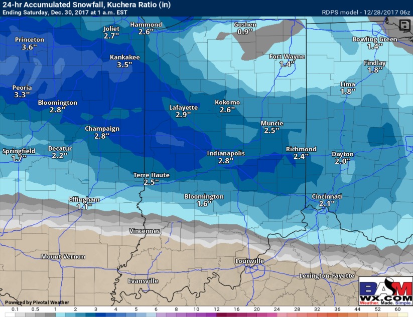
We think this modeled snow output has a decent handle with this system…again note there will be a tight gradient between 1-2″ of snow and nothing at all. We will have an update this afternoon once new model data comes in.