Today’s video (7 min):
Watching our next snowfall chances work in later this afternoon into the evening from west to east, mainly north of I-70…we time everything out in the video, but general thoughts are of light accumulations between 0.25-0.5″:
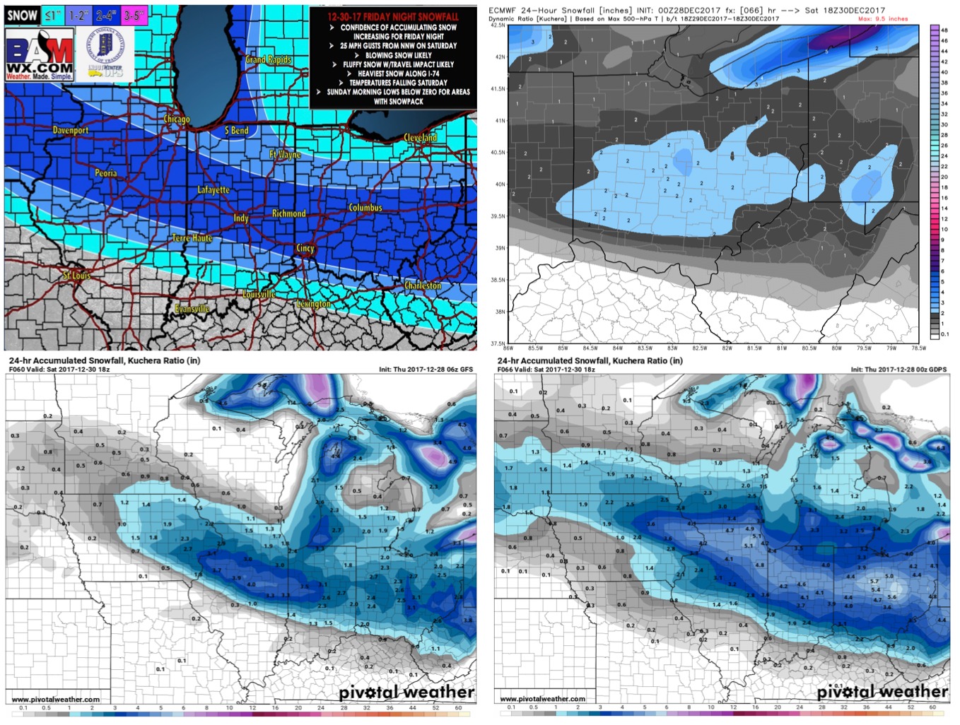
Here’s our latest thoughts just through Friday night into Saturday (not including lake effect to the northeast)…we still have differing data in terms on how far north the heaviest snowfall trends…likely will have an updated official snowfall map out by this afternoon/Friday morning:
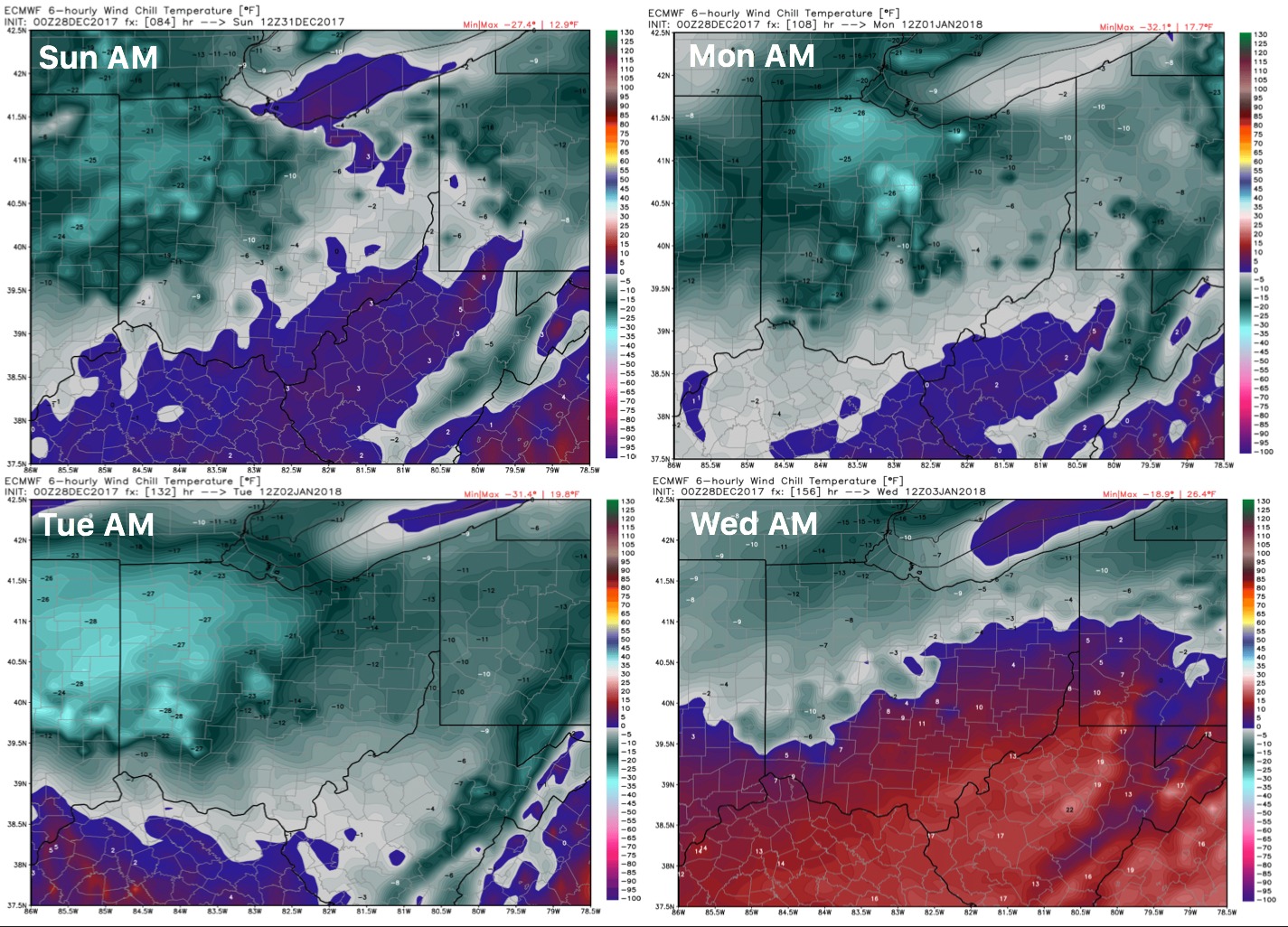
We get brutally cold behind this arctic front…check out these wind chills Sunday morning into early next week: