Synopsis: Good Thursday morning! Today we update you on the light snowfall working in later this afternoon into the evening from west to east as well as the latest on the accumulation snowfall getting into Friday afternoon into the overnight. We will see a solid lake effect band set up shop as we get into Saturday/Sunday as well, which was not included in the snowfall totals below or in the official forecast in the video as we want to take this one wave at a time. We get brutally cold Sunday morning into early next week with consistent lows at or below zero. Let us know if you have any questions, have a blessed day! -Kirk
Today’s video (7 min):
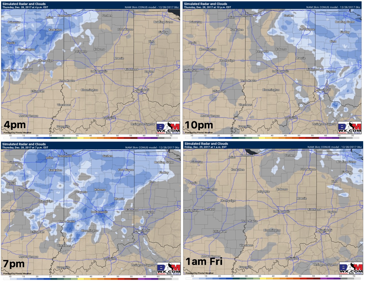
As we mentioned yesterday as well, another wave works in later this afternoon into this evening from west to east generally ~4-10pmEST…~0.25-0.5″ will be possible with this wave:
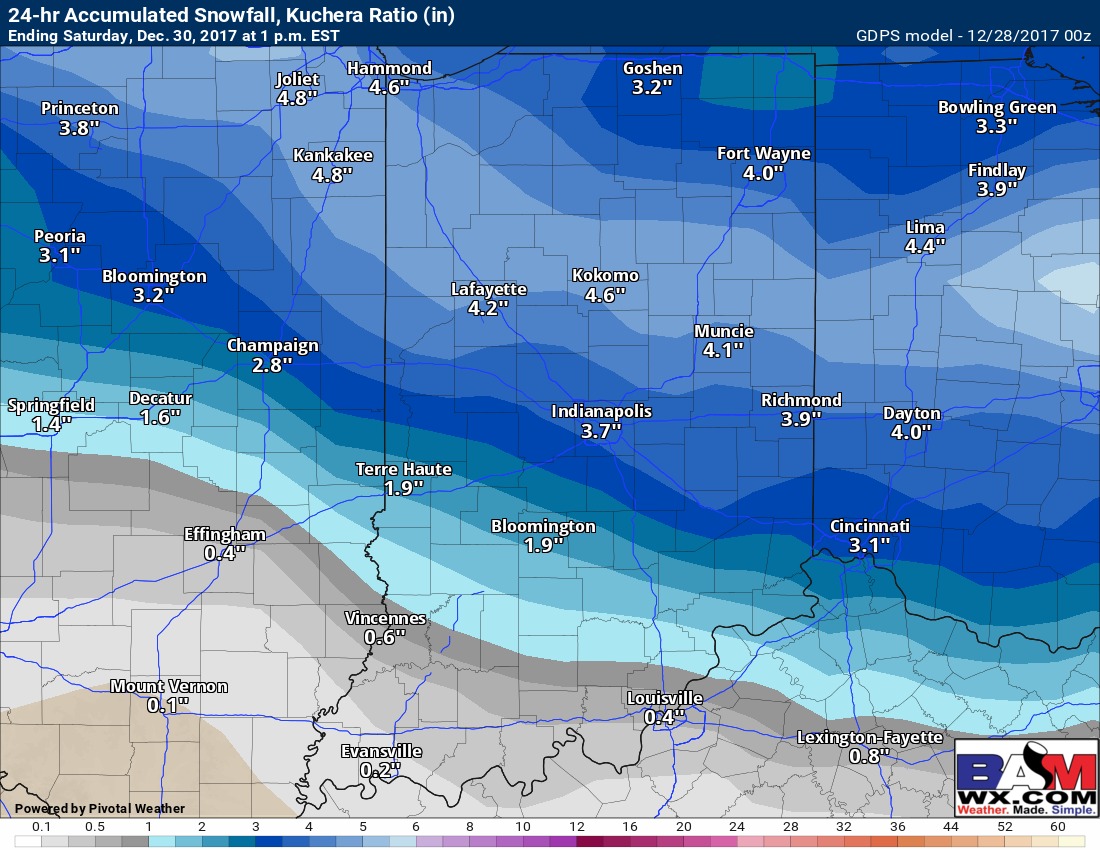
The “main show”, the bigger accumulating snowfall event still looks to move east Friday afternoon into the overnight…here’s the latest guidance from the Canadian which has been the most consistent model handling this wave (does best in these colder air events)…timing right now ~7pm Friday night to 7am Saturday morning generally; also remember, this will be a very fine, dry snow given the ratios between 20-30:1.
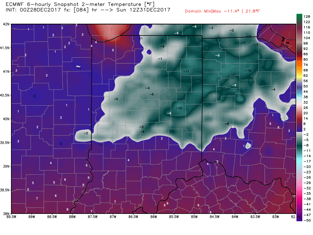
Very cold temps on the backside of this arctic front waking up Sunday morning…get used to negative temps for lows as we get into early next week as it’ll be the common theme, unfortunately: