Synopsis: Good Thursday afternoon! We are watching a disturbance that will continue to bring snow showers to the northern half of the state through the late afternoon into early evening. A good coating of snow is possible for the northern half of the state, with some 1-2″ amounts in north and west areas being possible. Still targeting a stronger, more widespread wave that will move through on Friday, delivering a swath of accumulating snows across much of northern Illinois. This update touches on the latest trends regarding timing, placement, and snowfall amounts. Watch the video for all the details. Have a great evening!
Video (5 min):
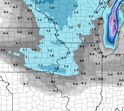
The northern half of the state will be in play for minor snowfall amounts into the evening, a few areas northwest seeing 1″ amounts or a bit more…otherwise a general coating of snow. Here is a look at forecast snowfall totals through the evening:
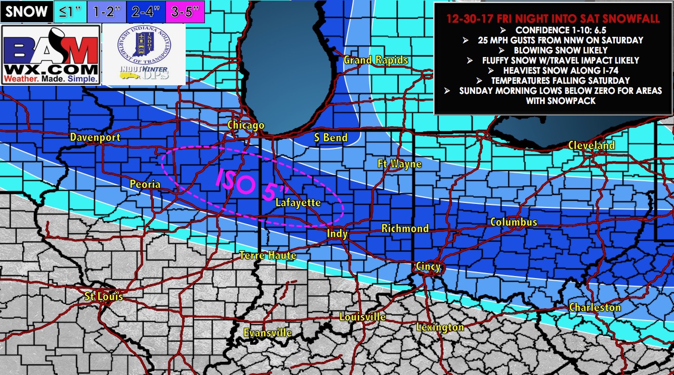
We continue to target a stronger wave that will move through the state Friday. This will bring a nice swath of accumulating snows across north-central Illinois, with a sharp south cut-off.
Updated snowfall potential: Overall no big changes from our previous forecast. The biggest change was to tighten up the snowfall gradient on the southern edge, as there will be a sharp south cut-off. Folks along the I-74 corridor (Peoria to Champaign) and points northeast to near Kankakee look to be in a 2-4″ swath, with an isolated 5″ total possible.