Synopsis: Good Wednesday morning, hope you all are staying warm out there given these frigid temps…unfortunately the bitterly cold air will continue as we head into the New Year. We continue to target off and on lake effect snow showers today mainly confined to LaPorte, St. Joseph and Elkhart Counties. We target multiple waves Thursday and the big-hitter Friday night that will bring additional accumulating snowfall chances…you’ll want to keep very close eyes on the short-term forecasts as we take things one wave at a time. If you have any questions please let us know, have a blessed day! -Kirk
Today’s video (6 min):
Wanted to look at Lake Michigan temps currently which are ~43ºF on average…you continue to get arctic air and NW winds to cross these warmer waters and you can see how the lake effect potential to continue will be possible heading into the New Year:
Targeting on and off lake effect snow showers mainly confined to LaPorte, St. Joseph and Elkhart Counties today…here’s simulated radar guidance below, more on timing in the video…1-2″ possible just with snow showers today:
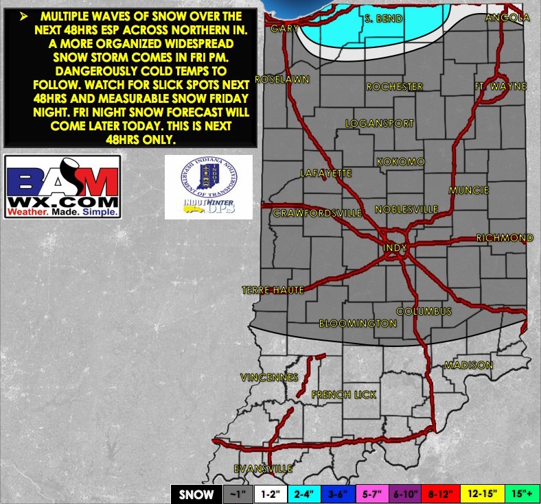
Latest snowfall accumulation forecast over the next 48 hours updated this morning (this does not include the wave Friday night into Saturday):
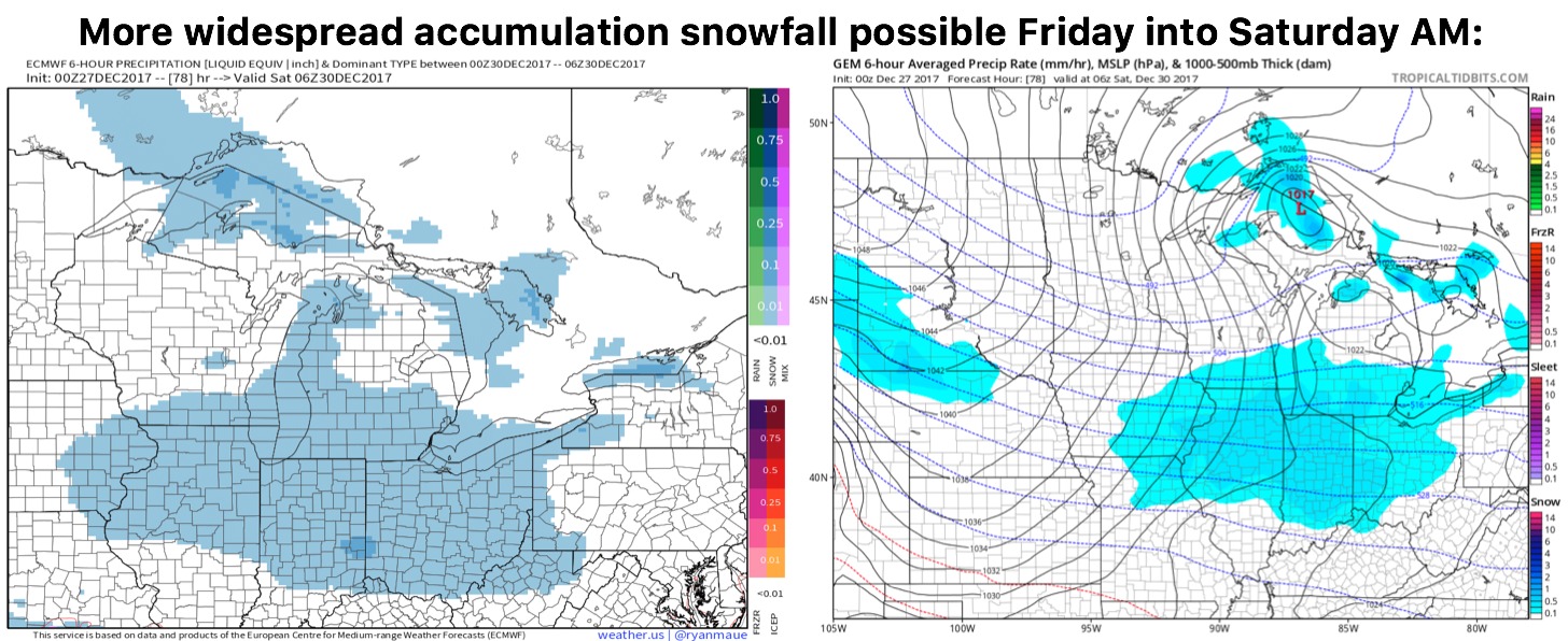
Still eyeing a more widespread snowfall threat on Friday afternoon into Saturday morning…data is gaining more confidence in terms of timing and accumulation but it’s looking more like a widespread swath of snowfall here: