Video:
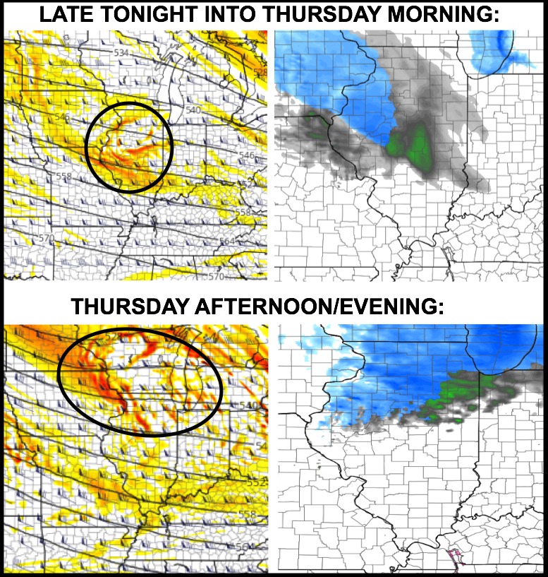
Watching for a few impulses of energy to bring additional snow chances to portions of the state over the next 72 hours. Much of today looks just fine with sunshine. Watching a wave of energy late tonight into Thursday morning, then another wave Thursday afternoon/evening:
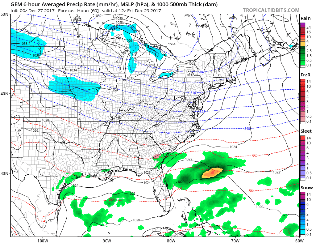
Still watching for a more widespread wave of snowfall to work across central and northern Illinois Friday afternoon and night. We think the Canadian model has a good handle on this system:
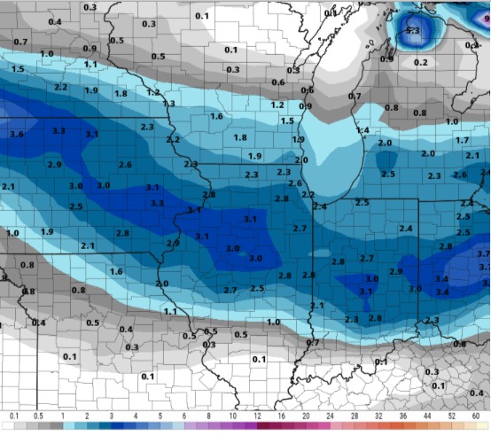
Snowfall forecast from the model:
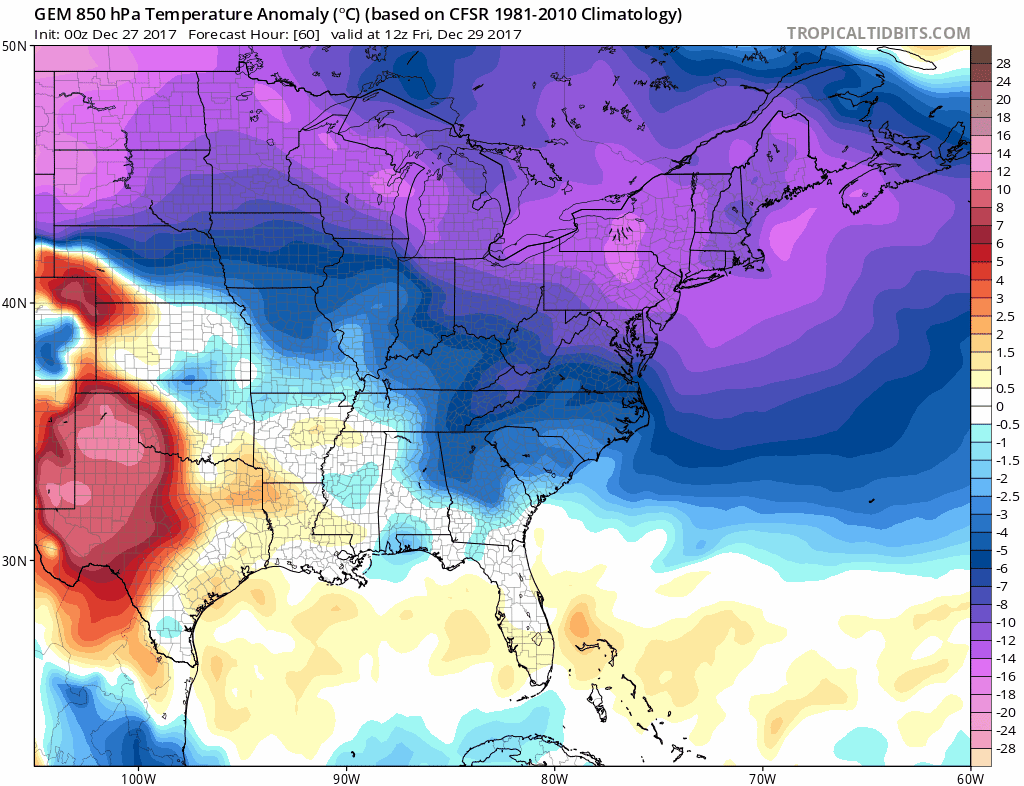
Reinforcing cold pushes in behind this system for the weekend into next week. Pipe bursting cold! Today’s video also discusses when we may see a relaxation in the cold.