12-26-17 Northern INDOT Districts Forecast – Very cold week ahead…targeting multiple bouts of snowfall. K.
Synopsis: Good Tuesday morning, we hope you all had a very Merry Christmas! Today’s video is a lengthy for the main reason that there is A LOT going on in terms of targeting snowfall over the next 5 days with at least 4 separate events we discuss in the video. Expecting the lake effect to pick back up more later this evening, mainly confined to LaPorte, St. Joe, Elkhart and Lagrange Counties and to linger off and on over the next 48 hours (below we posted thoughts on accumulations over this span). Targeting shots of snow Wed. night into Thursday morning, Thursday night into Friday morning and then on Saturday. We get brutally cold this week as well with lows every day dipping into the single digits if not below zero. If you have any questions please let us know, have a blessed day! -Kirk
Today’s video:
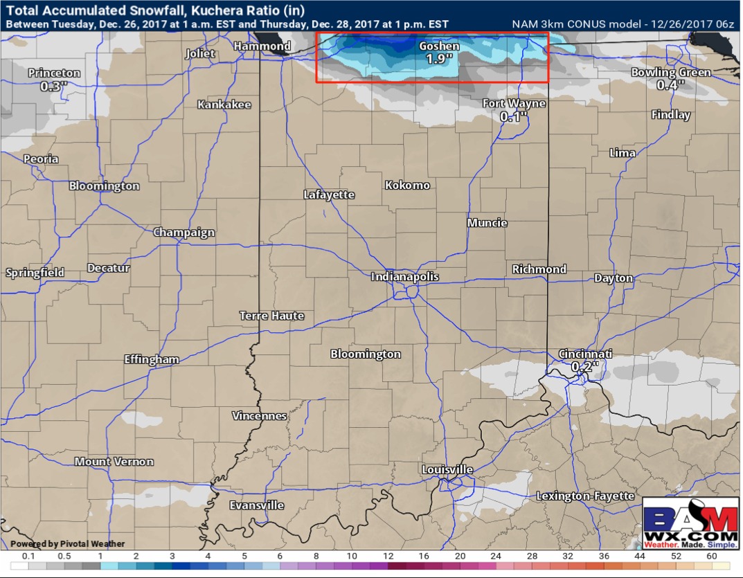
Thoughts on snowfall over the next 48-60 hours…the area in red we expect 1-3″ locally…with the heaviest coming close to the IN/MI border (isolated 4″ possible here):