Video:
Impulses of energy work work across central and southern Illinois today, bringing the risk for flurries and light snow showers in these areas. A coating of snow will be possible, so be sure to watch for slick spots.
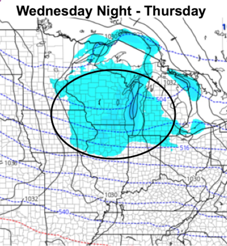
Sunny Wednesday, then we track our next disturbance Wednesday night and Thursday, bringing a light snow threat to the northern half of the state:
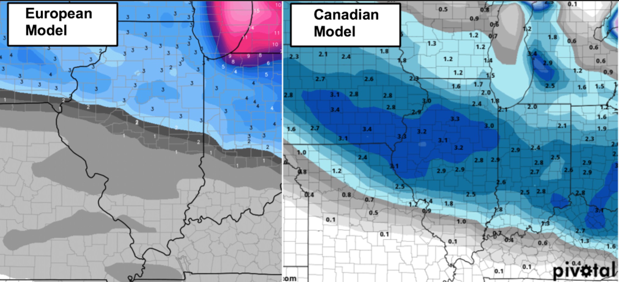
Our next chance for more widespread accumulating snowfall will arrive Friday evening/night with a clipper system. Here is a look at the European model for Friday night:
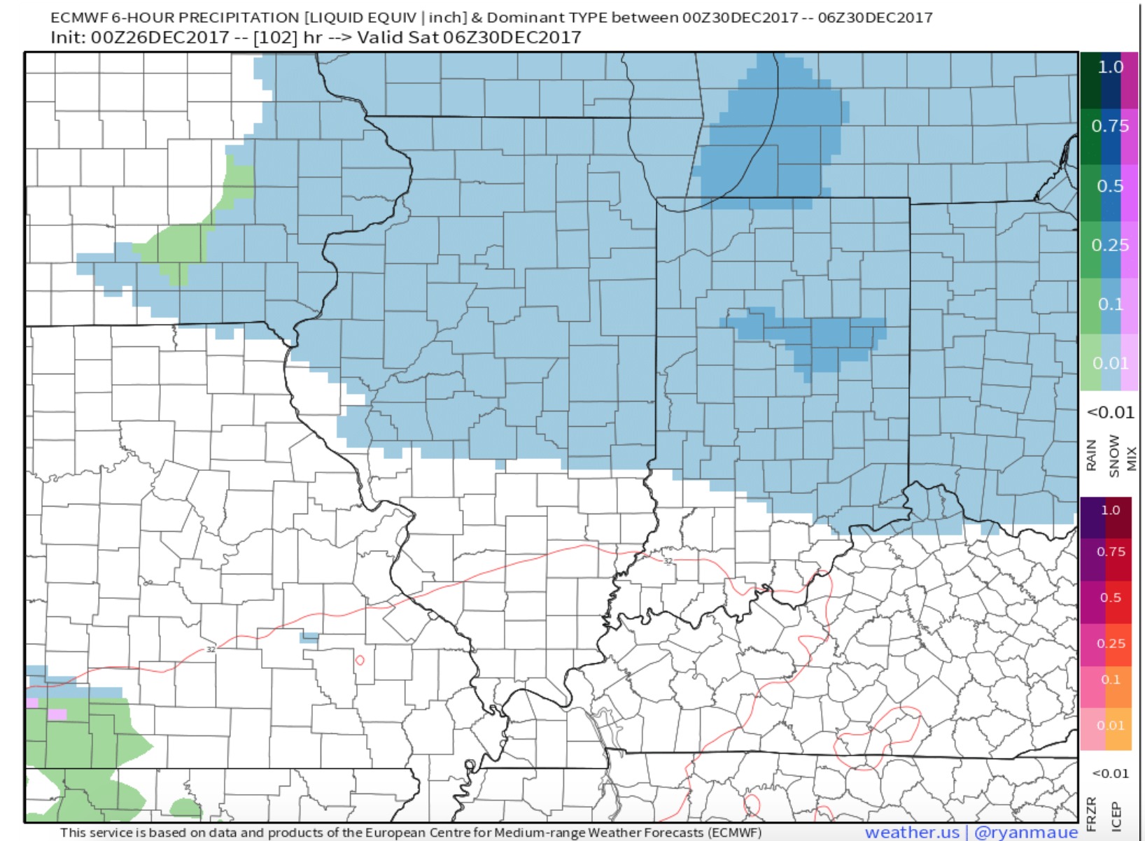
The Canadian and European model seem to have the best handle on our Friday night snow threat, putting down a 2-4″ swath. We note the central and northern portions of the state are the most likely areas, with some differences in the exact track of this system.
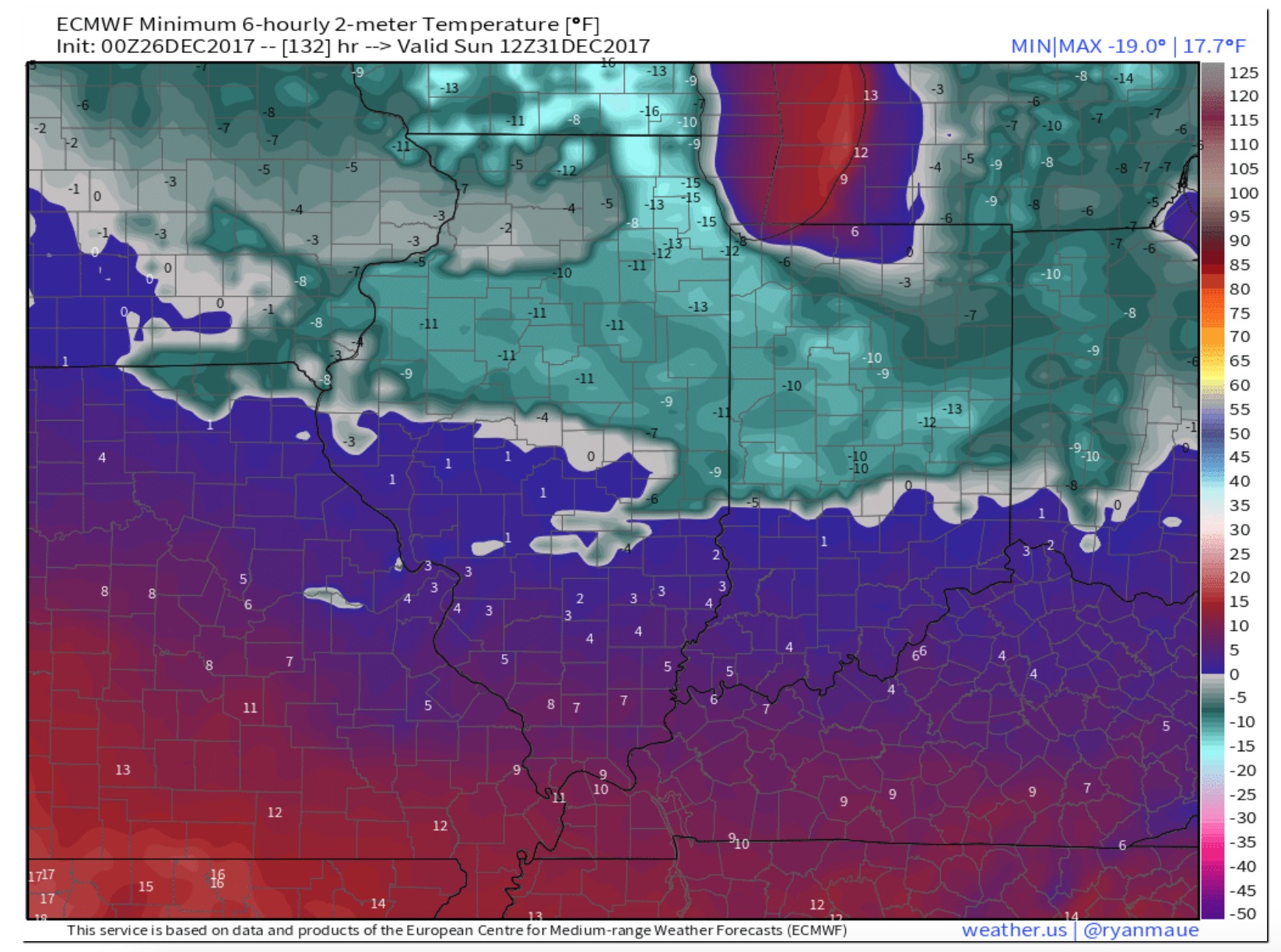
Behind this system, even colder air is expected. You can see wherever we lay down a healthy snow pack, temperatures have the potential to tank way below zero. Check out the European model low temperatures for New Year’s Eve morning: