12-26-17 Bitter Cold And Accumulating Snow Late Week. Details Here. M.
Synopsis: A few snow showers on the table today with little to no accumulation expected. More snow showers possible Wed AM and again Friday AM again each of these pesky waves only offering up maybe a coating of snow with them. Temps are bitter cold with lows in the single digits. The next storm system comes Fri night into Sat. Right now the models are all trying to figure out if this is going to be a 1-3″ clipper or a 3-5″ snow storm. Simply put we don’t have the specific answer yet but what we do know is snow is in the forecast. We will continue to fine tune in the coming days. Dangerous cold arrives Sat into early next week and we are talking wind chills as cold as -25ºF! The good news this morning is AS OF RIGHT NOW no snow is expected for NYE or NYD. If you have any questions please let us know.
Video is 7 min today:
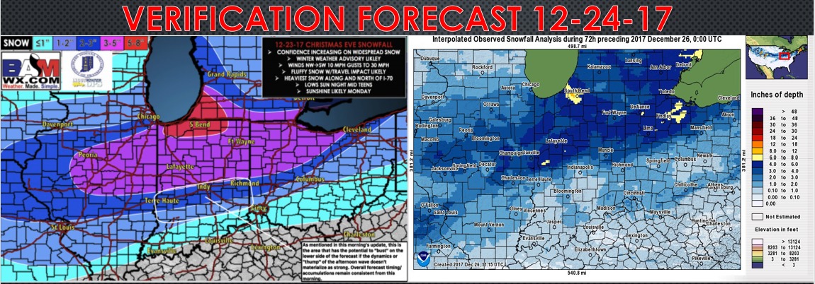
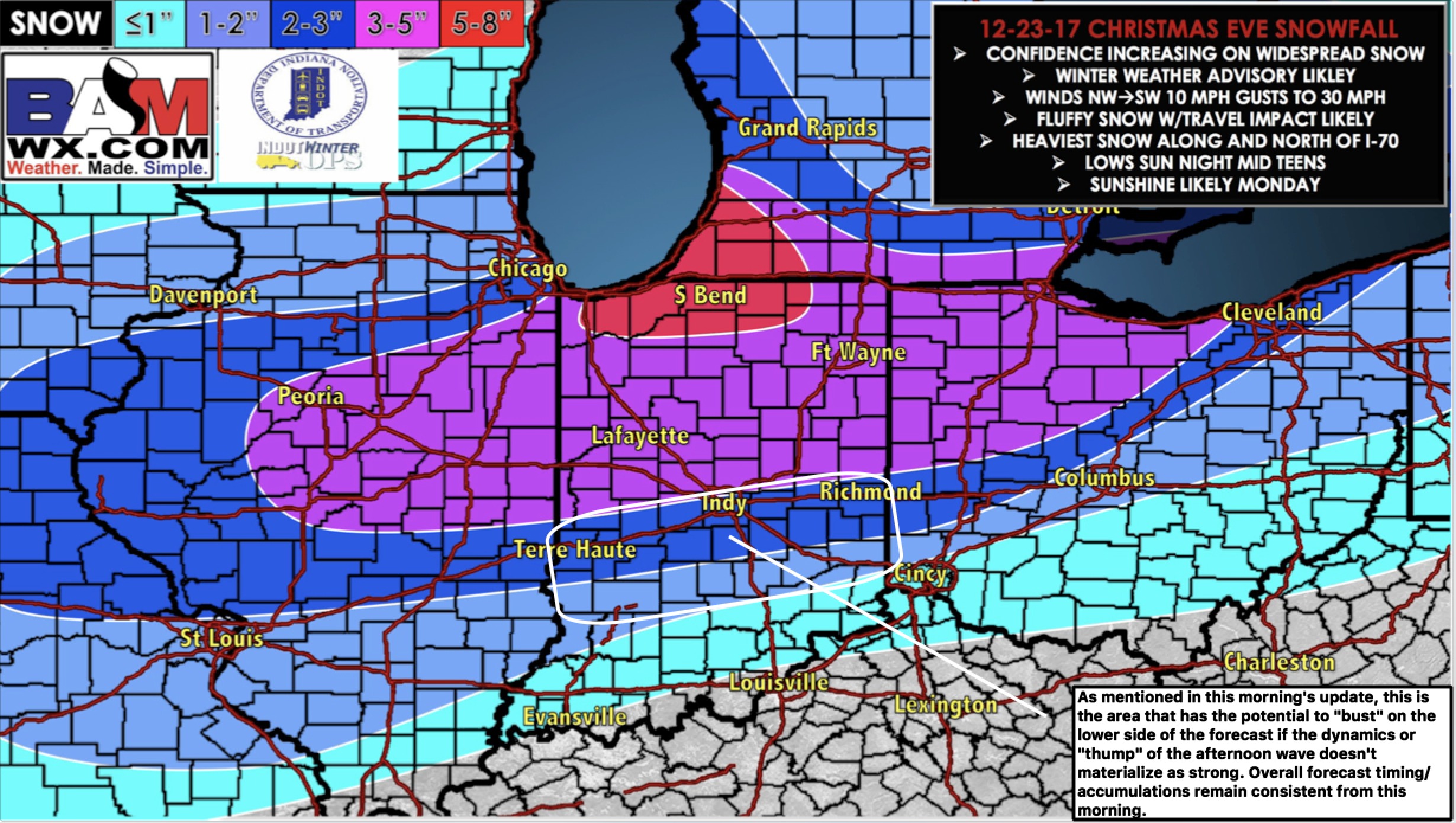
Forecast verification for the Christmas eve system overall was good with the exception of the area inside the white box where we were most concerned with the forecast to begin with. Overall we missed the Indy Metro accumulation forecast but elsewhere did rather well. The reason for what happened this weekend for Indy and points east is a warm nose of air worked in ahead of the storm system and the storm system sped up somewhat. A lot of the snow that fell initially melted on contact due to the warm nose that worked in. We will note that for the next system to eliminate forecast errors moving forward.