12-25-17 Northern INDOT District Update – Latest on pesky lake effect snow next 60 hours + eyeing weekend accumulating snowfall event/extreme cold. K.
Synopsis: Merry Christmas from all of us at BAM, we hope you got an opportunity to spend some time with family. Today we discuss pesky lake effect snow showers over the next 60 hours, mainly confined to the northern 4 counties (1-2″ from South Bend to Goshen over the next 24 hours possible). Beyond this is Friday night into Saturday eyeing our next accumulating snowfall event as a robust clipper system (high-ratio) works northwest to southeast…behind this bringing colder temps than we’ve seen since January 2014 (enhanced by the polar vortex swinging down). Let us know if you have any questions, have a very Merry Christmas! -Kirk
Today’s video (6 min):
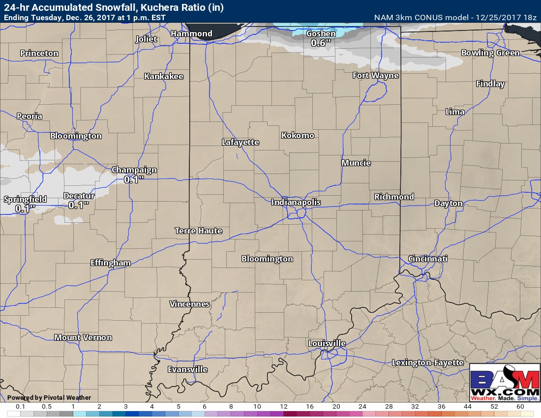
24 hour snowfall shows 1-2″ possible from South Bend to Goshen into Tuesday:
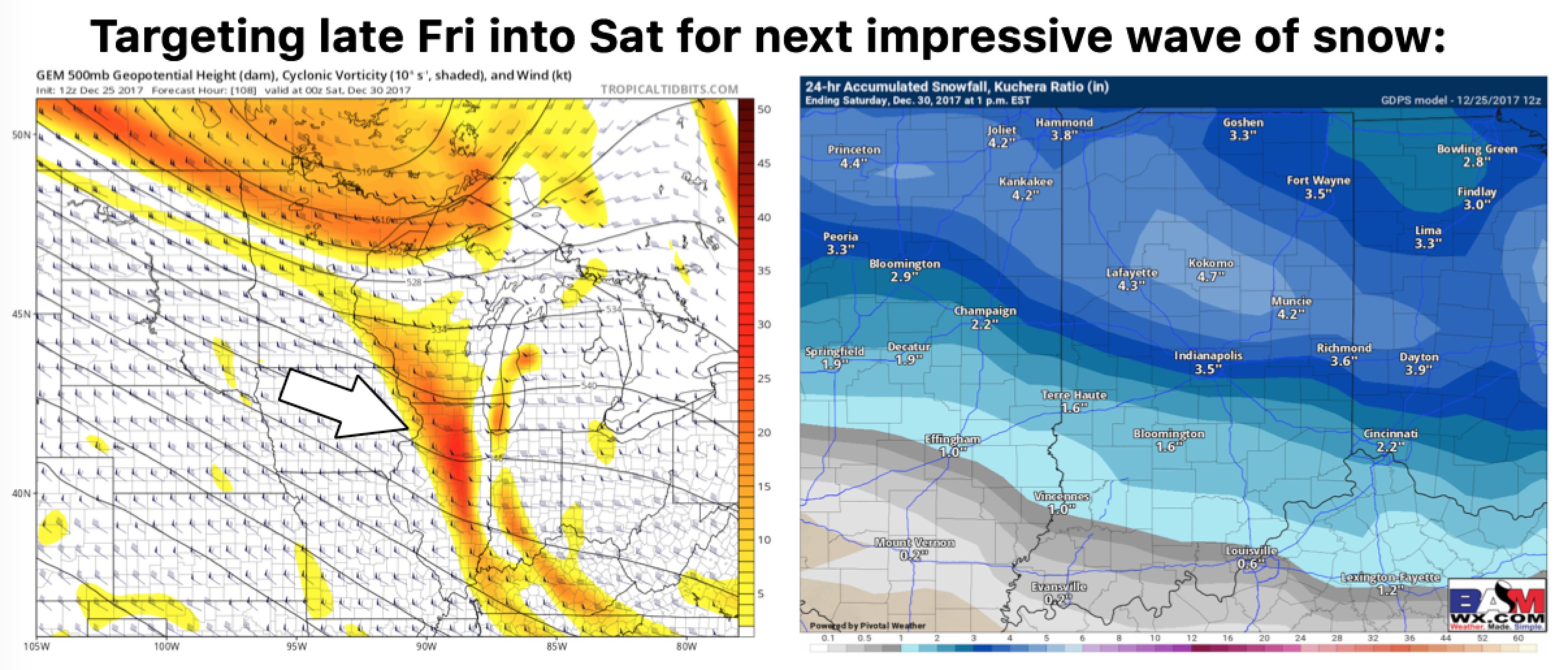
Eyeing next more robust accumulating snowfall event Friday night into Saturday:
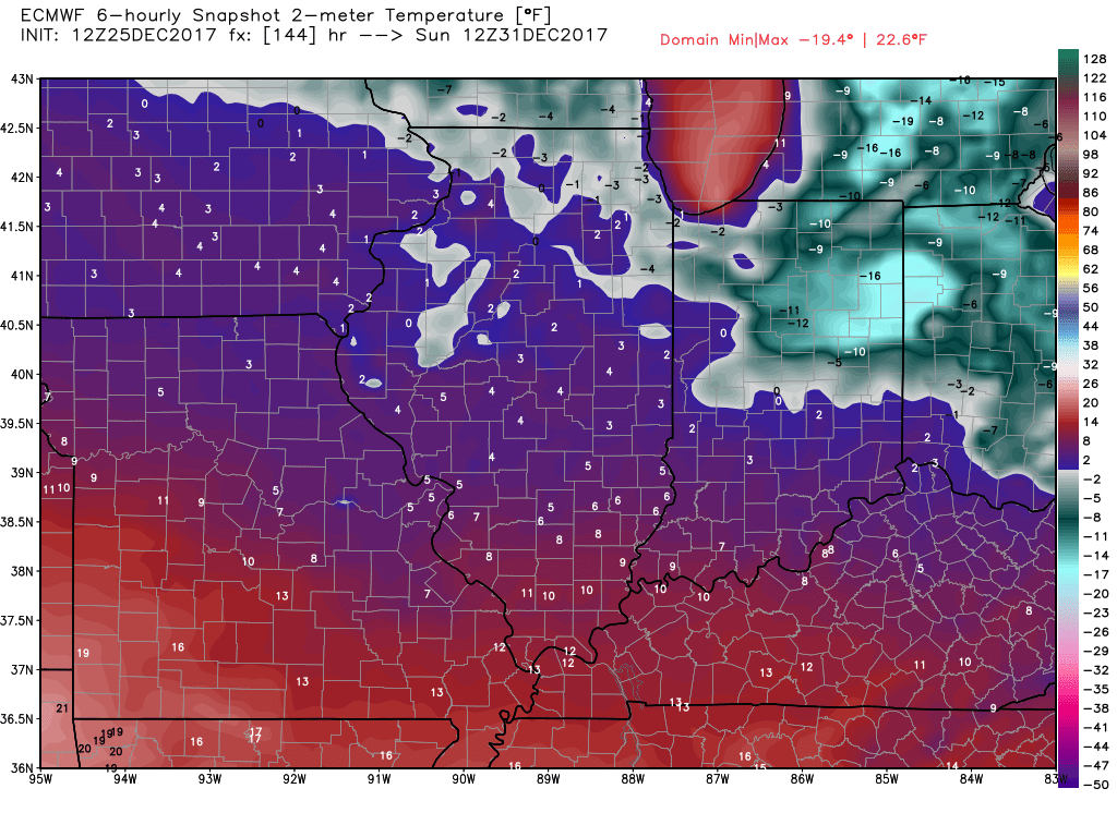
Extreme cold follows this wave with lows possibly dipping into the negative teens Sunday morning: