Detailed short-term forecast analysis:
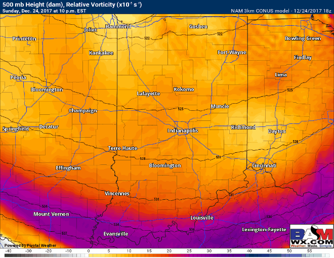
We will likely continue to see scattered flurries/snow showers lingering through about 1am EST, coming to an end once this upper-level vort max (shown below) moves northeast of the area. Just enough to continue creating slick roadways out there with these sharply colder temperatures.