Afternoon Video Update:
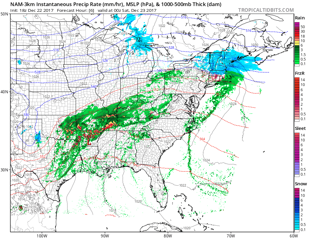
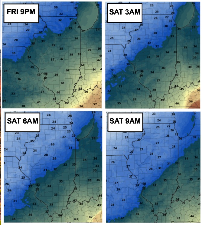
Rain showers will work in from the south this evening through tonight, mixing or possibly changing to some wet snow near I-70 by 2-4 am, and we expect this to continue into Saturday morning, exiting southeast Illinois by 11AM CST.
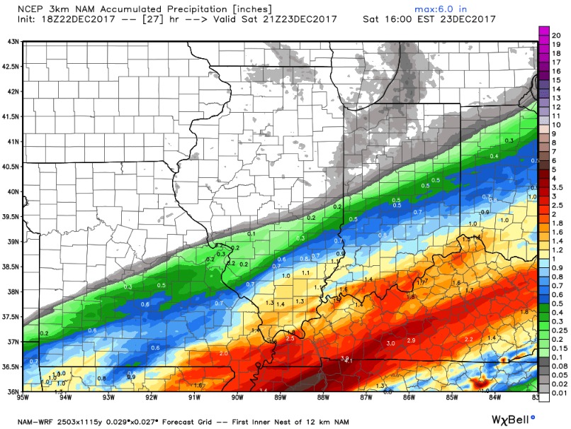
Any accumulations should be less than 1″ mainly on grassy/elevated surfaces:
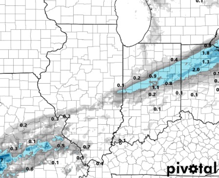
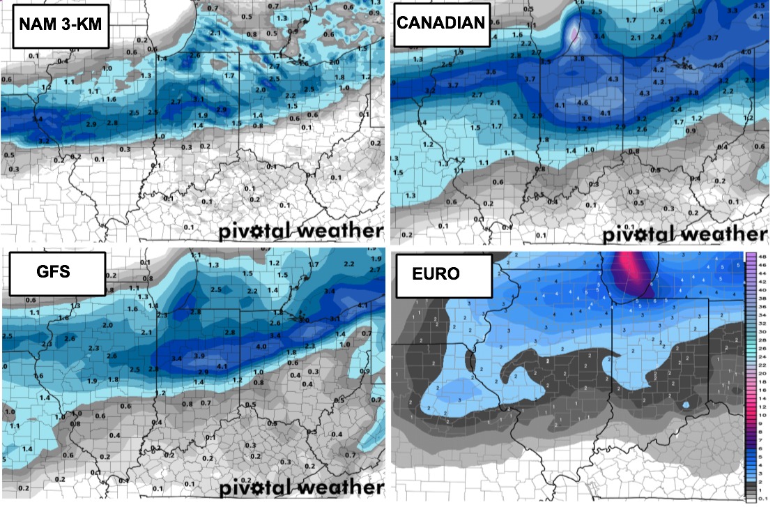
Here is the total precipitation expected by late Saturday morning. The bulk of the moisture remains along the I-70 corridor and points south.
Here is a look at temperatures throughout this time-frame. Note how the coldest air lags behind the moisture, which means we aren’t overly concerned for any slick spots or any big snow potential. If the colder air could of moved in a bit faster, this would have been a more impressive wintry system.
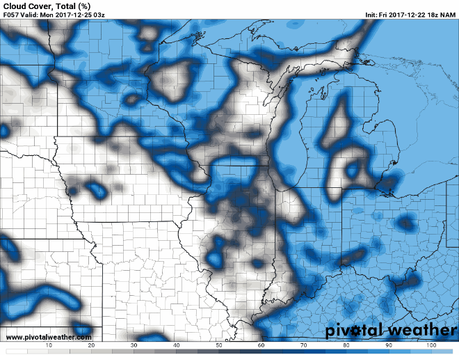
Next we track our Christmas Eve accumulating snow. We continue to note that the high resolution models are 12 hours faster with this system vs. the global models. We also note some differences in the placement of the heaviest band:
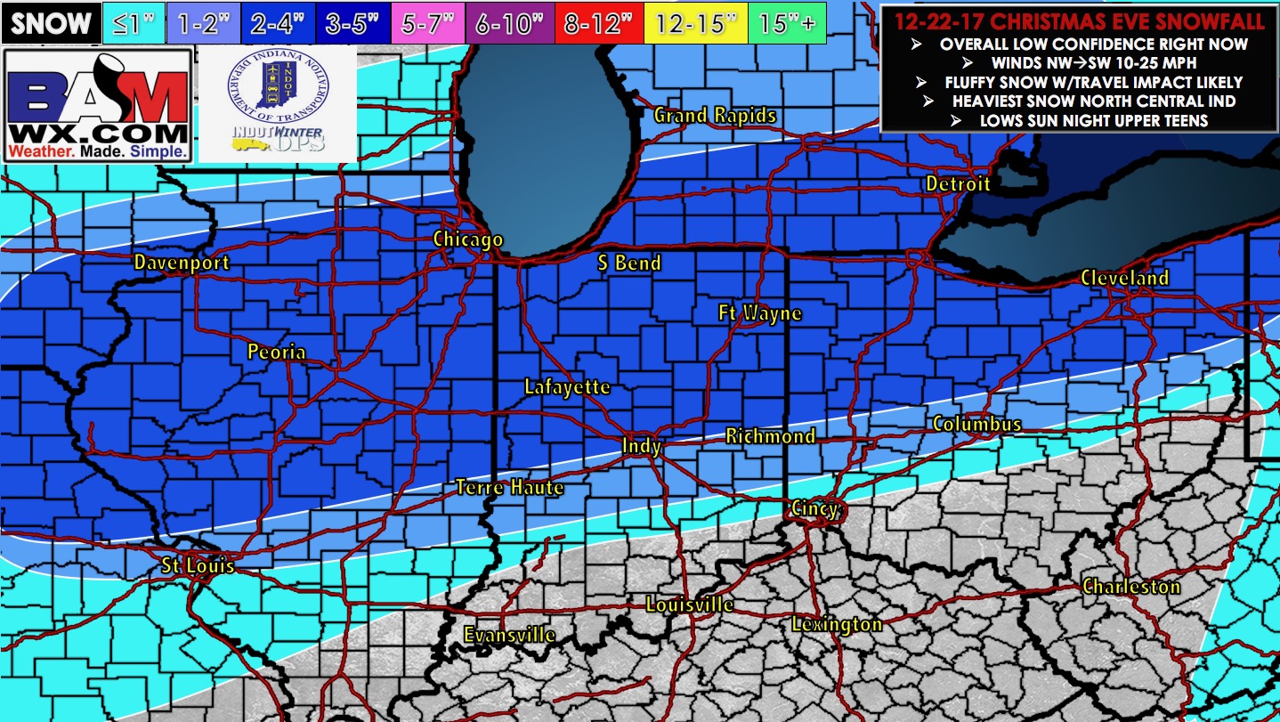
Here is our current idea on snowfall. While we do think there may be a heavier area of snow due to banding, it is currently unclear where that will be as data offers up multiple locations (shown above). We will continue to monitor the latest data and have an update out by 7AM Saturday. If you have any questions please don’t hesitate to reach out to us at anytime.
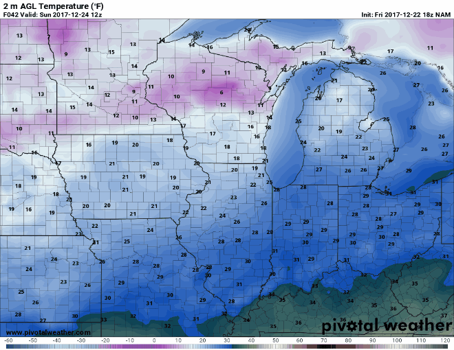
Here is an animation of temperatures from Sunday 6am to Tuesday 12am. Temperatures within the main snow band will hold in the 20s throughout the day Sunday, the fall to the upper teens by Christmas morning. Highs Christmas Day will struggle to get out of the 20s where you lay down the snow. Lower 30s in southern Illinois.
As we head into Christmas Day, we should see some sunshine which will allow for improvement in road conditions.