Today’s video (7 min):
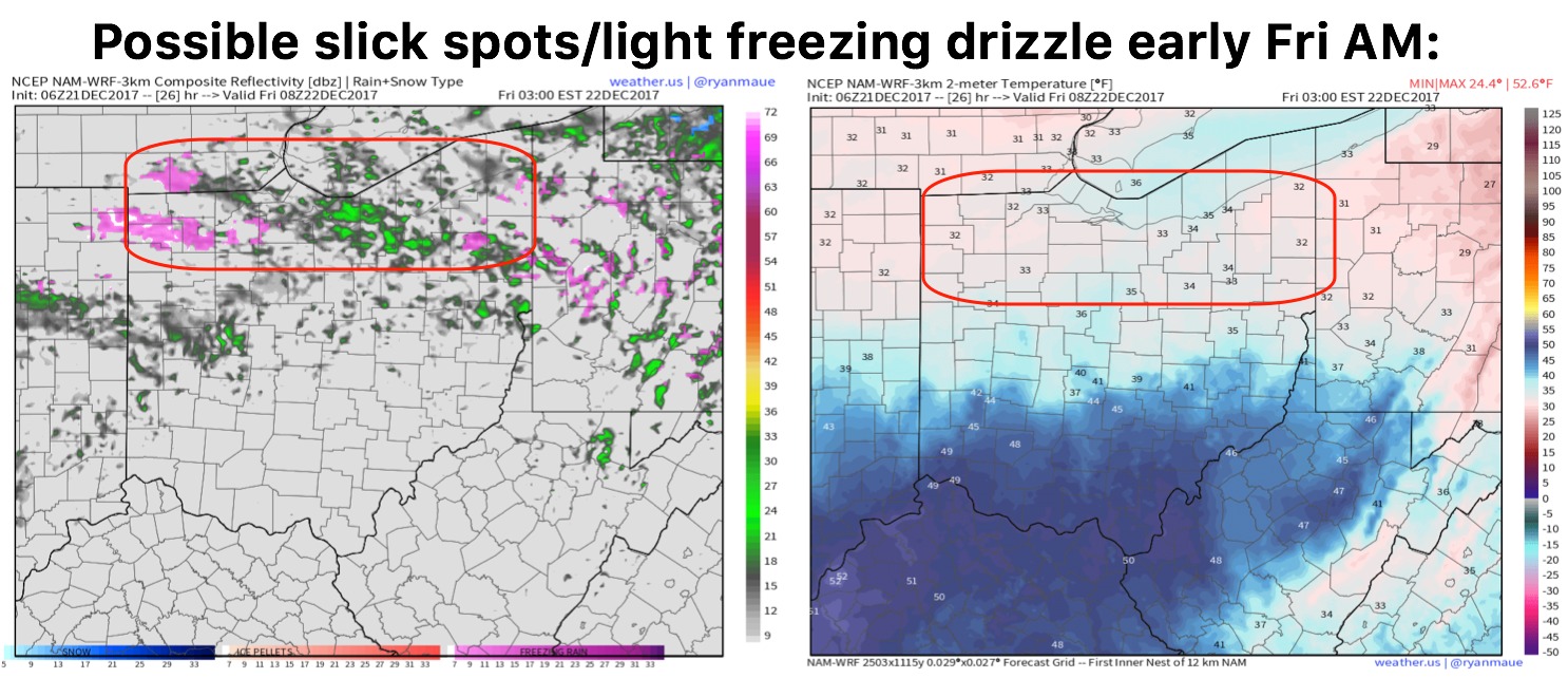
Light drizzle and showers working later today into Friday along a warm front…again, it’s the light and pesky stuff. We do have a concern, however, for northern locations for potential light freezing drizzle and slick spots where left untreated into Friday morning:
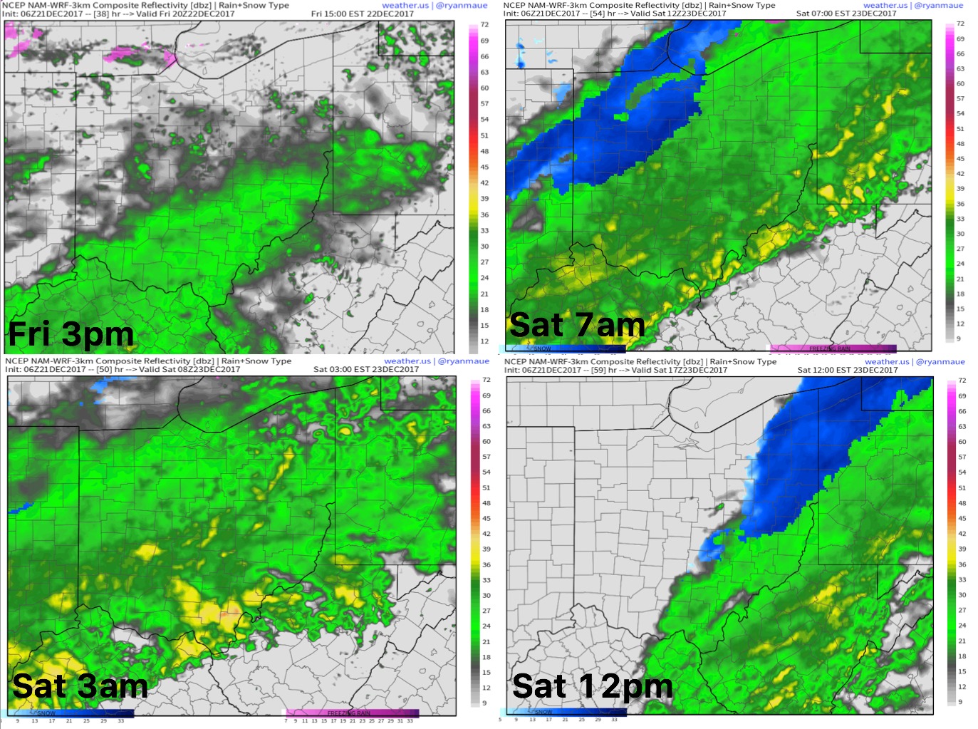
Right on its heals is the low pressure system working into the Ohio Valley…light to moderate rainfall will initially be falling at a coverage of 70-80% to 100% especially south of I-70…we will start to work in some mixed precipitation to at times, heavy, wet snow Saturday morning into early afternoon. At this time we aren’t anticipating much in the way of snowfall accumulation on pavement due to things being too warm…grassy surfaces and elevated areas may see a coating to slightly higher amounts:
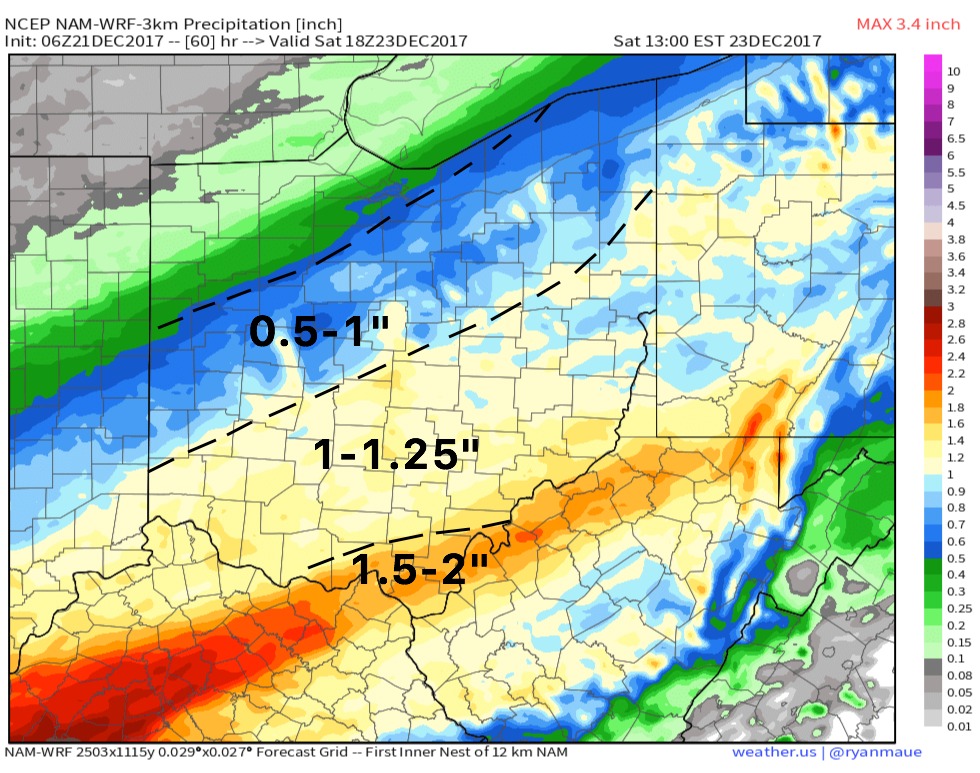
Here’s latest guidance on precipitation accumulation over the next 60 hours…south of I-70 has a solid shot of at least 1″:
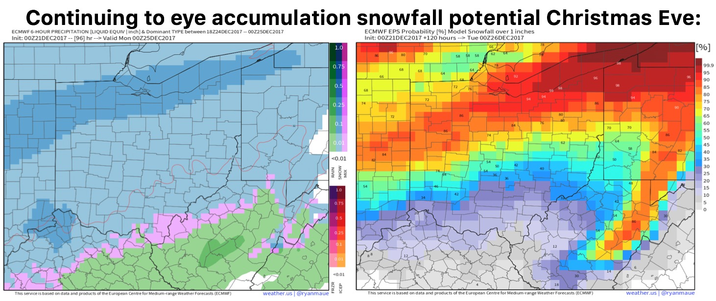
Continue to eye Christmas Eve for a potential accumulating snowfall event lingering into Christmas morning across Ohio as temps will be below freezing with a piece of energy swinging east…think of this as a glorified clipper system (more details in the video):