Video:
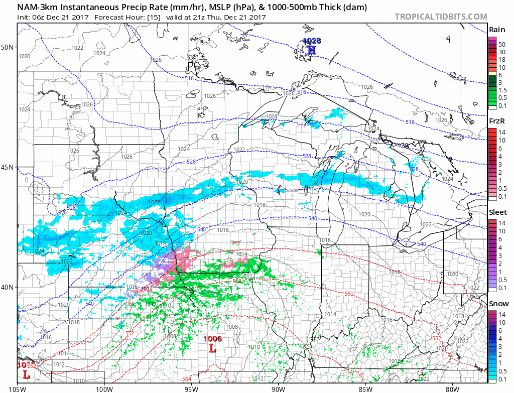
A weak storm system will work through the area this afternoon into tomorrow morning. Scattered showers are likely in the southern 2/3rds of the state with light freezing drizzle or freezing rain possible in the north third of the state. This could create hazardous driving conditions for the Thursday evening and Friday morning commute. (Timing: 4PM Thursday – 7AM Friday)
A stronger storm system will affect areas of southern Illinois late Friday into Saturday. Heavy rainfall is possible for the extreme southern extent of Illinois and totals could reach nearly an inch in some areas.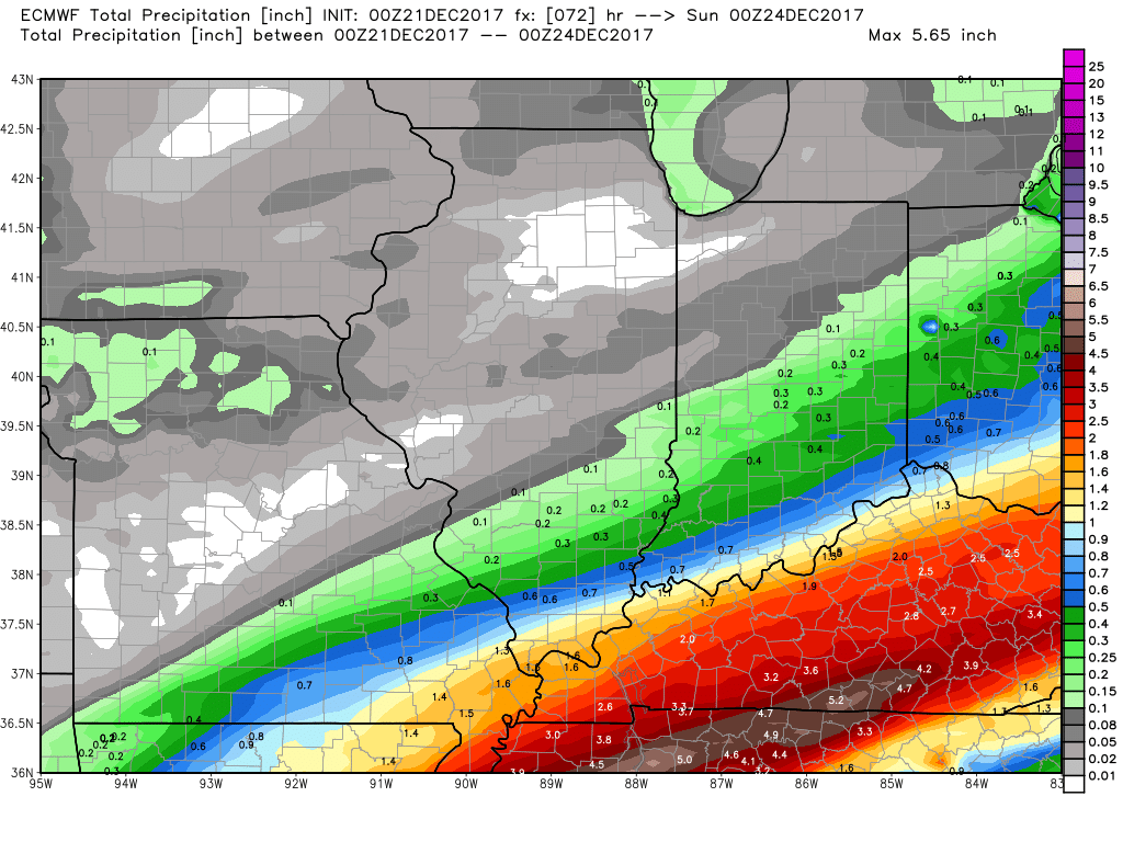
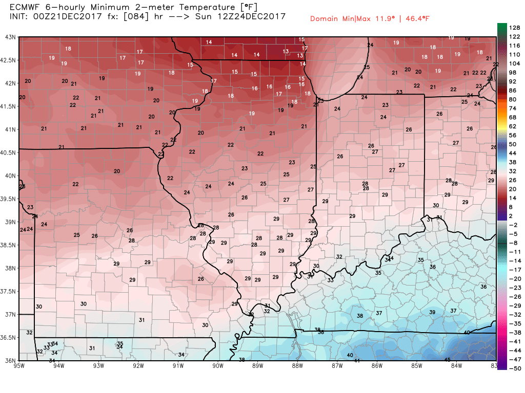
Behind this storm colder air will filter into the state allowing for a chilly start to Christmas Eve.
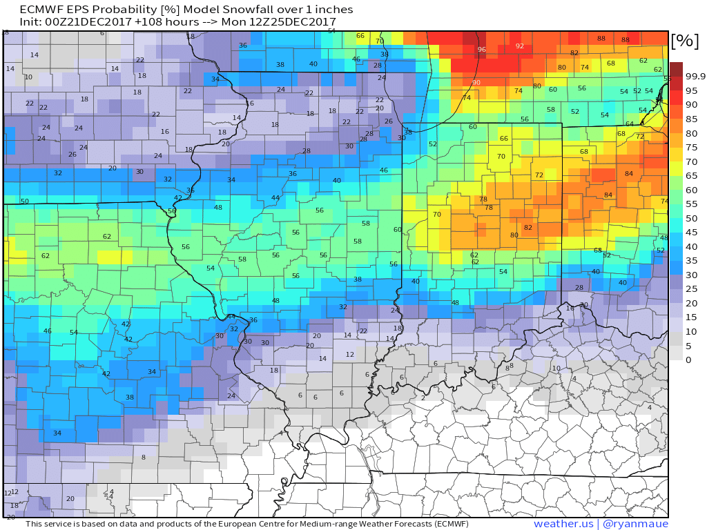
The potential for accumulating snow is still on the table for Christmas Eve Day. The European (snow > 1″ probabilities shown below) and Canadian models have been consistent with this idea for several days.
We will continue to fine tune the forecast as models begin to converge on a solid solution for this storm.
