Today’s video (7 min):
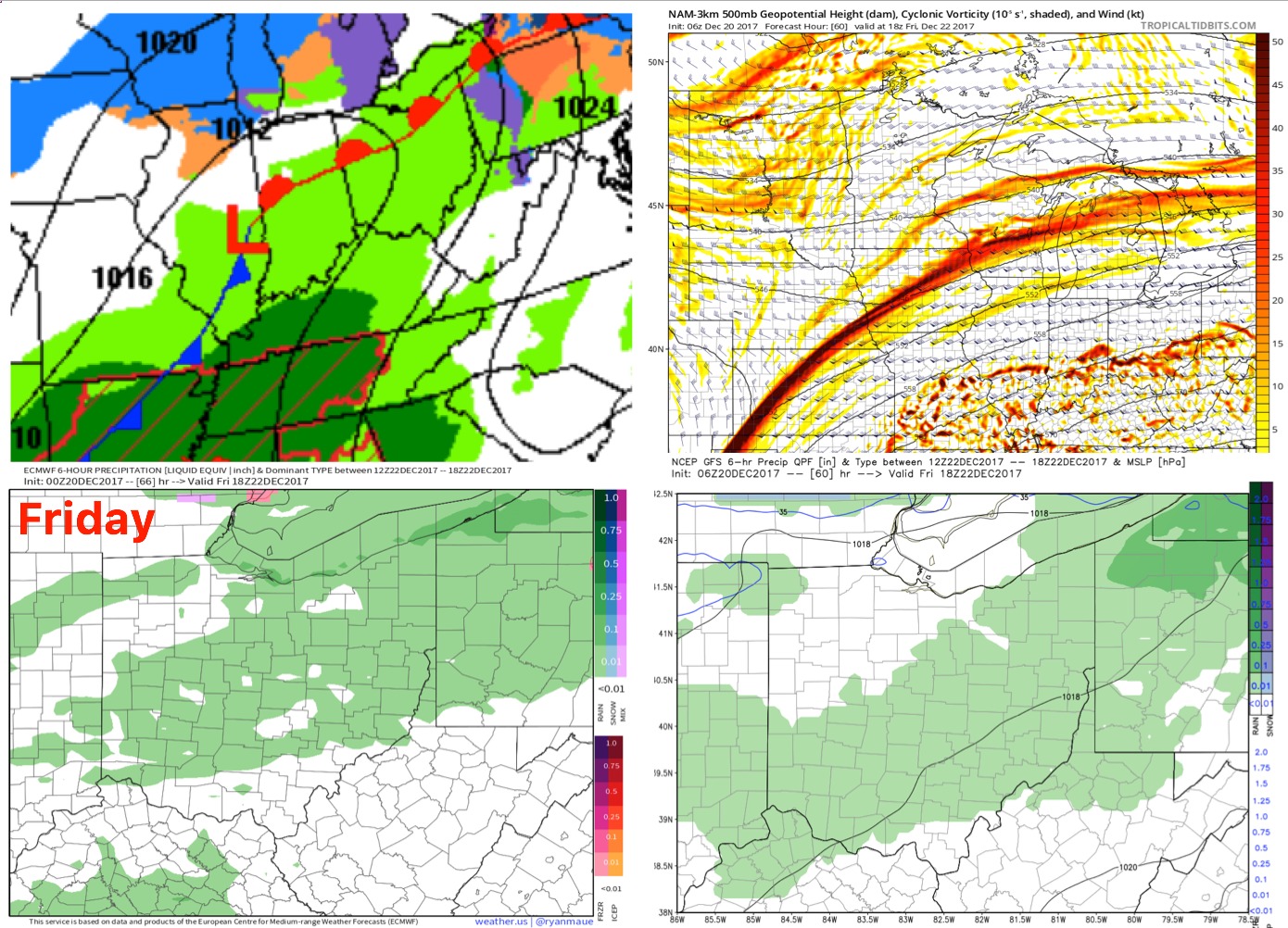
Friday a warm front works in…light showers to drizzle is the forecast for most of the day on and off:
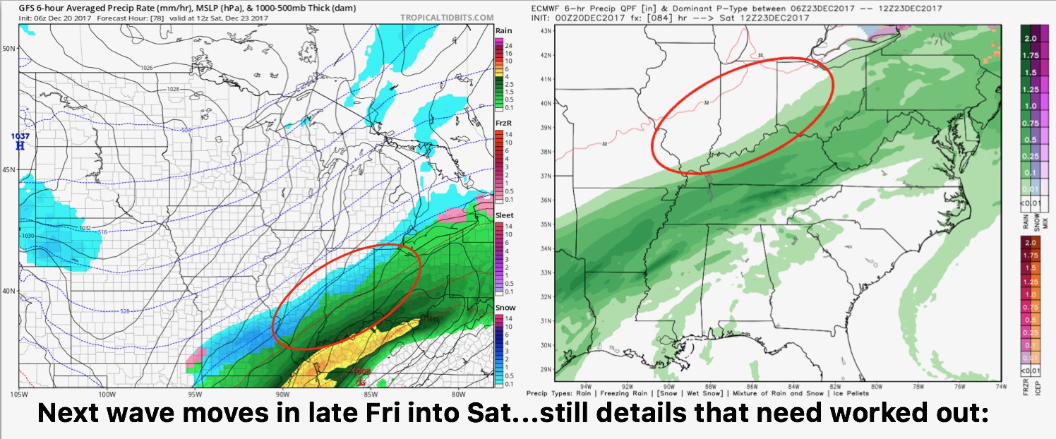
Eyeing later Friday into Saturday for our next notable wave of precipitation to work in…up for grabs still, unfortunately, is timing/intensity/precip-type. Cold air will rush in on the backside of this system so there will likely be a changeover to snow…in today’s video we discuss the risks for accumulation and timing because there differently is some big differences in data:
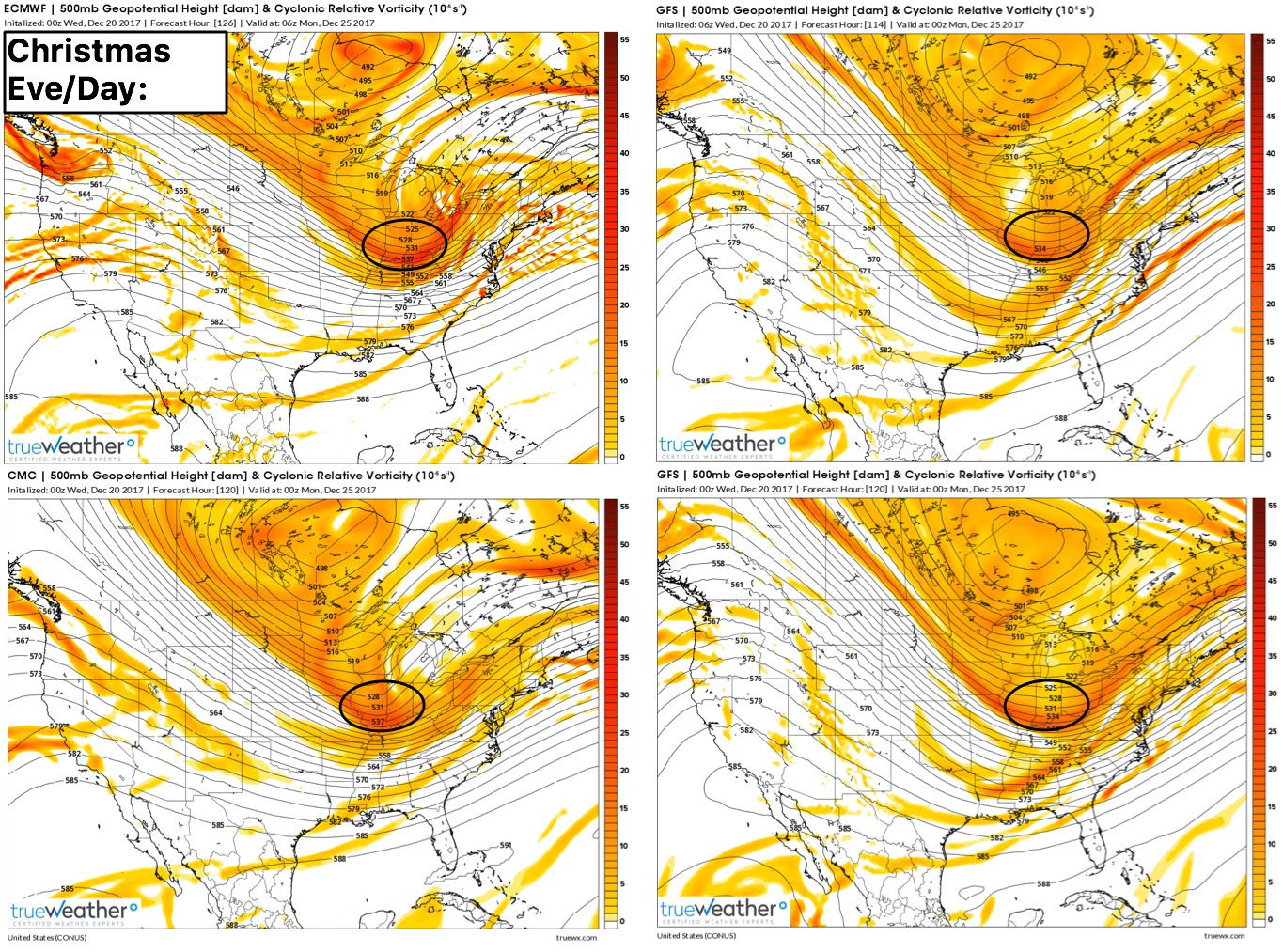
We continue to eye Christmas Eve into Christmas morning for a “leader-follower” solution, a piece of energy ushering into chilly air (~20ºF) bringing in a high-ratio, fluffy snow…below is a 4-panel of all the global forecast models showing the piece of energy pushing into the Ohio Valley: