Video:
Expecting some drizzly weather to settle in late Thursday/night, with the potential of a wintry mix and icy roads to develop in northwest portions of the state tomorrow night. Areas from Morrison to Rockford area and northwest appear to be the most likely area.
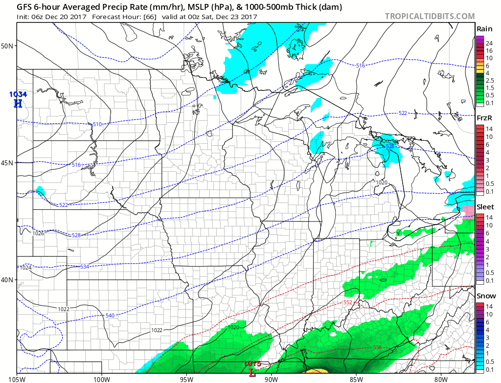
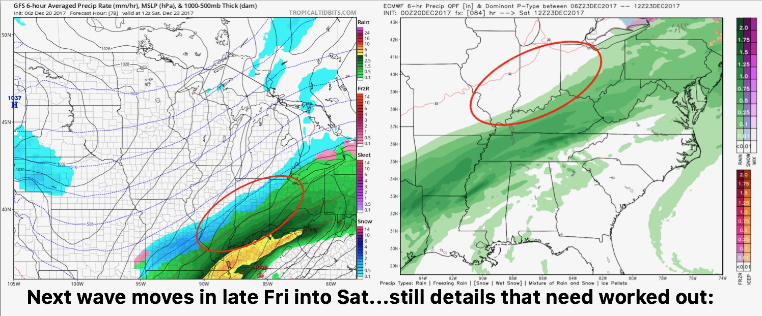
A wave of low pressure will work to our south Friday night into Saturday. This system has trended much further south than yesterday. This also leads to a colder trend and the potential of the back-edge of the moisture to feature some frozen precipitation. Some guidance keeps this even further south, nearly out of the state. The 6z GFS run (below) is colder and further south with a stripe of some snow. VERY low confidence in the forecast, so it is important you are checking back for the latest information.
Here is a comparison of EURO model vs. GFS….European keeps the moisture further south.
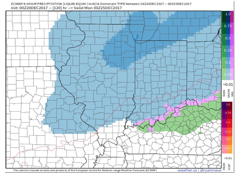
Another wave of snow showers is possible on Christmas Eve with some snow accumulation possible. The European model is more aggressive with snow potential for northern parts of the state, while the GFS remains the outlier keeping it dry. We think the European is the more likely scenario given that all models show the upper-level energy aloft. Forecast radar Christmas Eve afternoon shown below: