Video:
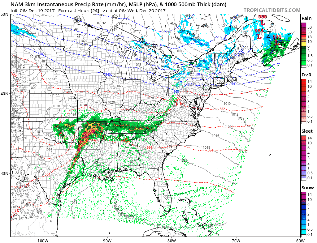
A storm system will pass by to the south of the area late tonight through Wednesday, possibly bringing a few showers to southern Illinois/Indiana. The rest of the area stays dry.
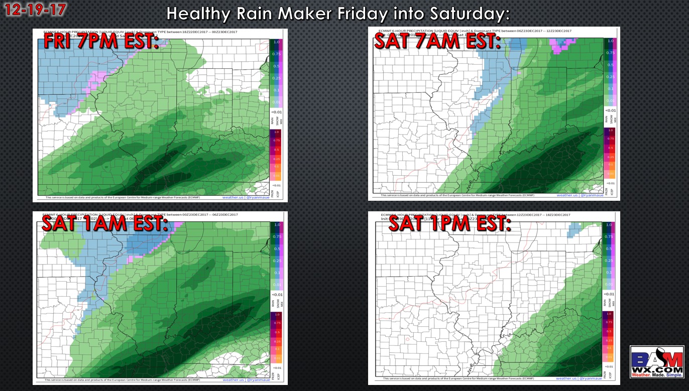
We are watching a storm system to move through Friday into Saturday. Data overall has trended wetter for most of the region. Heaviest rains fall across southern Indiana and into Ohio.
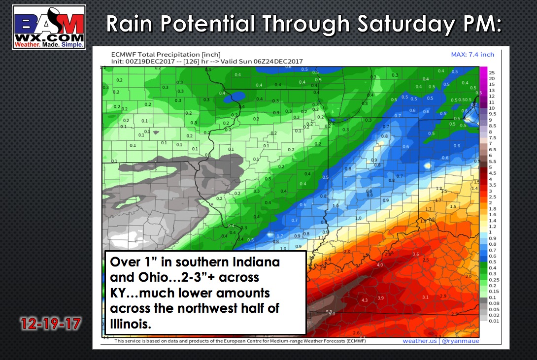
Check out the rainfall potential:
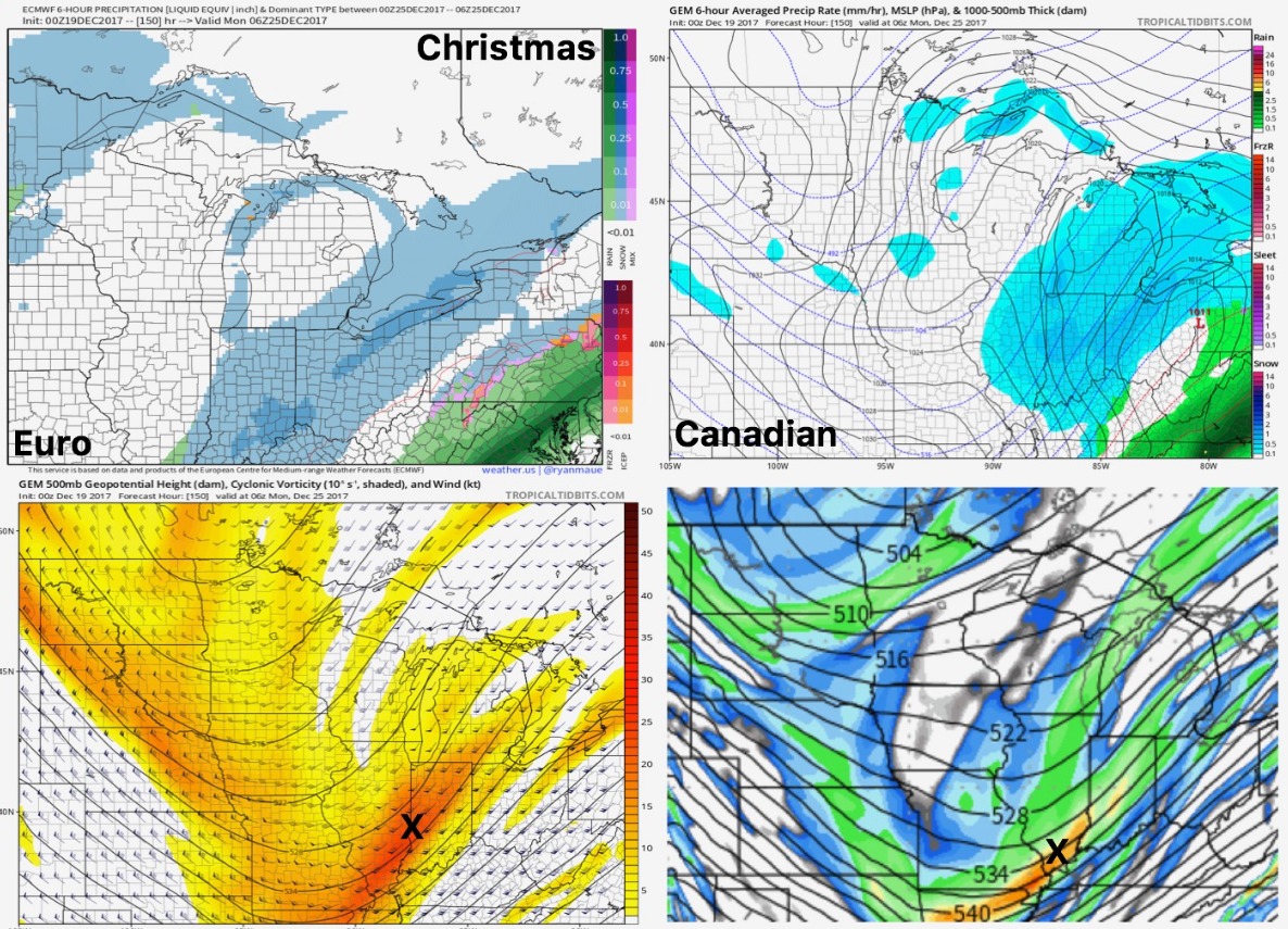
Watching for snow “potential” Christmas Eve/Day. Still plenty of uncertainty on placement/strength of this system, so be sure to check back over the coming days!
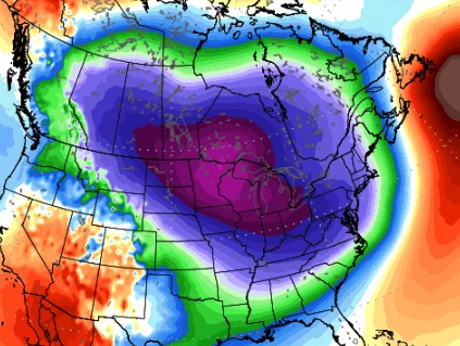
FRIGID air looks to settle in by Tuesday of next week. We are talking lows likely in the single digits (at least) with highs only in the teens for a day or two.