Video (6 min):
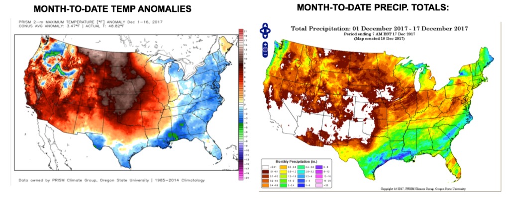
Month to date temperatures and precipitation:
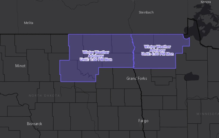
Winter weather advisory for northeast North Dakota and northwest Minnesota through mid-afternoon. Freezing rain/sleet has been reported here this morning. Roads may be very slick.
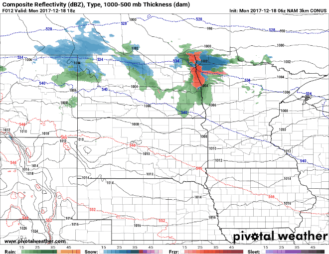
A couple weak disturbances will bring some light snow/mixed precipitation across North Dakota/northern Minnesota today…areas south should remain dry.
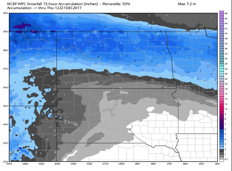
Tracking two shots of snow for mid/late week. The first round will move across North Dakota/northern half of Minnesota on Wednesday, with a solid 3-5″ possible. Here are the forecast snow totals out through 6am CST Thursday:
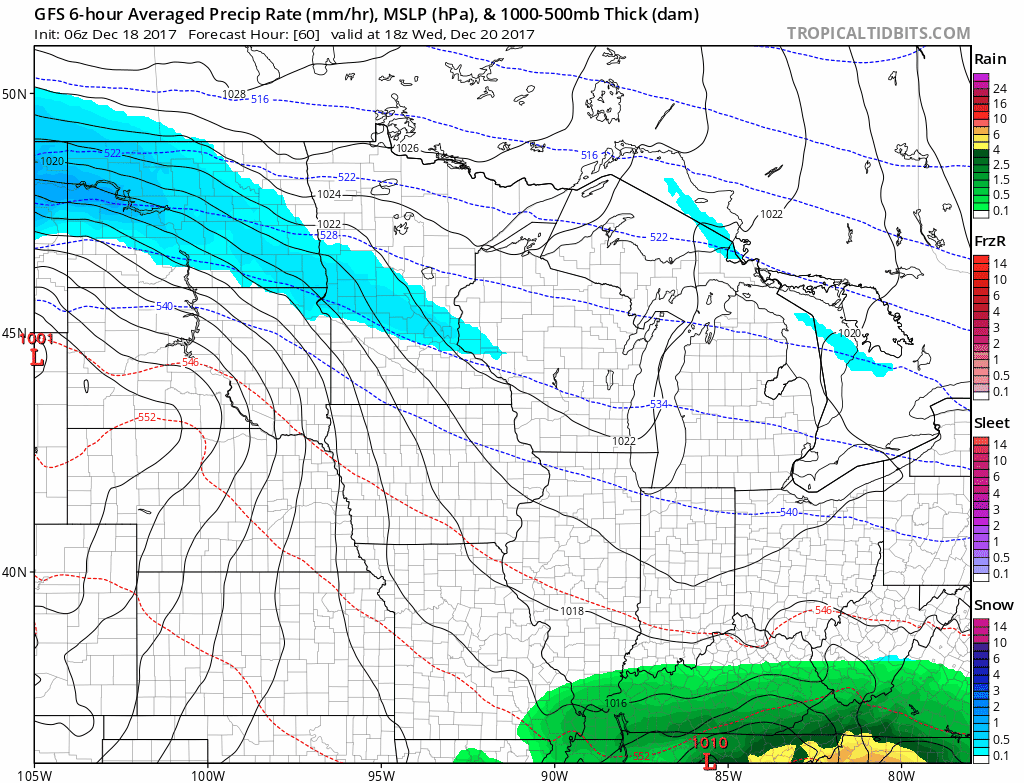
Another round of snow will attack southern parts of the region on Thursday. This likely lays down a few to several inches of snow. Still a few days to fine-tune amounts and exact placement. Here is the forecast radar from Wednesday afternoon through early Friday:
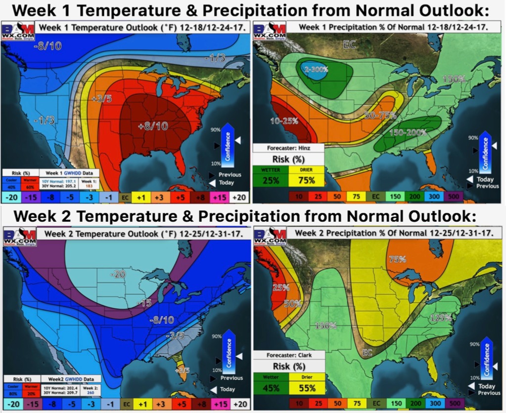
It turns FRIGID for the weekend into late next week. Here are our weeks 1 and 2 outlooks..we are talking 20º below seasonal normals for week 2.