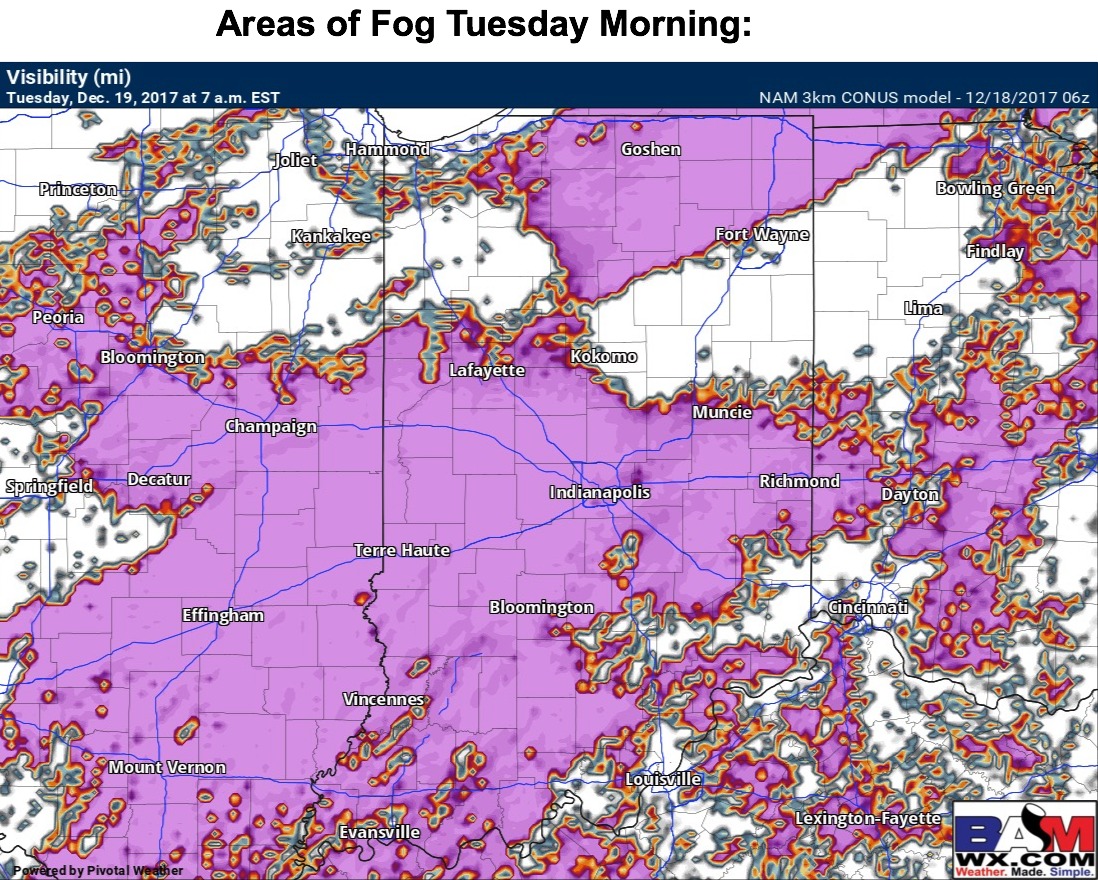
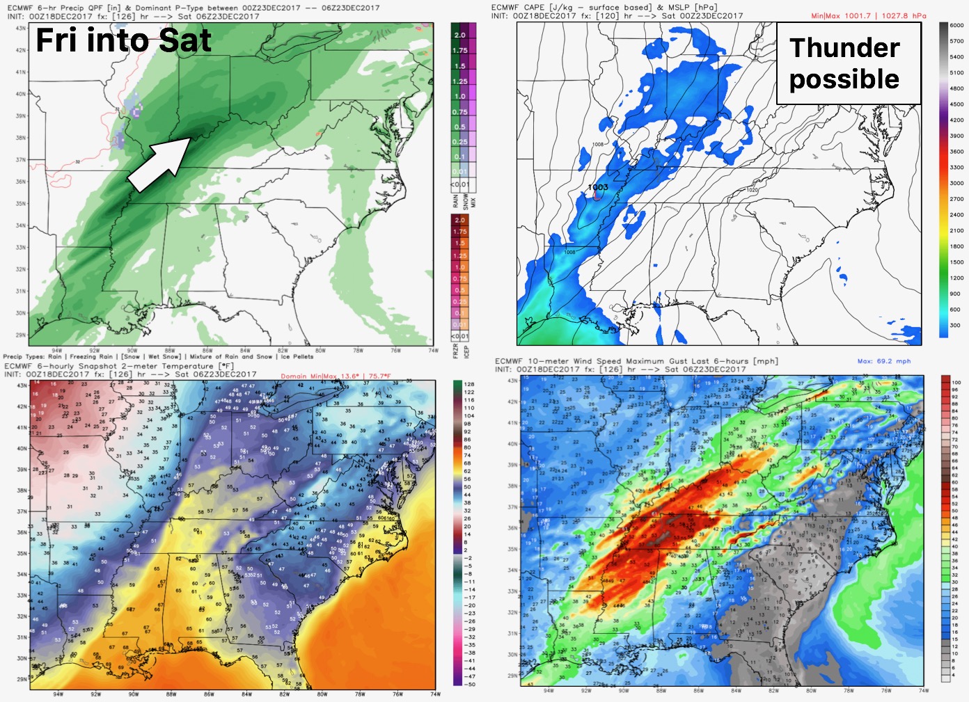
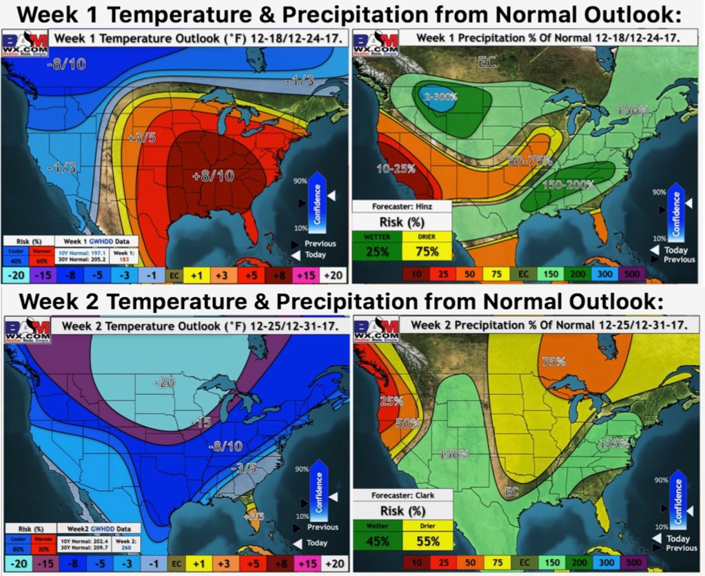
Synopsis: Good Monday morning! A mild week ahead, with little to no concerns for precipitation (beyond this morning) until late in the week. We are watching for continued clouds and patchy areas of drizzle today, decreasing this afternoon. Areas of fog look likely for Tuesday morning. Temperatures, however, will be well above freezing. A mid-week system looks to stay south of Indiana. The next storm system comes our way Friday into Saturday. This will bring showers, with a few thunderstorms possible as well (especially south). This will be followed by a continued colder trend in temperatures through the weekend. Still some uncertainty in any additional precipitation chances Christmas Eve/Day. High confidence that we turn very cold next week. Details in today’s video. Have a great Monday, and let us know if you have any questions!
Video: