Video:
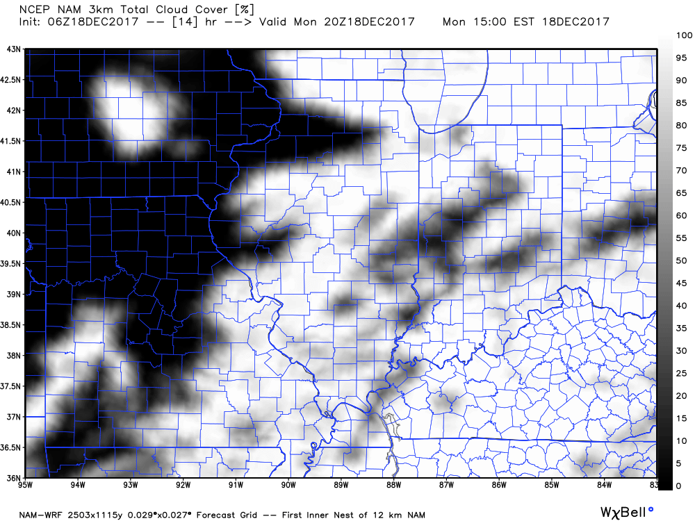
Areas of drizzle/fog expected to linger this morning, with a drier/clearing trend west to east this afternoon. Highs upper 40s and lower 50s.
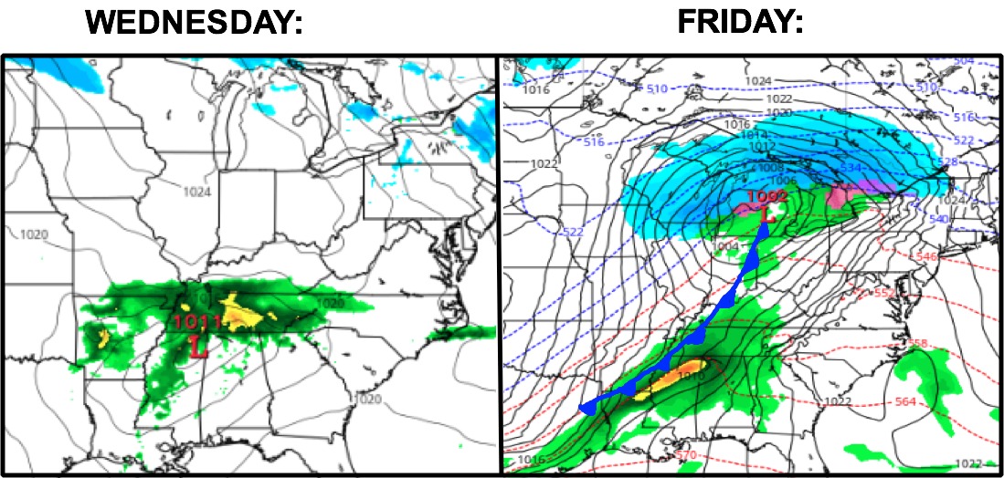
Southern sections of the state may get clipped with some rain Tuesday night/Wednesday, but the majority of the rain stays south. The main system of note this week comes on Friday. This will bring the chance for showers (thunder south) followed by dropping temperatures Friday night. This may end as a few snow showers. Saturday for now looks to trend dry but it will turn much cooler.
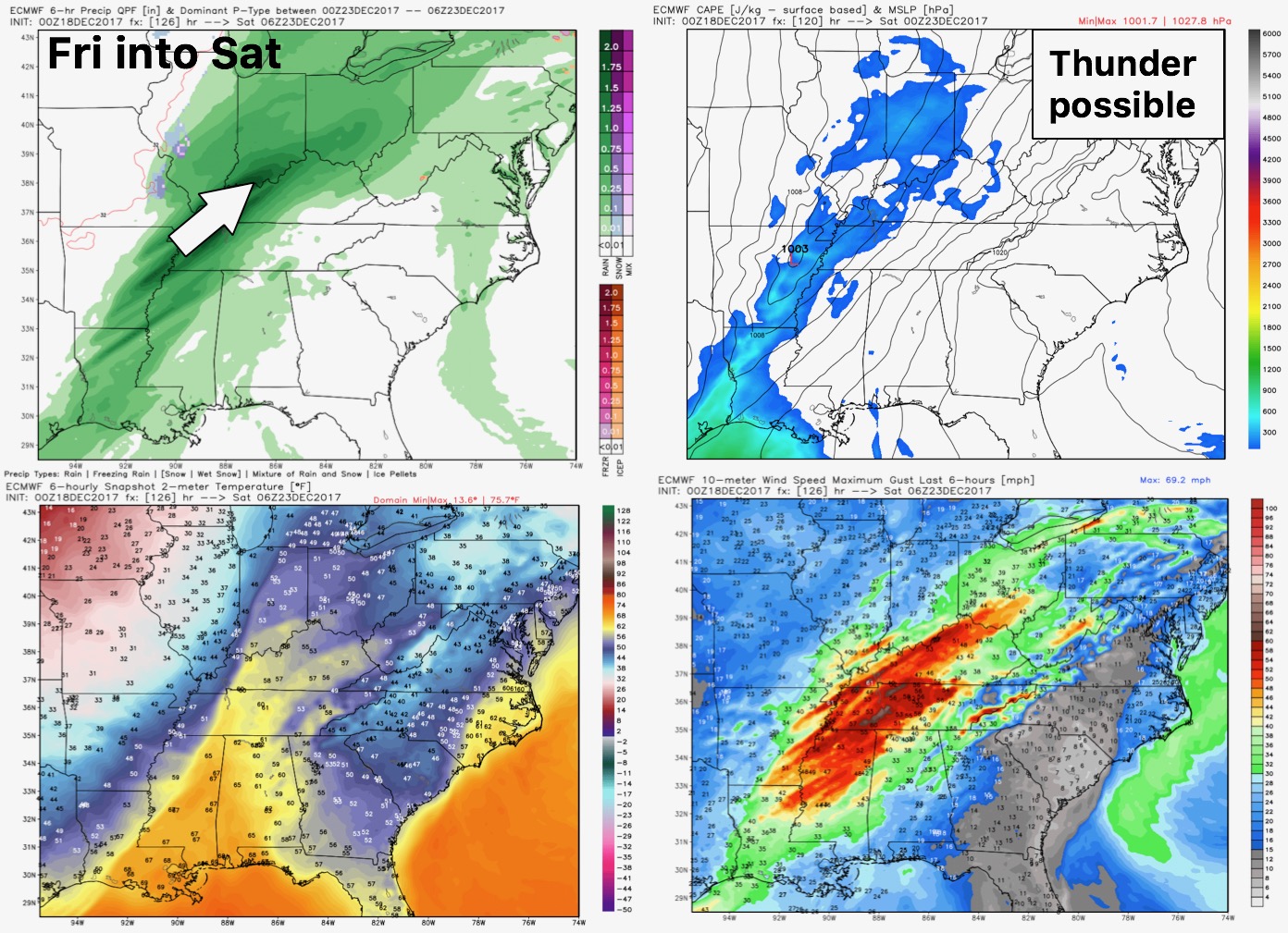
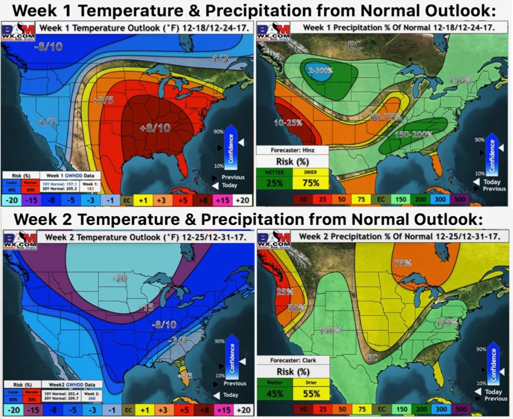
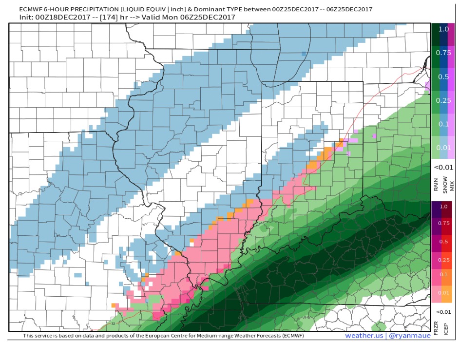
Still very low confidence on the forecast beyond Saturday. The models continue to show different solutions with each new run. There is still a chance for some wintry mischief, but the models have much to resolve. The latest European still brings in some wintry precipitation Christmas Eve into Christmas Day:
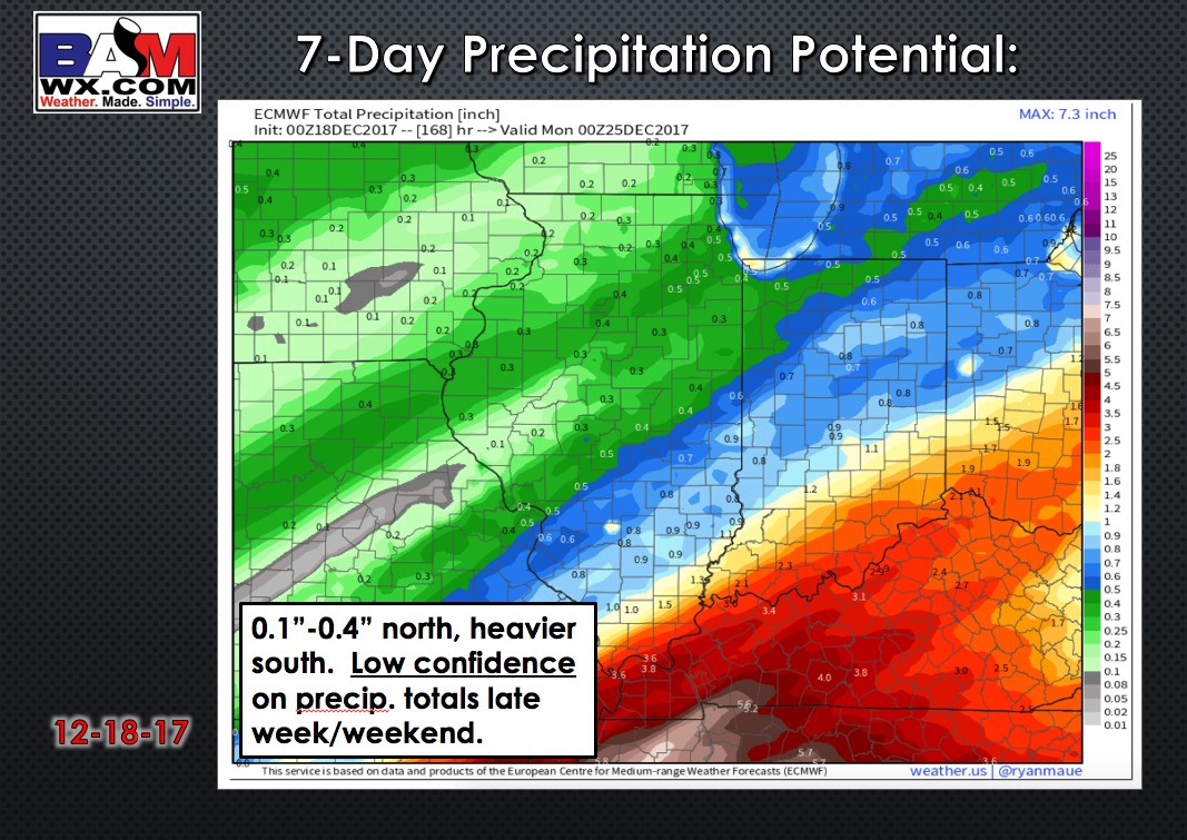
This also leads to lower than average confidence on 7-day precipitation totals:
Regardless of whether we get snow or not, high confidence that it turns frigid for the last week of the year.