Video:
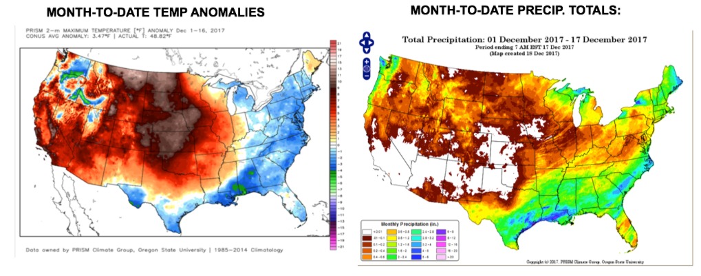
The month thus far has been running above normal in temperatures and much below normal in precipitation. Getting very dry out there.
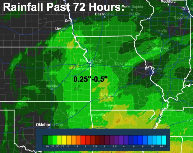
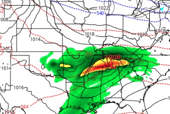
Here is a look at precipitation amounts from Saturday night-Sunday night. Nice to see at least some rain in eastern Kansas and into portions of Missouri.
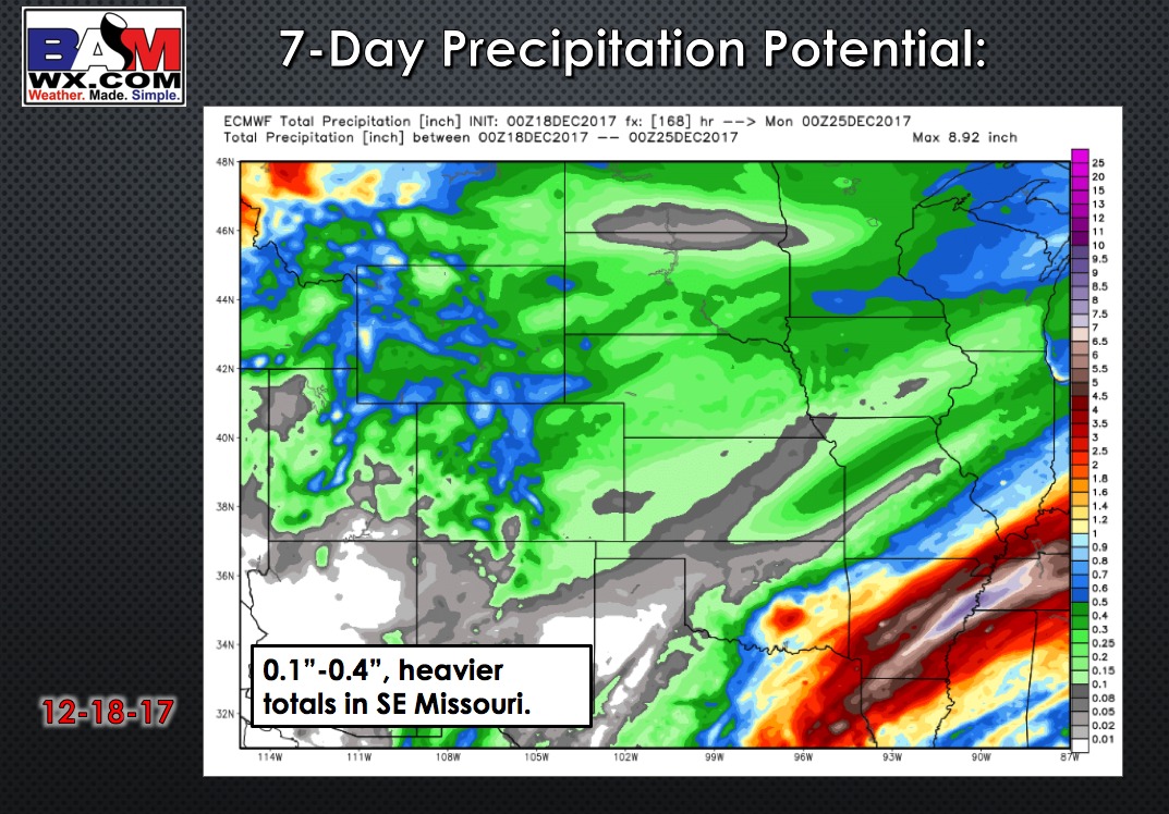
A southern system looks to miss much of the region to our south Tuesday into Wednesday…the bootheel of Missouri may get some decent rain out of it.
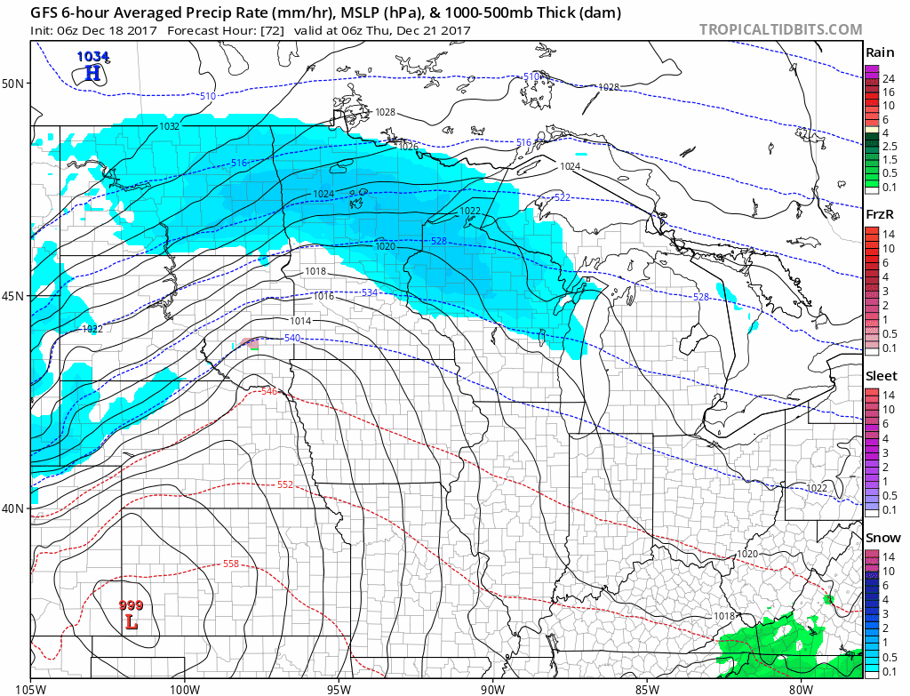
The main system we need to focus on comes in on Thursday. This system draws in sharply colder air with increasing likelihood of snow accumulations across central/northern Nebraska and northern Iowa.
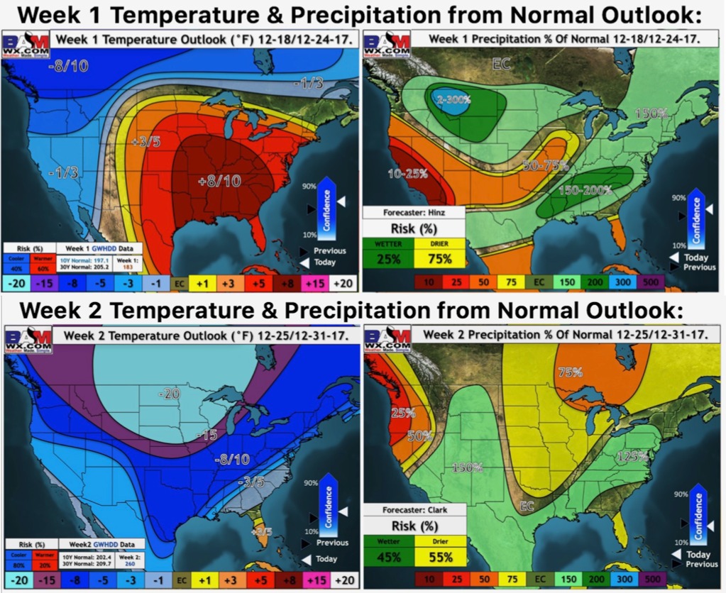
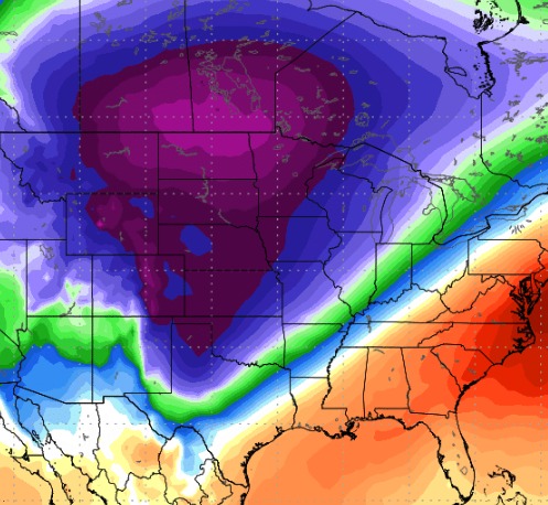
It turns drastically colder for Christmas weekend. Check out the temperature anomalies 5,000 feet aloft for Christmas Eve:
On the edge of the arctic air…we need to watch for additional threats of moisture from the southern stream to possibly bring some additional moisture. Low confidence at this point on any wintry precipitation for Christmas. High confidence it turns very cold.