Video:
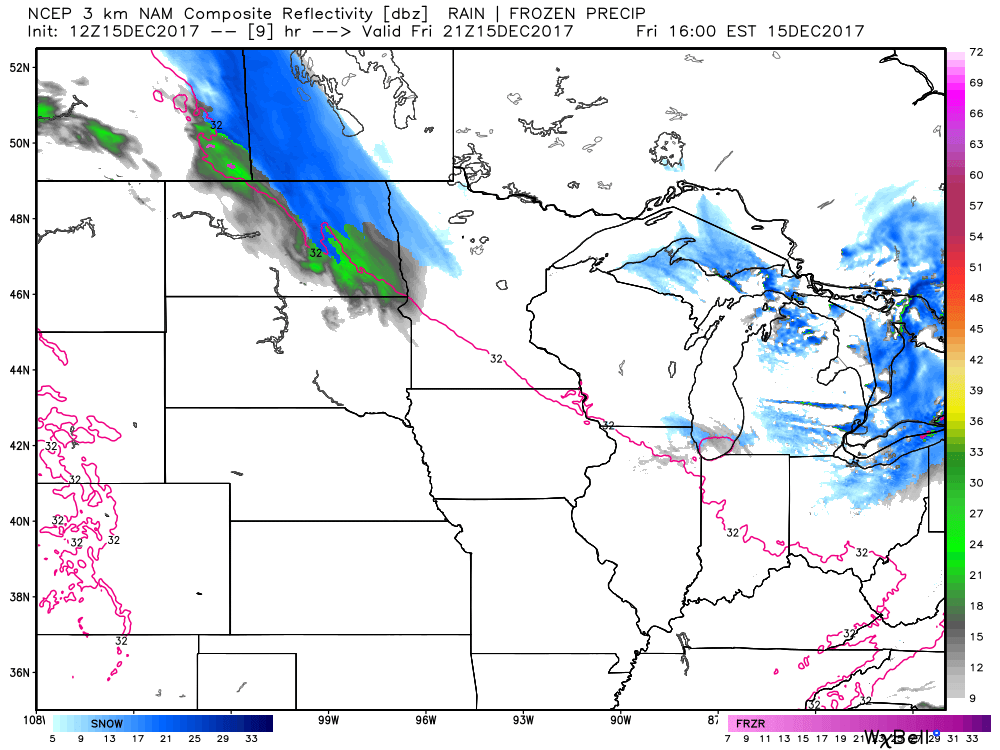
Forecast radar into Saturday morning…decent wave of light snow will work across northeast North Dakota into central Minnesota tonight:
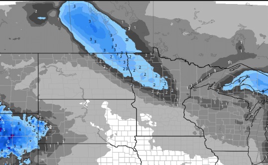
Here is a look at expected snow accumulations over the next 72 hours:
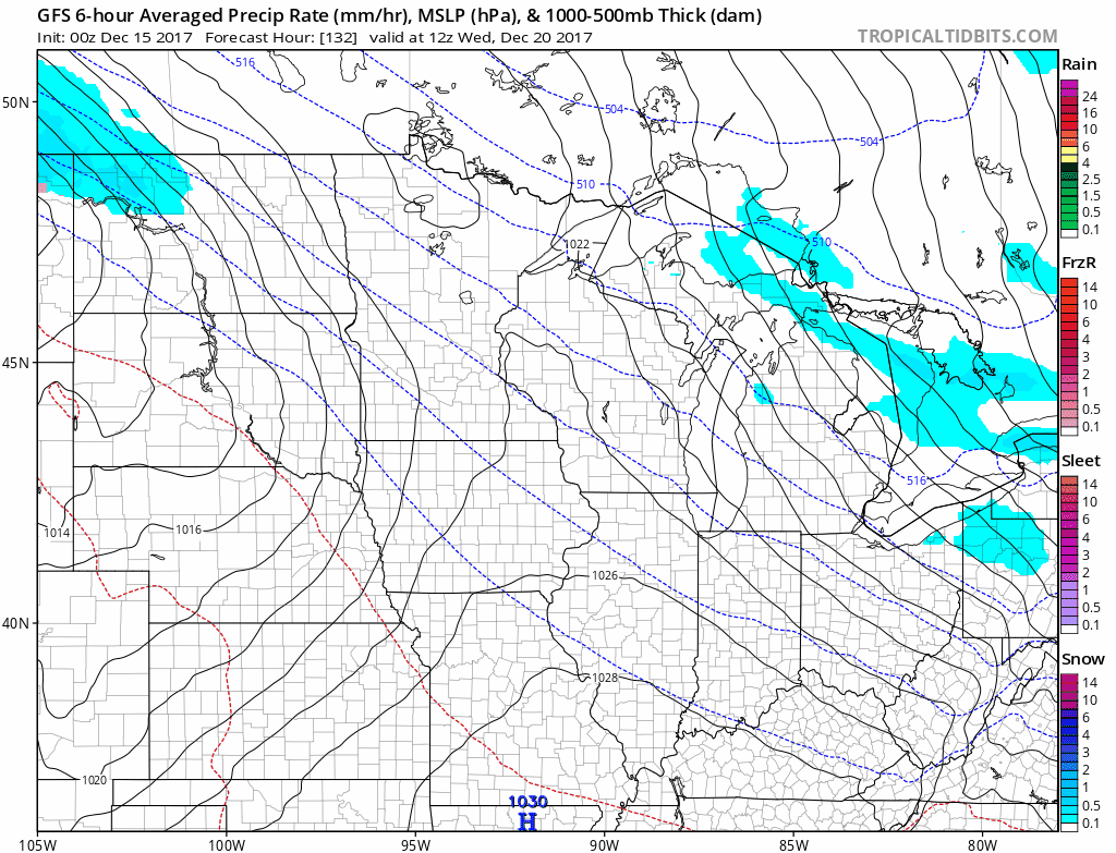
A stronger system looks to work through late Wednesday through Thursday. This could bring several inches of snow across portions of the region. This system will bring down frigid temperatures by the end of next week.
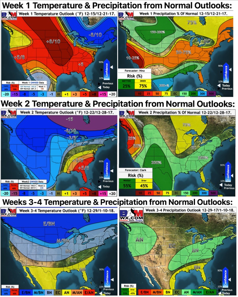
Christmas is looking cold. Here are our weeks 1 through 4 updated outlooks (going through January 10th):