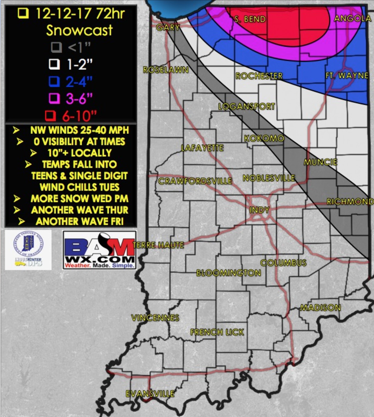
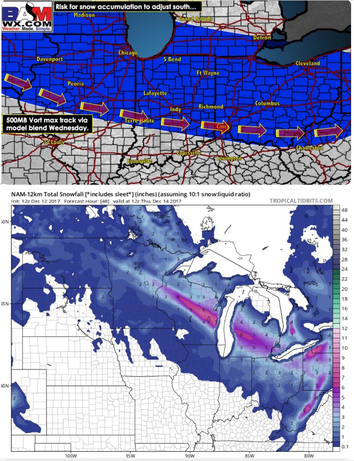
Synopsis: Good Tuesday afternoon! Lake-effect snow bands continue to work through, with a decent band from La Porte to Plymouth, another band from Granger to Syracuse, and another band near Lagrange (as of 2pm EST). These snow bands will gradually orient more eastward with time as the winds shift to a more westerly direction into the evening. Lake-effect bands gradually work out of northeast Indiana by 1-3am. Our next disturbance works in with snow showers breaking out Wednesday morning from 8-11am, especially across the Fort Wayne district. We may catch a bit of a lull before more snow works in from the 1pm-7pm time-frame. Snow showers likely linger beyond this, but gradually diminish. We may see some lake-effect Thursday morning across portions of La Porte and Porter counties with a north flow off Lake Michigan. Latest information in the video below. Have a great afternoon, and let us know if you have any questions!
PM Video (6min):