Today’s video (7:30 min):
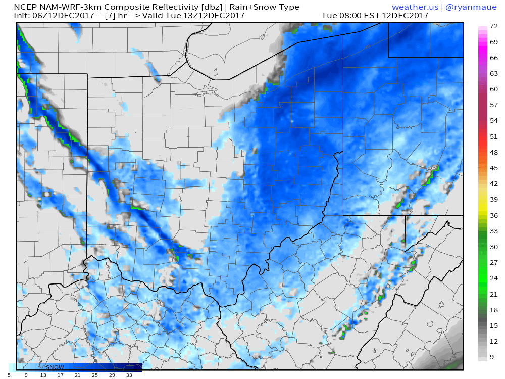
Simulated radar guidance over the next 60 hours shows the multiple bouts of snowfall, especially north of I-70 into Thursday:
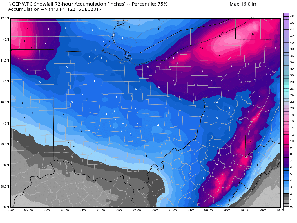
Latest thoughts on accumulating snowfall potential over the next 72 hours…northeaster parts of the state we feel have a very good shot at seeing 8-12, northwestern parts of the state from Defiance to Toledo we think are in a good spot to see 4-6″ with locally higher possible where the heavy lake effect band sets up shop:
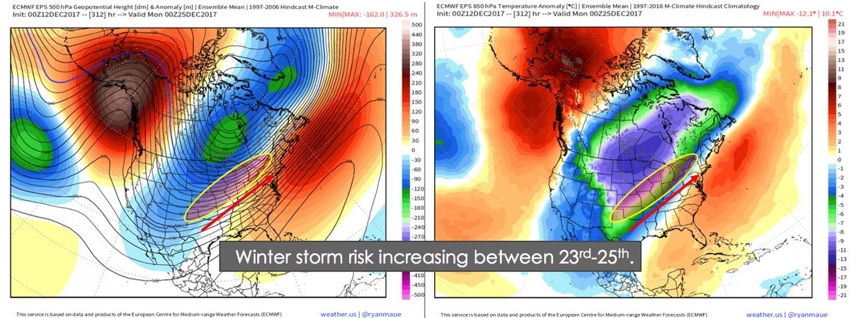
We are watching very closely around the Christmas timeframe for winter storm potential…make sure to check out today’s long-range for more details!