12-12-17 LaPorte & Ft. Wayne District Forecast:
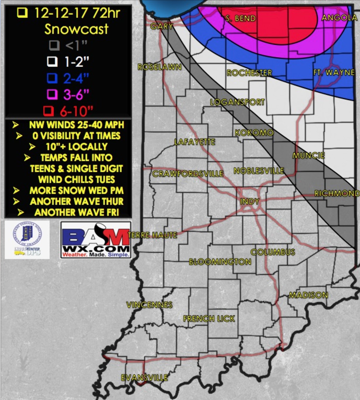
Synopsis: Good Tuesday morning! Temps in the 20s with snow falling right on time this morning, some heavy bands already setting up across South Bend to near Ft. Wayne. We think the snowfall ends ~4-6pm across the LaPorte District and then out of the Ft. Wayne District by ~12/1am Wed AM. Some of these bands will feature near-whiteout conditions, winds topping 40mph and snowfall rates of 2″/hr. We are targeting additional snow showers Wednesday AM ~6-10amEST and then another ~2-7pmEST in the afternoon…so as you can tell, an extremely busy next 48 hours, you won’t want to miss a single update and please reach out to us with any questions. We’ve posted an updated accumulating snowfall map over the next 72 hours, this won’t all fall at once but through multiple events.
Today’s video (7 min):
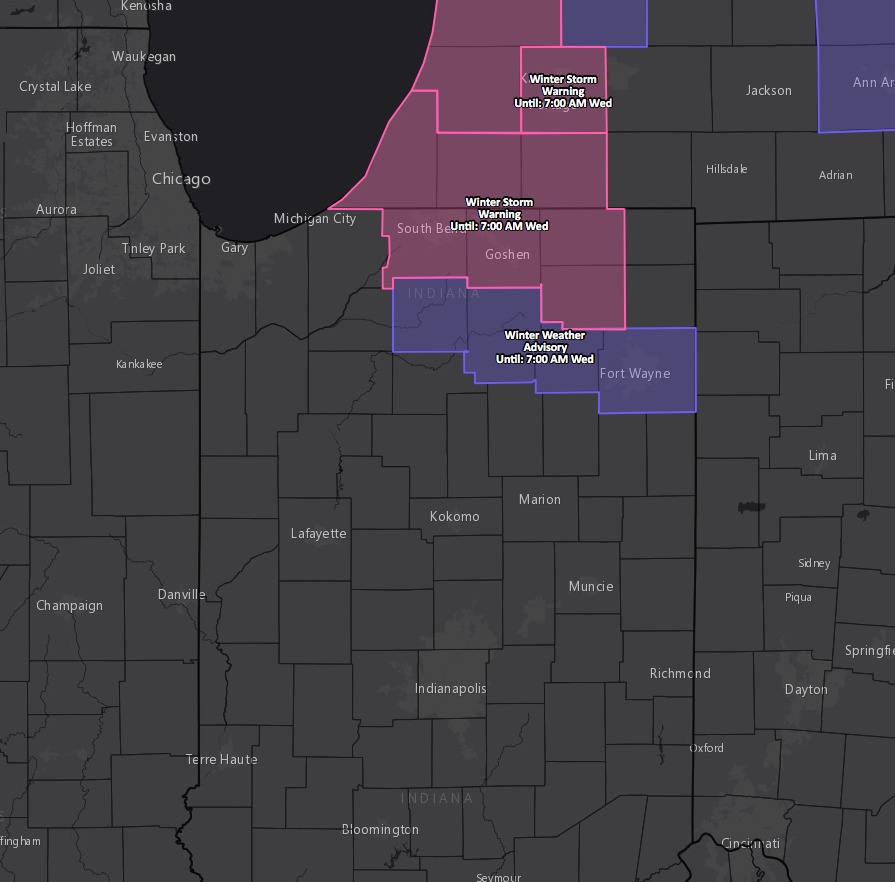
Current winter weather advisories/warnings:
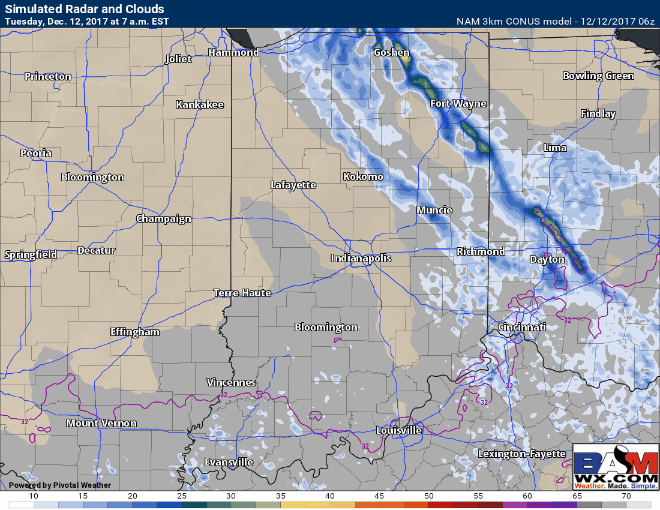
Updated simulated radar showing the impressive lake effect bands across northern and eastern Indiana throughout the day today…expecting things to start winding down around midnight/1amEST Wednesday AM across northeastern locations:
Updated snowfall map over the next 72 hours: