Today’s Illinois Video Forecast:
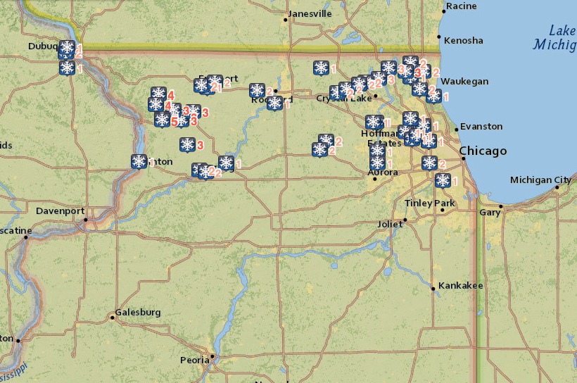
Very impressive snow totals yesterday across far northern portions of the state, where as much as 3-5″ were reported!! To say this system over-performed is an understatement. That said, the snow band quickly weakened as it moved south into Chicago and points south.
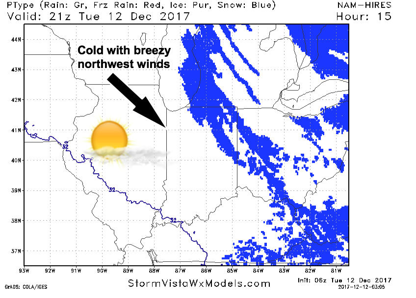
Outside of a few flurries in northeast areas this morning, we should trend dry through the day with sunshine. Winds will be breezy out of the northwest, making for a very cold day. Highs in the upper 20s and lower 30s.
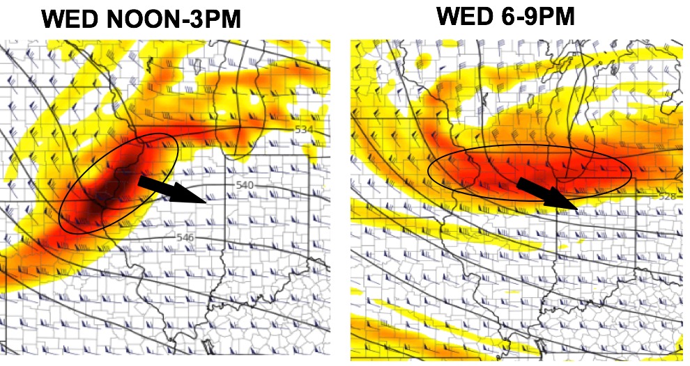
Our next system works in on Wednesday (similar to Monday’s set-up). Am impulse of energy works in from noon-3pm, bringing some precipitation mainly across the northern half of the state. Areas from Rockford, Chicago, down to Kankakee may see some light snow accumulations as this feature works through during the afternoon. Another wave of energy works in between 6-9pm across northern parts of the state (Freeport, Rockford, Chicago, down to Kankakee), and we need to watch this to bring some light snow accumulations.
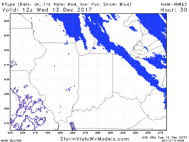
Forecast precipitation from 6am Wednesday to 8am Thursday:
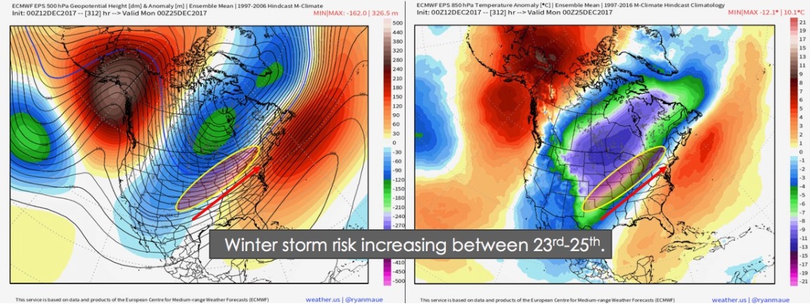
Certainly keeping an eye on the Christmas time-frame for an “interesting” pattern setting up that is favorable for a winter storm in portions of the Ohio Valley/Midwest.