Today’s video (7 min):
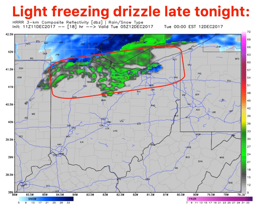
Eyeing a light mixed wintry precipitation moving west to east later tonight across the northern third of the state…need to watch for slick spots on untreated surfaces:
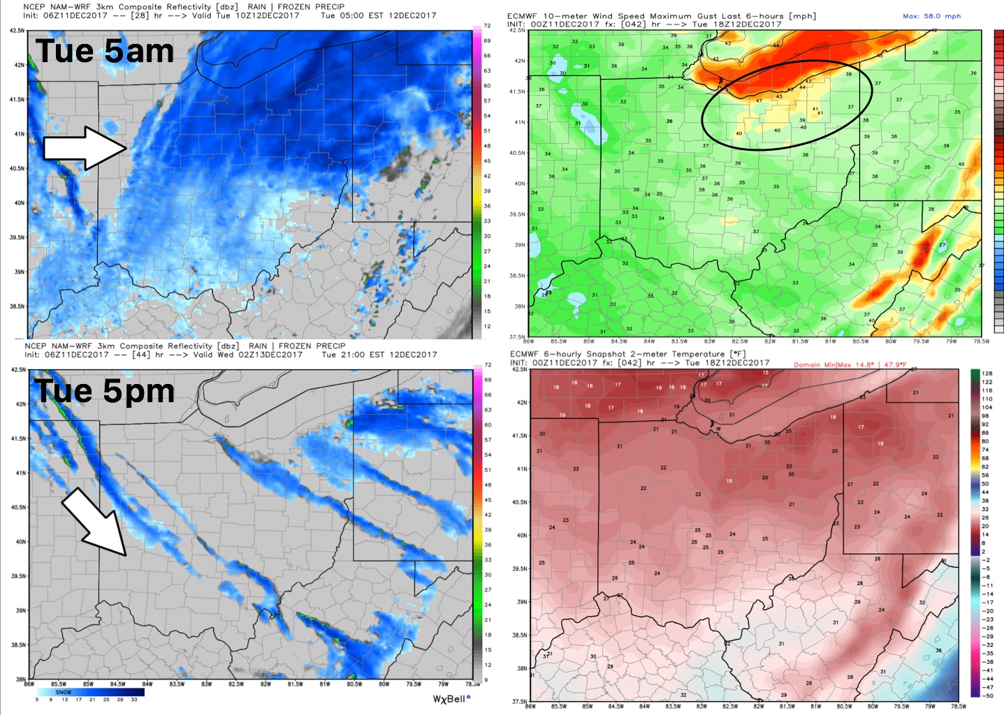
Multiple bouts of snow showers and lake effect snowfall will moving across the state on Tuesday…we think the band Tuesday morning into the afternoon could reach as far south from Lake Michigan as Cincinnati, Chillicothe and points to the east…this is what we call a lake effect “feeder” band. Points in the northeastern parts of the state see very heavy lake effect snowfall as well into Wednesday morning.
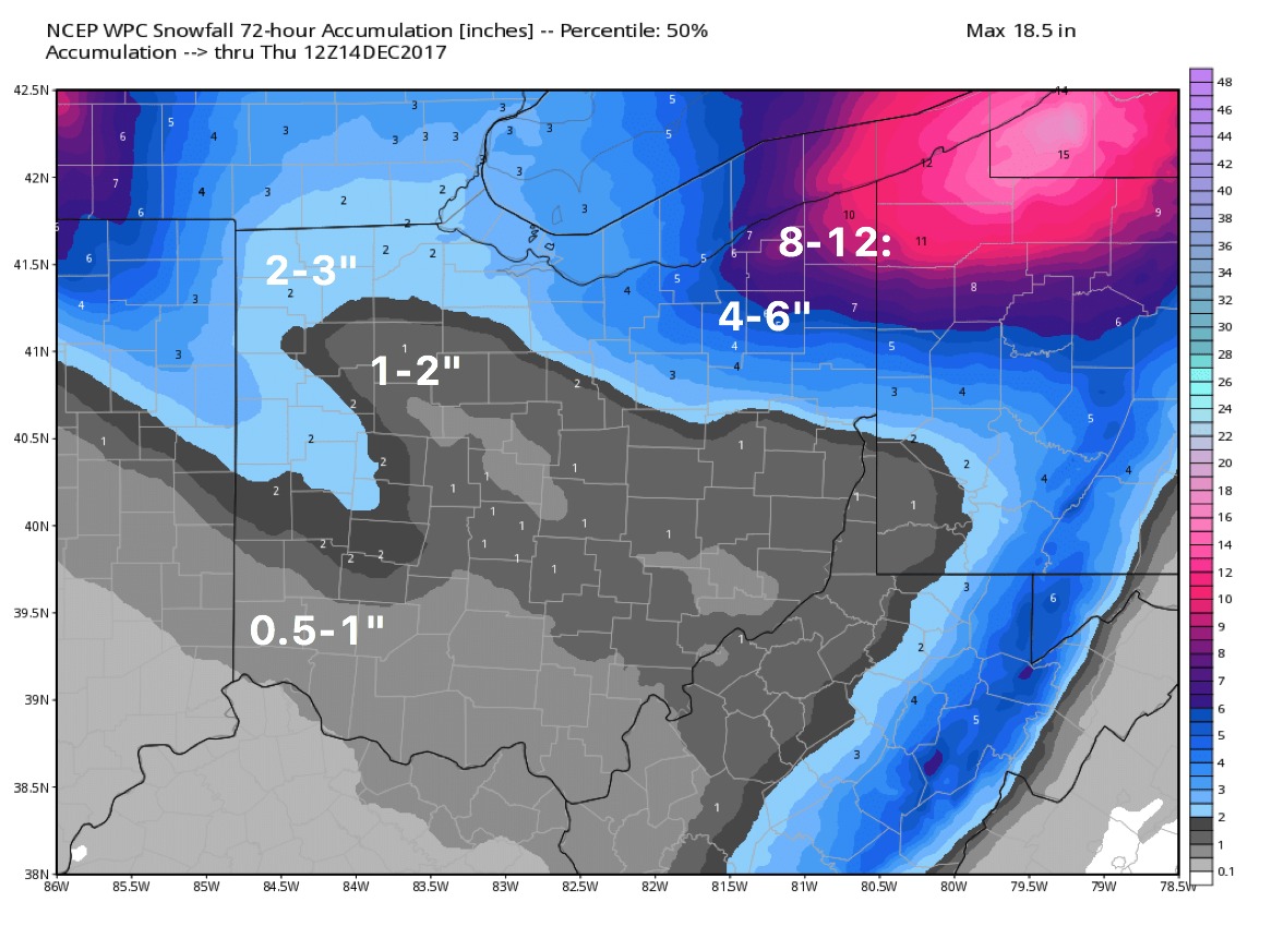
Current thoughts on snowfall accumulation through 7am Thursday morning…the heaviest being across northeastern parts of the state where up to a foot of all snowfall possible:
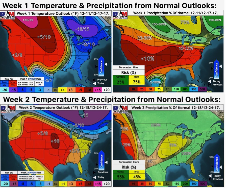
Updated weeks 1-2 long-range outlooks…we do see that moderation period coming as we get into next week: