12-11-17 LaPorte & Ft. Wayne District Forecast
Synopsis: Good Monday morning! Winter storm watches have been hoisted across parts of both Districts through Wednesday morning which will be upgraded to winter storm warnings for sure. First we will be dealing with a period of freezing drizzle beyond 6pm tonight given temps hovering near freezing with some slick spots on untreated surfaces. Winds shift out of the northwest gusting up to 40mph early Tuesday morning, gearing up for another big-time lake effect snowfall event throughout the day, at times with 1-2″ / hr snowfall rates and near-whiteout conditions likely. It will be very cold Tuesday as well with highs in the lower 20s and wind chills in the single digits. We think the lake effect snow doesn’t die down until ~7am Wednesday morning. Localized 10″+ will be possible before all is said and done. A very active next 24 hours, let us know if you have any questions…have a blessed day. -Kirk
Today’s video (7 min):
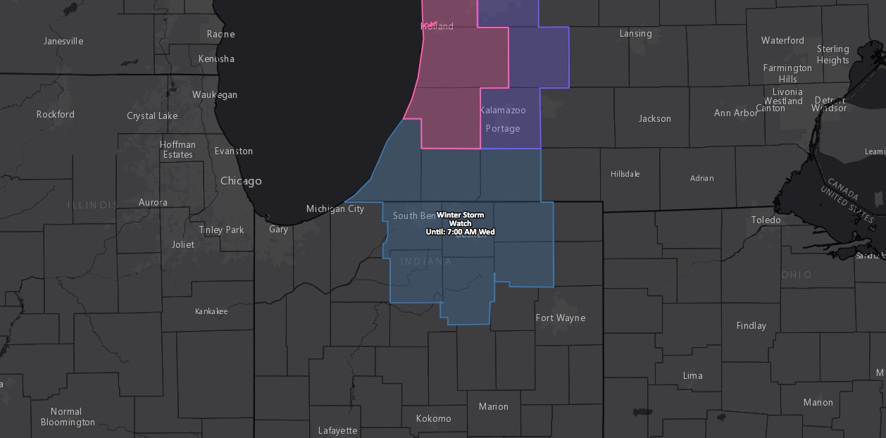
Winter storm watch hoisted for parts of northern Indiana through 7am Wednesday morning:
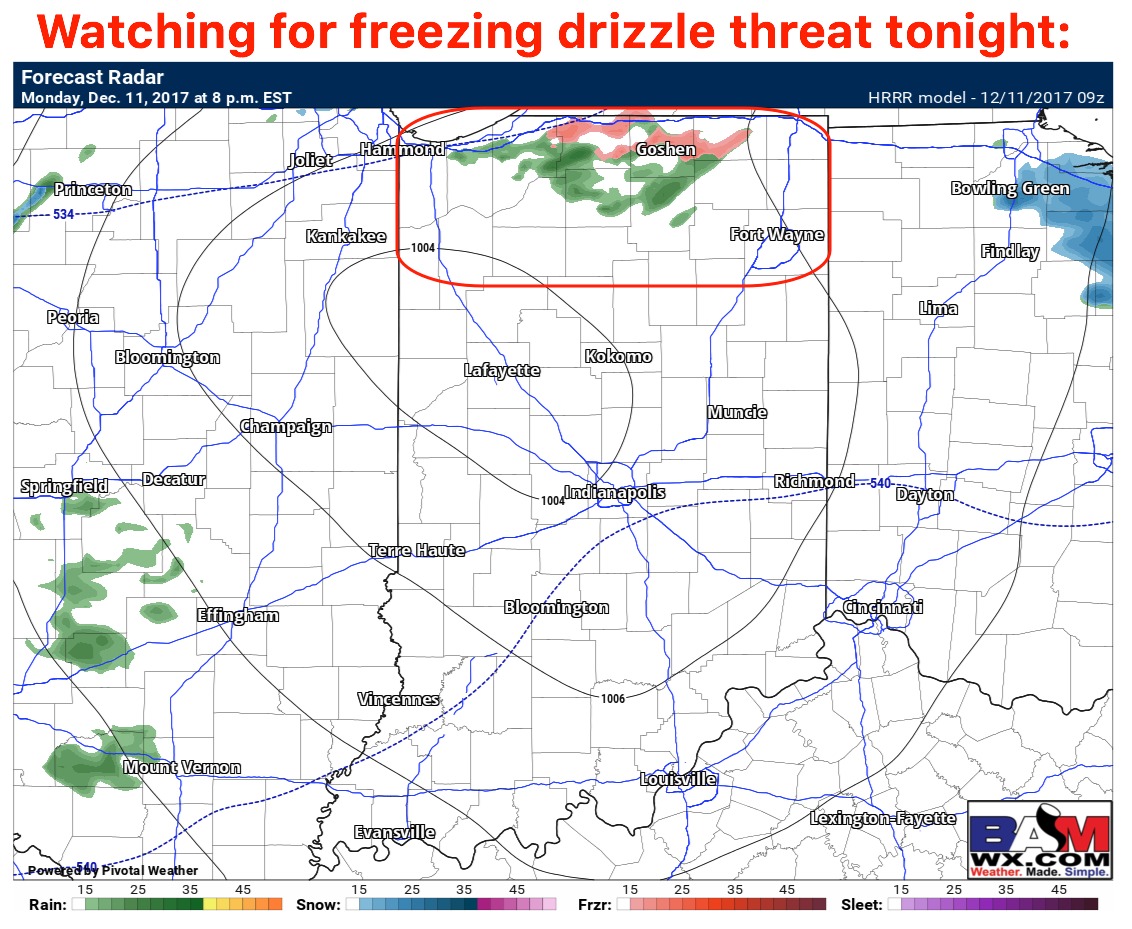
Watching for a brief period of some freezing drizzle this evening beyond 6-7pm:
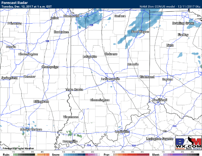
Continue to monitor for the lake effect snow machine to kick back into gear very early Tuesday morning ~1amEST, gradually shifting off more exclusively to the far eastern LaPorte and Ft. Wayne districts into the evening and overnight; there will be periods of whiteout conditions where the lake effect band sets-up with rates up to 1-2″ / hr.
Current thoughts on accumulation into Wednesday morning concerning the lake effect snow band:
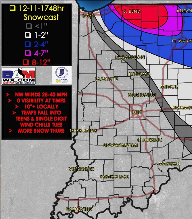
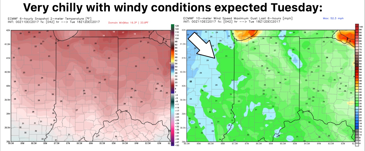
Will be very chilly Tuesday with highs in the lower 20s and wind chills in the single digits…winds will be gusting out of the Northwest at times to 30-40mph.