Today’s Video:
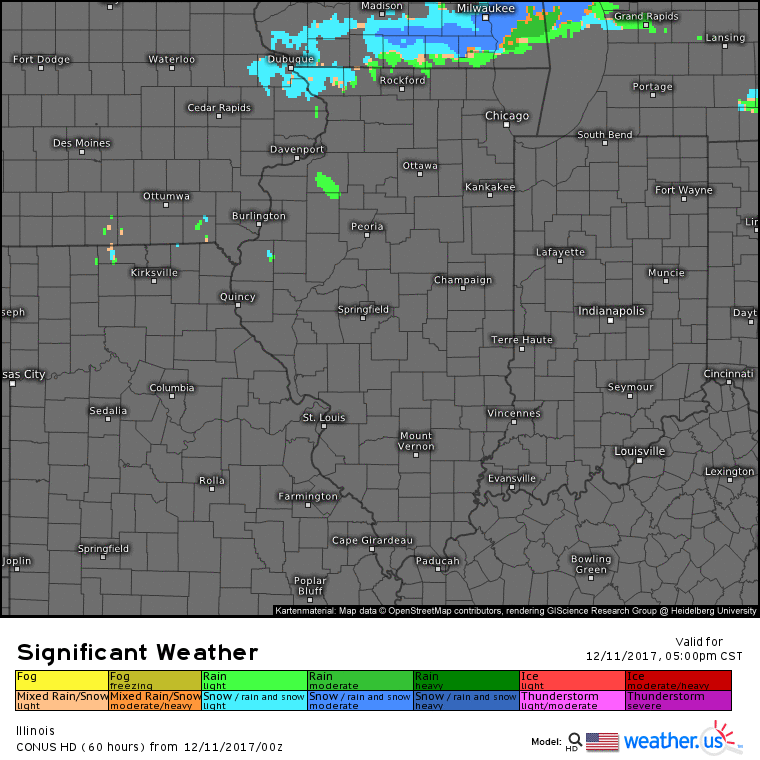
Forecast radar into Tuesday morning….light snow/rain mix across northern portions of the state this afternoon (Rockford to Chicago) will shift southward into tonight. As colder air works in overnight, watch for the potential of slick areas on roadways.
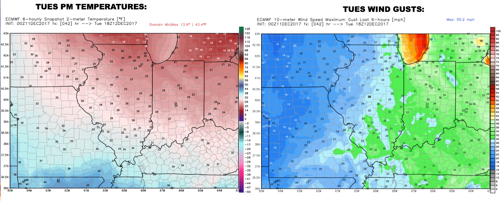
Sharply colder on Tuesday along with breezy conditions. A few additional flurries east, other-wise some sunshine builds in.
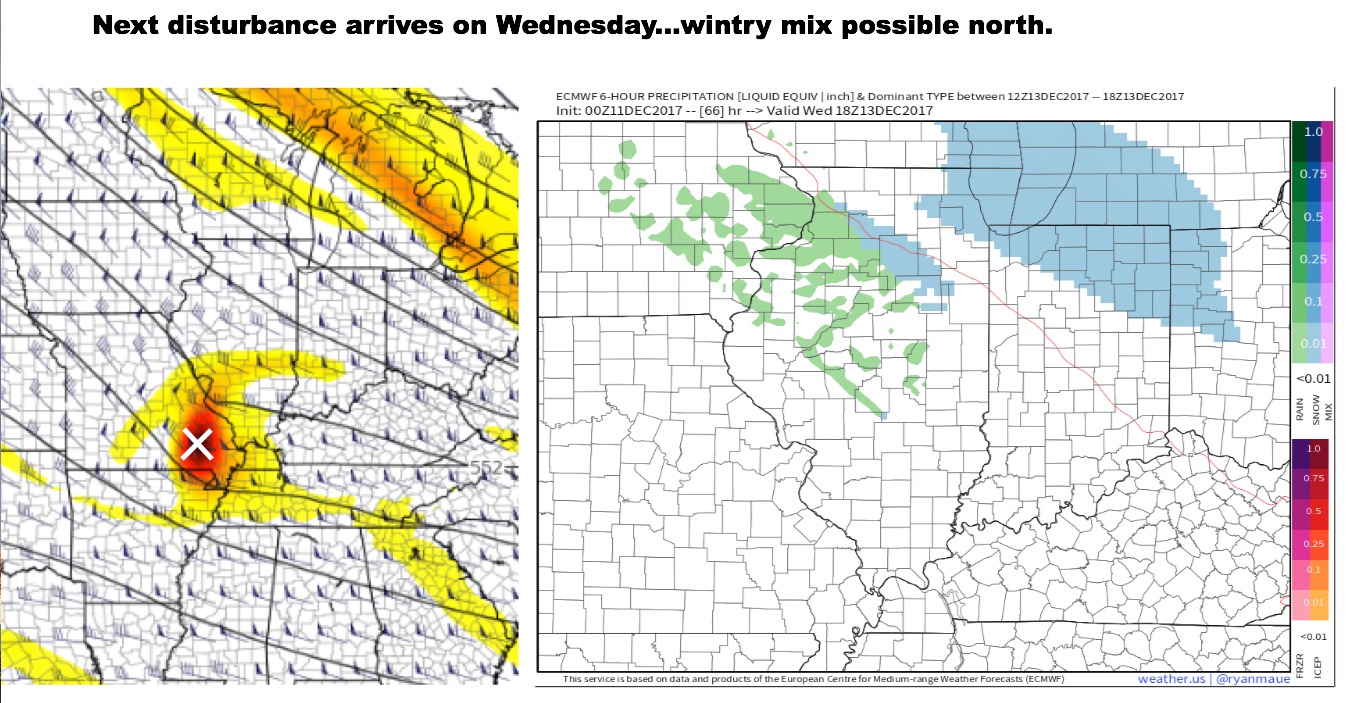
Our next disturbance to watch arrives on Wednesday. This will try to bring back in somewhat milder air in central/southern portions of the state, while areas northeast stay colder. We have lower confidence in Wednesday’s system due to a displacement of greatest energy aloft and forecast precipitation from the data. At this time, plan on a light wintry mix in northern portions of the state, maybe minor accumulations Rockford to Chicago.
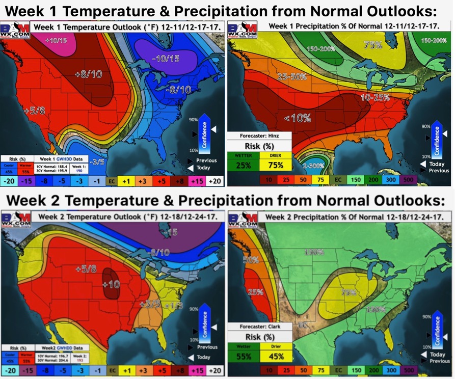
Weeks 1 and 2 outlooks..more details on pattern evolution towards Christmas in today’s video.