12-11-17 Crawfordsville & Greenfield Forecast Update
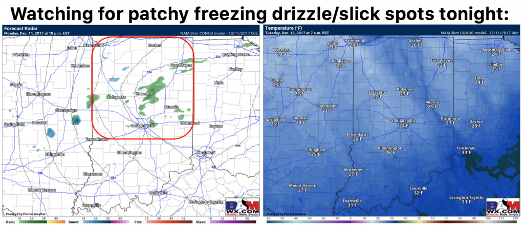
Synopsis: Good Monday morning! Today we discuss the latest in terms of some patchy freezing drizzle later tonight with slick spots possible on untreated surfaces as temps crash behind an arctic front into the 20s. The lake effect snow machine gears back up on Tuesday impacting parts of the Greenfield District with accumulating snowfall. It’s a very busy forecast for the northern half of the state even as we go into mid to late week targeting multiple pieces of energy to swing through from the north. If you have any questions please let us know, have a blessed day! -Kirk
Today’s video (7 min):
We are monitoring for some patchy freezing drizzle late tonight as temps crash behind an arctic front creating some potential for slick spots across central IN.
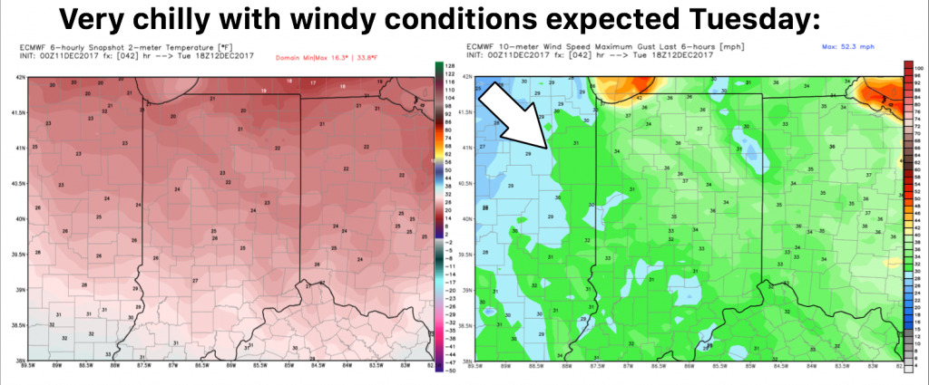
Very chilly and windy as we get into Tuesday:
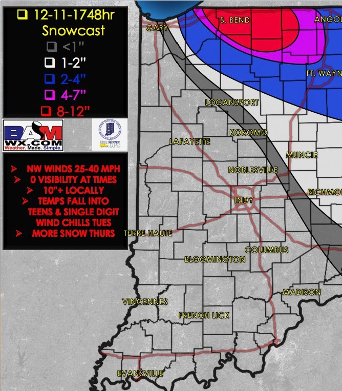
Targeting lake effect snowfall bands to reach the Greenfield District into Tuesday, accumulating snowfall becoming more likely across northern and eastern sections specifically:


