Today’s Central Plains Regional Forecast:
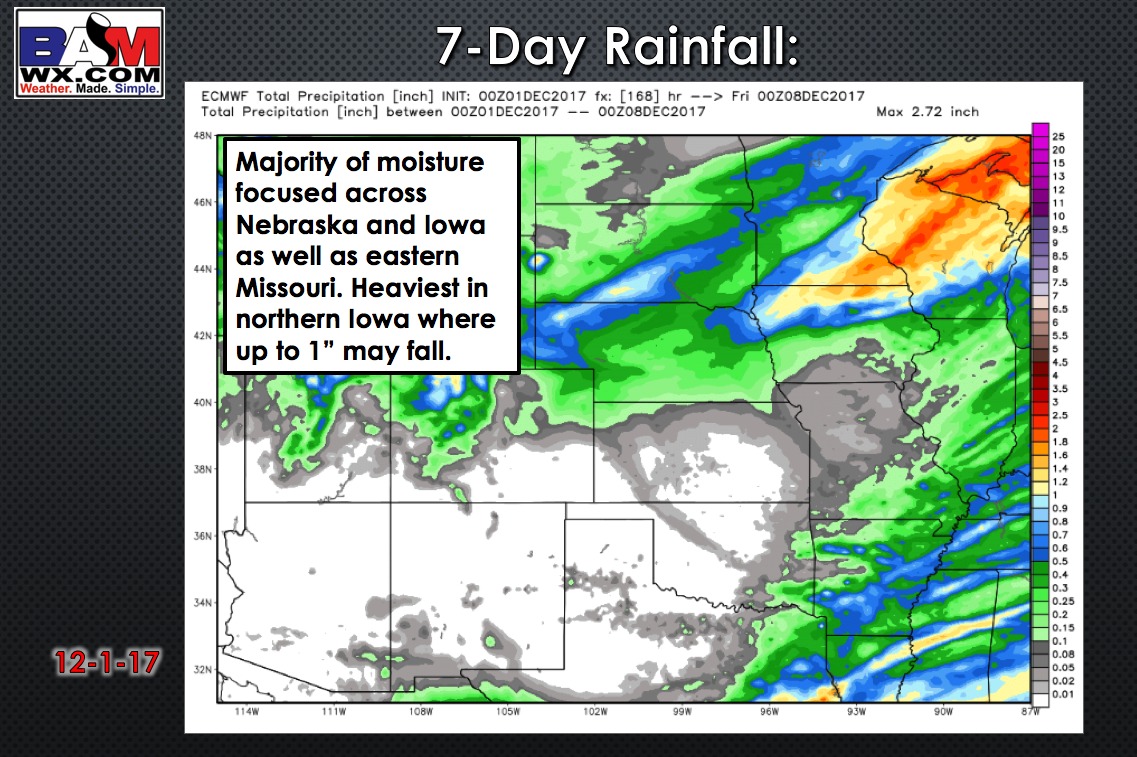
Nice weather continues into most of the weekend with above average temperatures. A storm system will strengthen as it moves across the region Sunday night through Monday night, and will deliver SHARPLY colder temperatures in its wake. We expect a band of some snow across central/northern Nebraska into northwest Iowa on Monday. Some accumulating snow looking likely across northern Nebraska and Northwest Iowa. Further south and east, showers and isolated storms across central and eastern Missouri as the front passes Monday.
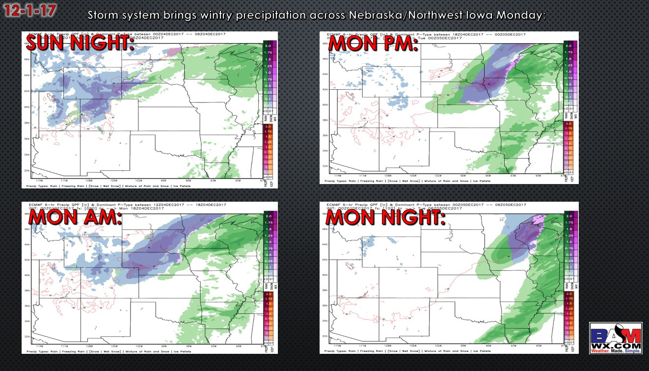
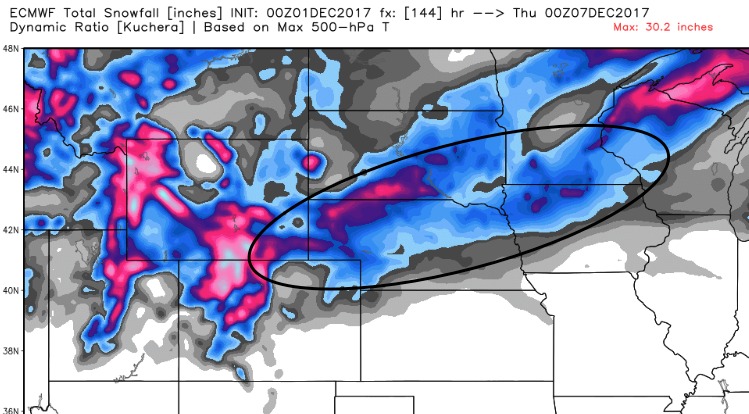
Current snowfall guidance shows a few inches of snow possible in northern Nebraska into northwest Iowa. Confidence is high that this area will see some snow, but lots of uncertainty regarding amounts.
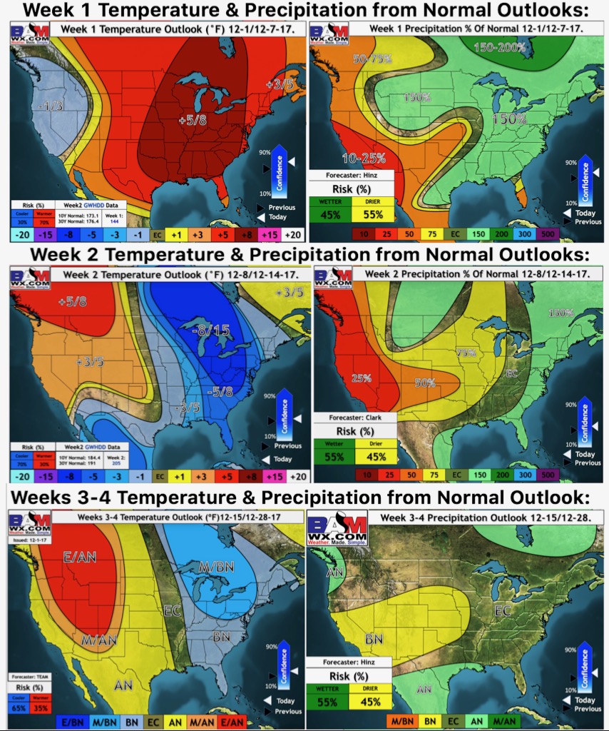
Here are our weeks 1 through 4 updated outlooks, taking us all the way to December 28th: