Thursday, November 9, 2017 Ohio Forecast:
Today’s video (6 min):
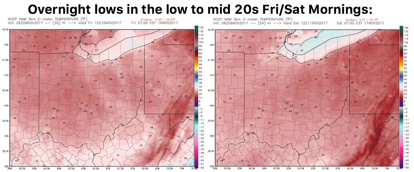
Coldest air of the season works in Friday and Saturday mornings with lows in the low to mid 20s expected with wind chills dipping into the lower teens to spots of upper single digits possible at times especially Friday morning:
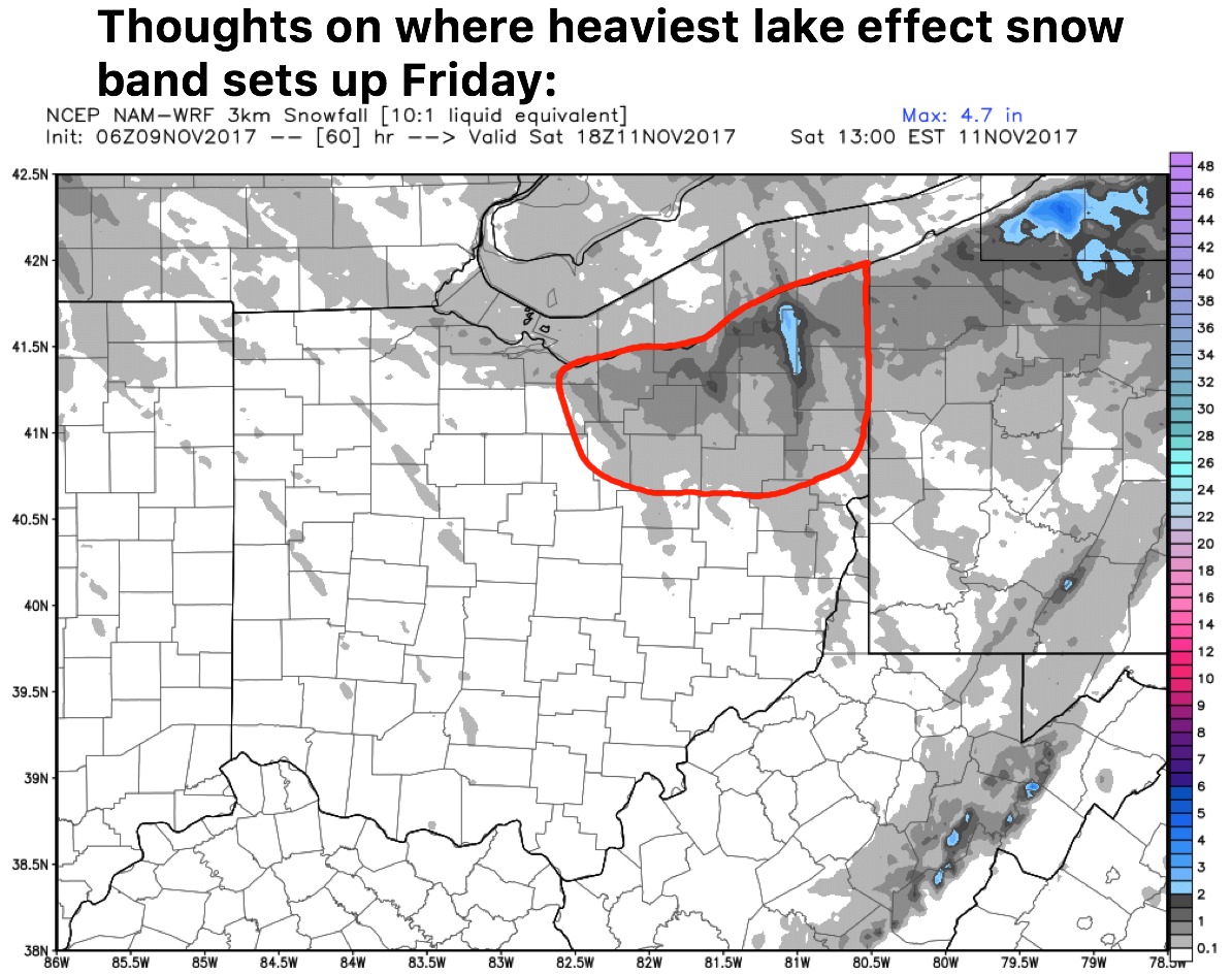
Continue to eye for lake effect snow showers to kick up early Friday morning and persist from east to west throughout the day. In the area circled in red we think localized 0.5-1.5″ will be possible with areas of 1-3″ where that heaviest band sets up across far northeast locations from Cleveland to Jefferson.
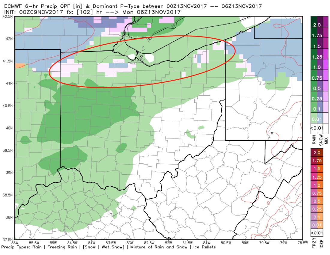
Our next precipitation chances comes later Sunday evening from west to east…these will be generally be light rain showers south of I-70, but for the far northern 2-3 rows of the state we could see some frozen precipitation working in at times through the pre-dawn hours Monday. We also think some slick spots will be possible here as well. Rainfall totals of generally 0.1-0.3″ is expected through Monday.
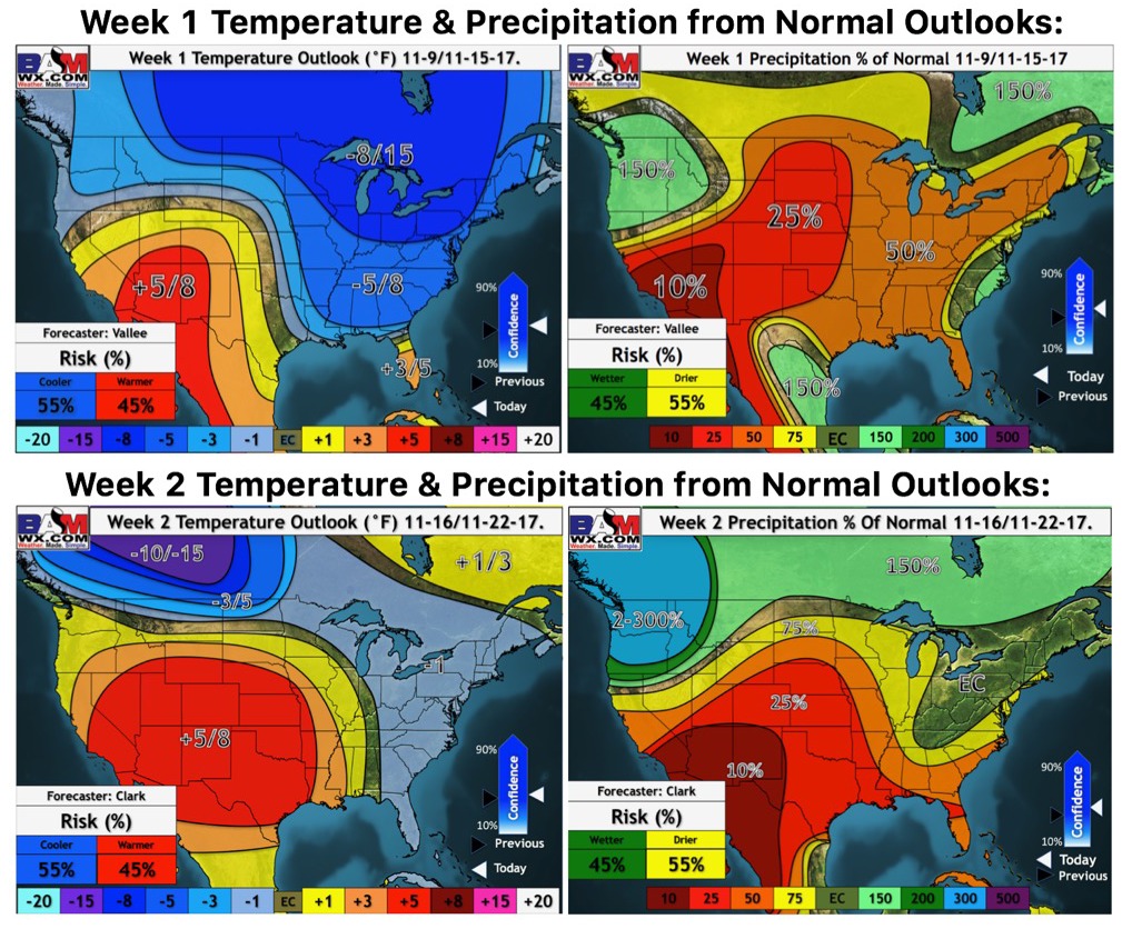
Updated long-range outlooks over the next 2 weeks is below…we continue to cool the week 2 forecast: